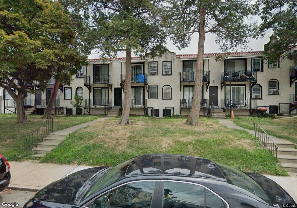
7212 Alderbrook Rd Upper Darby, PA 19082
Estimated Value: $56,000 - $73,461
1
Bed
2
Baths
432
Sq Ft
$155/Sq Ft
Est. Value
About This Home
This home is located at 7212 Alderbrook Rd, Upper Darby, PA 19082 and is currently estimated at $67,154, approximately $155 per square foot. 7212 Alderbrook Rd is a home located in Delaware County with nearby schools including Upper Darby Kdg Center, Upper Darby High School, and Vision Academy Charter School.
Ownership History
Date
Name
Owned For
Owner Type
Purchase Details
Closed on
Dec 28, 2016
Sold by
Almar Realty Llc
Bought by
Lansdowne Gardens Lp
Current Estimated Value
Home Financials for this Owner
Home Financials are based on the most recent Mortgage that was taken out on this home.
Original Mortgage
$5,645,000
Outstanding Balance
$4,639,995
Interest Rate
4.03%
Mortgage Type
Construction
Estimated Equity
-$4,572,841
Purchase Details
Closed on
Jun 28, 2004
Sold by
Snp Properties Inc
Bought by
The Gardens Realty Lp
Home Financials for this Owner
Home Financials are based on the most recent Mortgage that was taken out on this home.
Original Mortgage
$2,100,000
Interest Rate
6.32%
Mortgage Type
Purchase Money Mortgage
Create a Home Valuation Report for This Property
The Home Valuation Report is an in-depth analysis detailing your home's value as well as a comparison with similar homes in the area
Home Values in the Area
Average Home Value in this Area
Purchase History
| Date | Buyer | Sale Price | Title Company |
|---|---|---|---|
| Lansdowne Gardens Lp | $6,000,000 | None Available | |
| The Gardens Realty Lp | $3,050,000 | Commonwealth Title |
Source: Public Records
Mortgage History
| Date | Status | Borrower | Loan Amount |
|---|---|---|---|
| Open | Lansdowne Gardens Lp | $5,645,000 | |
| Previous Owner | The Gardens Realty Lp | $2,100,000 |
Source: Public Records
Tax History Compared to Growth
Tax History
| Year | Tax Paid | Tax Assessment Tax Assessment Total Assessment is a certain percentage of the fair market value that is determined by local assessors to be the total taxable value of land and additions on the property. | Land | Improvement |
|---|---|---|---|---|
| 2025 | $935 | $22,120 | $7,450 | $14,670 |
| 2024 | $935 | $22,120 | $7,450 | $14,670 |
| 2023 | $927 | $22,120 | $7,450 | $14,670 |
| 2022 | $902 | $22,120 | $7,450 | $14,670 |
| 2021 | $1,216 | $22,120 | $7,450 | $14,670 |
| 2020 | $712 | $11,000 | $11,000 | $0 |
| 2019 | $699 | $11,000 | $11,000 | $0 |
| 2018 | $691 | $11,000 | $0 | $0 |
| 2017 | $673 | $11,000 | $0 | $0 |
| 2016 | $60 | $11,000 | $0 | $0 |
| 2015 | $62 | $11,000 | $0 | $0 |
| 2014 | $60 | $11,000 | $0 | $0 |
Source: Public Records
Map
Nearby Homes
- 669 Long Ln
- 419 Gilpin Rd
- 404 Croyden Rd
- 7120 Clinton Rd
- 7139 Guilford Rd
- 607 Littlecroft Rd
- 7155 Radbourne Rd
- 7162 Radbourne Rd
- 213 1/2 Melrose Ave
- 346 Long Ln
- 178 Melrose Ave
- 92 Springton Rd
- 219 Le Carra Dr
- 6982 Clinton Rd
- 433 Copley Rd
- 175 Houston Rd
- 432 Grace Rd
- 204 Chapman Ave
- 426 Hampden Rd
- 504 Woodcliffe Rd
- 7212 Alderbrook Rd
- 7212 Alderbrook Rd
- 7212 Alderbrook Rd
- 7214 Alderbrook Rd
- 7214 Alderbrook Rd
- 7214 Alderbrook Rd
- 7214 Alderbrook Rd
- 7210 Alderbrook Rd
- 7210 Alderbrook Rd
- 7210 Alderbrook Rd
- 7210 Alderbrook Rd
- 7210 Lamport Rd
- 7212 Lamport Rd
- 7216 Alderbrook Rd
- 7216 Alderbrook Rd
- 7216 Alderbrook Rd
- 7216 Alderbrook Rd
- 7211 Clinton Rd
- 7214 Lamport Rd
- 7213 Clinton Rd