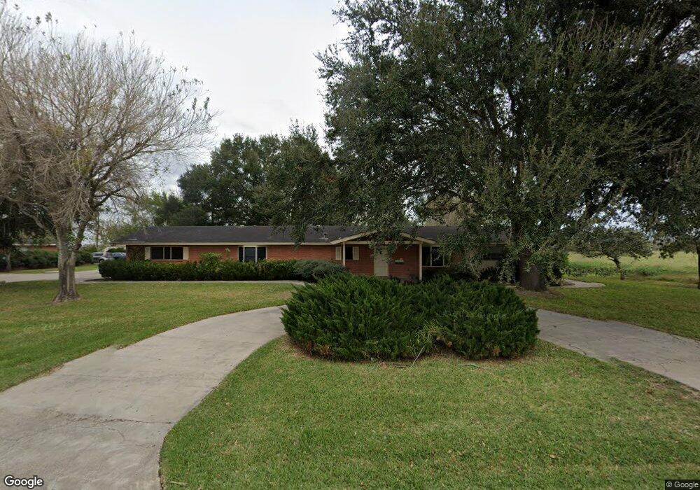
7212 N Mile 6 1/2 W Weslaco, TX 78599
Estimated Value: $460,000
3
Beds
14
Baths
5,604
Sq Ft
$82/Sq Ft
Est. Value
About This Home
This home is located at 7212 N Mile 6 1/2 W, Weslaco, TX 78599 and is currently estimated at $460,000, approximately $82 per square foot. 7212 N Mile 6 1/2 W is a home located in Hidalgo County with nearby schools including Rodolfo Rudy Silva Jr. Elementary School, Beatriz G. Garza Middle School, and Weslaco High School.
Ownership History
Date
Name
Owned For
Owner Type
Purchase Details
Closed on
Jan 18, 2013
Sold by
Boltie Karl and The Estate Of Ernest L Boltie
Bought by
Boltie Properties Llc
Current Estimated Value
Home Financials for this Owner
Home Financials are based on the most recent Mortgage that was taken out on this home.
Original Mortgage
$175,000
Interest Rate
3.33%
Mortgage Type
Purchase Money Mortgage
Create a Home Valuation Report for This Property
The Home Valuation Report is an in-depth analysis detailing your home's value as well as a comparison with similar homes in the area
Home Values in the Area
Average Home Value in this Area
Purchase History
| Date | Buyer | Sale Price | Title Company |
|---|---|---|---|
| Boltie Properties Llc | -- | Valley Land Title Llc |
Source: Public Records
Mortgage History
| Date | Status | Borrower | Loan Amount |
|---|---|---|---|
| Closed | Boltie Properties Llc | $175,000 |
Source: Public Records
Tax History Compared to Growth
Tax History
| Year | Tax Paid | Tax Assessment Tax Assessment Total Assessment is a certain percentage of the fair market value that is determined by local assessors to be the total taxable value of land and additions on the property. | Land | Improvement |
|---|---|---|---|---|
| 2025 | $5,273 | $266,000 | $77,160 | $188,840 |
| 2024 | $5,273 | $281,452 | $77,160 | $204,292 |
| 2023 | $5,176 | $278,665 | $77,160 | $201,505 |
| 2022 | $4,995 | $265,395 | $77,160 | $188,235 |
| 2021 | $4,953 | $257,665 | $77,160 | $180,505 |
| 2020 | $5,094 | $255,821 | $77,160 | $178,661 |
| 2019 | $5,195 | $249,611 | $45,576 | $204,035 |
| 2018 | $5,015 | $240,356 | $45,576 | $194,780 |
| 2017 | $6,144 | $295,524 | $45,576 | $249,948 |
| 2016 | $2,365 | $86,767 | $37,980 | $48,787 |
| 2015 | $1,775 | $86,767 | $37,980 | $48,787 |
Source: Public Records
Map
Nearby Homes
- 2035 W Mile 12 N
- 848 Mile 12 1 2 Rd N
- 2817 Las Nubes
- TBD Roosevelt Rd
- 1308 Navel St
- 1414 Navel St
- 2819 Puma Dr
- 111 Troy Ave
- 10 Roosevelt Rd
- 0000 Mile 12 Rd N
- 00000 Mile 12 Rd N
- 1236 Chloe Rae Cir
- 2802 Stone Oak Dr
- 1901 W Mile 11 N
- 2809 Island Dr
- 5621 N Mile 6 W
- 1/2 S Mile 11 W
- 2501 Kingdom Dr
- 2909 W Mile 11 N
- 1104 Sofia St
- 0 E Mile 12 N
- 2504 W Mile 12 N
- 1217 E Mile 12 N Unit 19 & 20
- 7020 N Mile 6 1/2 W
- 2314 W Mile 12 N
- 2918 W Mile 12 N
- 2940 W Mile 12 N
- 2310 W Mile 12 N
- 7209 N Mile 6 W
- 7209 N Mile 6 W
- 6902 Kathy Ln
- 6812 Kathy Ln
- 2502 La Estrella Dr
- 6808 Kathy Ln
- 2514 La Estrella Dr
- 6804 Kathy Ln
- 2606 La Estrella Dr
- 2612 La Estrella Dr
- 6710 Kathy Ln
- 6901 Kathy Ln