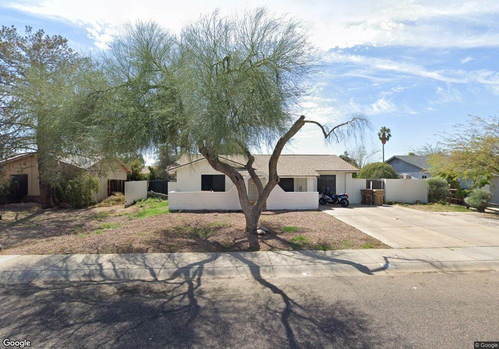
7215 W Carol Ave Peoria, AZ 85345
Estimated Value: $398,000 - $423,000
5
Beds
2
Baths
1,940
Sq Ft
$211/Sq Ft
Est. Value
About This Home
This home is located at 7215 W Carol Ave, Peoria, AZ 85345 and is currently estimated at $408,822, approximately $210 per square foot. 7215 W Carol Ave is a home located in Maricopa County with nearby schools including Ira A Murphy Elementary School, Centennial High School, and Academy of Math and Science - Peoria Advanced.
Ownership History
Date
Name
Owned For
Owner Type
Purchase Details
Closed on
May 22, 2006
Sold by
Byrd Keone L
Bought by
Simms Stacy
Current Estimated Value
Home Financials for this Owner
Home Financials are based on the most recent Mortgage that was taken out on this home.
Original Mortgage
$49,600
Interest Rate
6.57%
Mortgage Type
Stand Alone Second
Purchase Details
Closed on
May 30, 2003
Sold by
Brown Ronald Addison and Brown Annmarie L
Bought by
Beinhart Rosa I
Home Financials for this Owner
Home Financials are based on the most recent Mortgage that was taken out on this home.
Original Mortgage
$125,000
Interest Rate
5.12%
Mortgage Type
Purchase Money Mortgage
Purchase Details
Closed on
May 29, 2003
Sold by
Otis Todd A
Bought by
Brown Ronald Addison and Brown Annmarie L
Home Financials for this Owner
Home Financials are based on the most recent Mortgage that was taken out on this home.
Original Mortgage
$125,000
Interest Rate
5.12%
Mortgage Type
Purchase Money Mortgage
Purchase Details
Closed on
May 9, 2003
Sold by
Patino Ruben C
Bought by
Beinhart Rosa I
Home Financials for this Owner
Home Financials are based on the most recent Mortgage that was taken out on this home.
Original Mortgage
$125,000
Interest Rate
5.12%
Mortgage Type
Purchase Money Mortgage
Purchase Details
Closed on
Feb 12, 2003
Sold by
Jara David and Colchado Luz D
Bought by
Otis Todd A
Purchase Details
Closed on
Mar 27, 1996
Sold by
Colchado Eduardo
Bought by
Colchado Luz D
Purchase Details
Closed on
Feb 22, 1996
Sold by
Jara Margarita
Bought by
Jara David
Purchase Details
Closed on
Aug 18, 1994
Sold by
Stulce Kelly
Bought by
Hawkins Neil C and Hawkins Lynn A
Create a Home Valuation Report for This Property
The Home Valuation Report is an in-depth analysis detailing your home's value as well as a comparison with similar homes in the area
Home Values in the Area
Average Home Value in this Area
Purchase History
| Date | Buyer | Sale Price | Title Company |
|---|---|---|---|
| Simms Stacy | -- | Fidelity National Title | |
| Simms Stacy | $248,000 | Fidelity National Title | |
| Beinhart Rosa I | $125,000 | Security Title Agency | |
| Brown Ronald Addison | -- | Security Title Agency | |
| Beinhart Rosa I | -- | Security Title Agency | |
| Otis Todd A | $73,993 | Stewart Title & Trust | |
| Colchado Luz D | -- | Fidelity Title | |
| Jara David | -- | Fidelity Title | |
| Jara David | $77,000 | Fidelity Title | |
| Hawkins Neil C | -- | First Service Title Agency I | |
| Stulce Kelly | -- | First Service Title Agency I |
Source: Public Records
Mortgage History
| Date | Status | Borrower | Loan Amount |
|---|---|---|---|
| Closed | Simms Stacy | $49,600 | |
| Open | Simms Stacy | $198,400 | |
| Closed | Simms Stacy | $198,400 | |
| Previous Owner | Beinhart Rosa I | $125,000 | |
| Previous Owner | Brown Ronald Addison | $125,000 | |
| Previous Owner | Beinhart Rosa I | $125,000 |
Source: Public Records
Tax History Compared to Growth
Tax History
| Year | Tax Paid | Tax Assessment Tax Assessment Total Assessment is a certain percentage of the fair market value that is determined by local assessors to be the total taxable value of land and additions on the property. | Land | Improvement |
|---|---|---|---|---|
| 2025 | $1,286 | $16,525 | -- | -- |
| 2024 | $1,267 | $15,738 | -- | -- |
| 2023 | $1,267 | $28,820 | $5,760 | $23,060 |
| 2022 | $1,241 | $21,970 | $4,390 | $17,580 |
| 2021 | $1,328 | $20,180 | $4,030 | $16,150 |
| 2020 | $1,341 | $19,050 | $3,810 | $15,240 |
| 2019 | $1,297 | $16,920 | $3,380 | $13,540 |
| 2018 | $1,254 | $15,870 | $3,170 | $12,700 |
| 2017 | $707 | $11,360 | $2,270 | $9,090 |
| 2016 | $700 | $10,700 | $2,140 | $8,560 |
| 2015 | $653 | $9,350 | $1,870 | $7,480 |
Source: Public Records
Map
Nearby Homes
- 7133 W Hatcher Rd
- 9672 N 72nd Ave
- 9167 N 73rd Ln
- 7040 W Olive Ave Unit 94
- 6942 W Olive Ave Unit 45
- 6942 W Olive Ave Unit 108
- 6942 W Olive Ave Unit 73
- 6942 W Olive Ave Unit 44
- 6942 W Olive Ave Unit 114
- 6942 W Olive Ave Unit 30
- 6942 W Olive Ave Unit 20
- 7115 W Brown St
- 7136 W Cheryl Dr
- 7336 W Cheryl Dr
- 6854 W Ironwood Dr
- 6931 W Beryl Ave
- 7508 W Beryl Ave
- 8601 N 71st Ave
- 9540 N 66th Dr
- 8601 N 71st Ave Unit 166
- 7209 W Carol Ave
- 7221 W Carol Ave
- 7214 W Hatcher Rd
- 7208 W Hatcher Rd
- 7220 W Hatcher Rd Unit 4
- 7203 W Carol Ave
- 7227 W Carol Ave
- 7214 W Carol Ave
- 7220 W Carol Ave
- 7208 W Carol Ave
- 7226 W Hatcher Rd
- 7202 W Hatcher Rd
- 7226 W Carol Ave
- 7139 W Carol Ave
- 7233 W Carol Ave
- 7232 W Hatcher Rd
- 7138 W Hatcher Rd
- 7215 W Vogel Ave
- 7209 W Vogel Ave
- 7221 W Vogel Ave