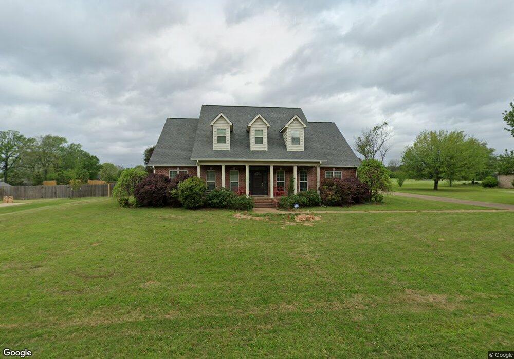
7217 N Richland Dr Texarkana, TX 75503
Estimated Value: $440,000 - $498,000
5
Beds
4
Baths
3,195
Sq Ft
$144/Sq Ft
Est. Value
About This Home
This home is located at 7217 N Richland Dr, Texarkana, TX 75503 and is currently estimated at $460,625, approximately $144 per square foot. 7217 N Richland Dr is a home located in Bowie County with nearby schools including Margaret Fischer Davis Elementary School, Pleasant Grove Intermediate School, and Pleasant Grove Middle School.
Ownership History
Date
Name
Owned For
Owner Type
Purchase Details
Closed on
May 6, 2013
Sold by
Matthews Melissa Davis and Matthews Eric
Bought by
Drewry Marcus James and Drewry Kimberly Michelle
Current Estimated Value
Home Financials for this Owner
Home Financials are based on the most recent Mortgage that was taken out on this home.
Original Mortgage
$243,000
Outstanding Balance
$172,608
Interest Rate
3.61%
Mortgage Type
New Conventional
Estimated Equity
$288,017
Create a Home Valuation Report for This Property
The Home Valuation Report is an in-depth analysis detailing your home's value as well as a comparison with similar homes in the area
Home Values in the Area
Average Home Value in this Area
Purchase History
| Date | Buyer | Sale Price | Title Company |
|---|---|---|---|
| Drewry Marcus James | -- | None Available |
Source: Public Records
Mortgage History
| Date | Status | Borrower | Loan Amount |
|---|---|---|---|
| Open | Drewry Marcus James | $243,000 |
Source: Public Records
Tax History Compared to Growth
Tax History
| Year | Tax Paid | Tax Assessment Tax Assessment Total Assessment is a certain percentage of the fair market value that is determined by local assessors to be the total taxable value of land and additions on the property. | Land | Improvement |
|---|---|---|---|---|
| 2025 | $7,870 | $444,245 | $30,000 | $414,245 |
| 2024 | $7,870 | $416,484 | $30,000 | $402,549 |
| 2023 | $7,129 | $378,622 | $0 | $0 |
| 2022 | $8,452 | $378,723 | $30,000 | $348,723 |
| 2021 | $8,183 | $312,911 | $30,000 | $282,911 |
| 2020 | $8,123 | $308,973 | $30,000 | $278,973 |
| 2019 | $7,987 | $296,101 | $30,000 | $266,101 |
| 2018 | $7,701 | $287,106 | $30,000 | $257,106 |
| 2017 | $7,163 | $267,770 | $30,000 | $237,770 |
| 2016 | $6,852 | $256,134 | $25,000 | $231,134 |
| 2015 | $6,902 | $258,956 | $25,000 | $233,956 |
| 2014 | $6,902 | $256,768 | $25,000 | $231,768 |
Source: Public Records
Map
Nearby Homes
- 7207 N Richland Dr
- 7104 N Richland Dr
- 5608 Hillcrest Dr
- 14 Stonewall Trace
- 8227 N Kings Hwy
- 6706 Cameron
- 6803 Kincaid St
- 7303 Old Spanish Dr
- 6810 Kincaid St
- 8109 Gadwall Trail
- 6714 Lawson Cir
- 8304 Greenhead Dr
- 7008 Cameron
- 8102 Gadwall Trail
- 8308 Greenhead Dr
- Lot 1 High -Cooper Lane Estate III Dr
- 7012 Cameron
- 1302 Arnold Ln
- 8203 Teal Rd
- 8112 Gadwall Trail
- 7210 N Richland Dr
- 7213 N Richland Dr
- 7206 N Richland Dr
- 7204 N Richland Dr
- 7214 N Richland Dr
- 7211 N Richland Dr
- 7202 N Richland Dr
- 6403 Lost Creek Dr
- 7215 Stonewall Dr
- 7213 Stonewall Dr
- 7200 N Richland Dr
- 7217 Stonewall Dr
- 7211 Stonewall Dr
- 7209 N Richland Dr
- 7209 Stonewall Dr
- 6404 Lost Creek Dr
- 6404 Lost Creek Dr
- 7219 Stonewall Dr
- 7110 N Richland Dr
- 7207 Stonewall Dr