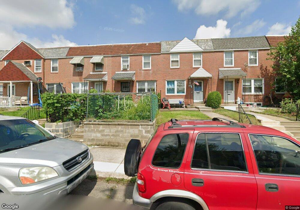
7218 Horrocks St Philadelphia, PA 19149
Castor Gardens NeighborhoodEstimated Value: $235,000 - $262,000
3
Beds
1
Bath
1,216
Sq Ft
$202/Sq Ft
Est. Value
About This Home
This home is located at 7218 Horrocks St, Philadelphia, PA 19149 and is currently estimated at $245,796, approximately $202 per square foot. 7218 Horrocks St is a home located in Philadelphia County with nearby schools including Solomon Solis-Cohen School, Castor Gardens Middle School, and Northeast High School.
Ownership History
Date
Name
Owned For
Owner Type
Purchase Details
Closed on
Dec 7, 2001
Sold by
Dorfman Anita and Estate Of Eleanore Slomsky
Bought by
Huang Yok Shun and Wen Ling Mei
Current Estimated Value
Home Financials for this Owner
Home Financials are based on the most recent Mortgage that was taken out on this home.
Original Mortgage
$40,000
Interest Rate
6.61%
Mortgage Type
Stand Alone First
Create a Home Valuation Report for This Property
The Home Valuation Report is an in-depth analysis detailing your home's value as well as a comparison with similar homes in the area
Home Values in the Area
Average Home Value in this Area
Purchase History
| Date | Buyer | Sale Price | Title Company |
|---|---|---|---|
| Huang Yok Shun | $60,000 | -- |
Source: Public Records
Mortgage History
| Date | Status | Borrower | Loan Amount |
|---|---|---|---|
| Closed | Huang Yok Shun | $40,000 |
Source: Public Records
Tax History Compared to Growth
Tax History
| Year | Tax Paid | Tax Assessment Tax Assessment Total Assessment is a certain percentage of the fair market value that is determined by local assessors to be the total taxable value of land and additions on the property. | Land | Improvement |
|---|---|---|---|---|
| 2025 | $2,703 | $232,300 | $46,460 | $185,840 |
| 2024 | $2,703 | $232,300 | $46,460 | $185,840 |
| 2023 | $2,703 | $193,100 | $38,620 | $154,480 |
| 2022 | $1,298 | $148,100 | $38,620 | $109,480 |
| 2021 | $1,928 | $0 | $0 | $0 |
| 2020 | $1,928 | $0 | $0 | $0 |
| 2019 | $1,849 | $0 | $0 | $0 |
| 2018 | $1,299 | $0 | $0 | $0 |
| 2017 | $1,719 | $0 | $0 | $0 |
| 2016 | $1,299 | $0 | $0 | $0 |
| 2015 | $1,244 | $0 | $0 | $0 |
| 2014 | -- | $122,800 | $22,339 | $100,461 |
| 2012 | -- | $15,584 | $1,363 | $14,221 |
Source: Public Records
Map
Nearby Homes
- 7123 Souder St
- 7247 Eastwood St
- 7231 Eastwood St
- 7219 Rutland St
- 7039 Kindred St
- 7034 Souder St
- 7155 Saul St
- 7153 Saul St
- 7123 Castor Ave
- 7050 Lynford St
- 7214 Bradford St
- 7035 Rutland St
- 2105 Friendship St
- 7019 Rutland St
- 1405 Saint Vincent St
- 7223 Hanford St
- 1403 Englewood St
- 1352 Englewood St
- 2140 Princeton Ave
- 7414 Castor Ave
- 7220 Horrocks St
- 7216 Horrocks St
- 7214 Horrocks St
- 7222 Horrocks St
- 7212 Horrocks St
- 7224 Horrocks St
- 7226 Horrocks St
- 7210 Horrocks St
- 7208 Horrocks St
- 7217 Souder St
- 7228 Horrocks St
- 7223 Souder St
- 7215 Souder St
- 7206 Horrocks St
- 7221 Souder St
- 7225 Souder St
- 7213 Souder St
- 7227 Souder St
- 7211 Souder St
- 7209 Souder St