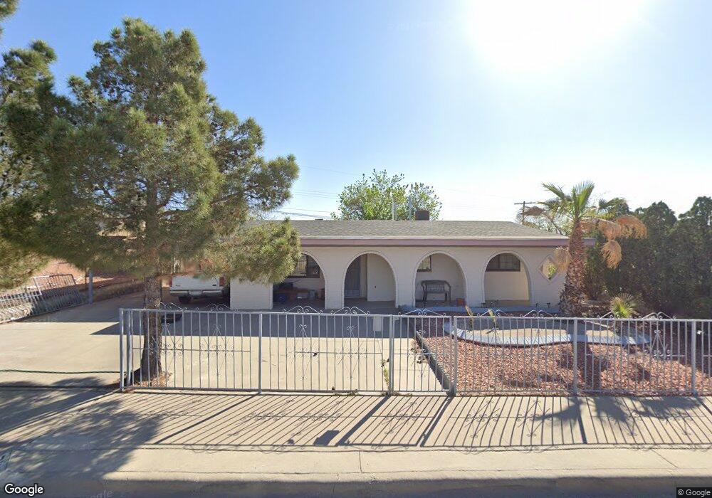
7219 Benson Dr El Paso, TX 79915
Ranchland West NeighborhoodEstimated Value: $194,018 - $222,000
3
Beds
3
Baths
1,900
Sq Ft
$108/Sq Ft
Est. Value
About This Home
This home is located at 7219 Benson Dr, El Paso, TX 79915 and is currently estimated at $206,005, approximately $108 per square foot. 7219 Benson Dr is a home located in El Paso County with nearby schools including Bel Air Middle, Bel Air High School, and Immanuel Christian School.
Ownership History
Date
Name
Owned For
Owner Type
Purchase Details
Closed on
Feb 19, 2004
Sold by
Reza Gilberto and Reza Carolina Tercero
Bought by
Aranda Javier and Aranda Claudia
Current Estimated Value
Home Financials for this Owner
Home Financials are based on the most recent Mortgage that was taken out on this home.
Original Mortgage
$77,388
Outstanding Balance
$35,562
Interest Rate
5.65%
Mortgage Type
FHA
Estimated Equity
$170,443
Purchase Details
Closed on
Nov 8, 1996
Sold by
Haciendas Del Norte Joint Venture
Bought by
Reza Gilberto and Reza Petra R
Home Financials for this Owner
Home Financials are based on the most recent Mortgage that was taken out on this home.
Original Mortgage
$21,565
Interest Rate
9.87%
Mortgage Type
Seller Take Back
Purchase Details
Closed on
Jan 13, 1995
Sold by
American Finance & Investment Co Inc
Bought by
Reza Gilberto and Reza Petra
Create a Home Valuation Report for This Property
The Home Valuation Report is an in-depth analysis detailing your home's value as well as a comparison with similar homes in the area
Home Values in the Area
Average Home Value in this Area
Purchase History
| Date | Buyer | Sale Price | Title Company |
|---|---|---|---|
| Aranda Javier | -- | -- | |
| Reza Gilberto | -- | -- | |
| Reza Gilberto | -- | -- |
Source: Public Records
Mortgage History
| Date | Status | Borrower | Loan Amount |
|---|---|---|---|
| Open | Aranda Javier | $77,388 | |
| Previous Owner | Reza Gilberto | $21,565 |
Source: Public Records
Tax History Compared to Growth
Tax History
| Year | Tax Paid | Tax Assessment Tax Assessment Total Assessment is a certain percentage of the fair market value that is determined by local assessors to be the total taxable value of land and additions on the property. | Land | Improvement |
|---|---|---|---|---|
| 2025 | $2,449 | $169,356 | -- | -- |
| 2024 | $2,449 | $153,960 | -- | -- |
| 2023 | $2,220 | $139,964 | $0 | $0 |
| 2022 | $3,951 | $127,240 | $15,122 | $112,118 |
| 2021 | $4,136 | $127,240 | $15,122 | $112,118 |
| 2020 | $3,700 | $117,154 | $15,122 | $102,032 |
| 2018 | $3,599 | $115,720 | $14,840 | $100,880 |
| 2017 | $3,249 | $106,302 | $14,840 | $91,462 |
| 2016 | $3,249 | $106,302 | $14,840 | $91,462 |
| 2015 | $2,488 | $106,302 | $14,840 | $91,462 |
| 2014 | $2,488 | $106,203 | $14,840 | $91,363 |
Source: Public Records
Map
Nearby Homes
- 7204 Benson Dr
- 7315 Mojave Dr
- 7403 Mojave Dr
- 15161 Target Ave
- 1124 Hunter Dr
- 1121 Belen Rd
- 7229 Stiles Dr
- 7113 Dale Rd
- 9525 Desert Ridge Dr
- 7534 Taxco Dr
- 7564 Matamoros Dr
- 304 Ramona Ave
- 8536 Morley Dr
- 9674 Stonehaven Dr
- 9605 Montwood Dr
- 7622 Matamoros Dr
- 7542 Hermosillo Dr
- 9500 Mcintosh Dr
- 8704 Darlina Dr
- 215 Wooldridge Dr
- 7217 Benson Dr
- 7221 Benson Dr
- 7220 Alpine Dr
- 7215 Benson Dr
- 7223 Benson Dr
- 7222 Alpine Dr
- 7218 Alpine Dr
- 7214 Benson Dr
- 7216 Benson Dr
- 7212 Benson Dr
- 7218 Benson Dr
- 7216 Alpine Dr
- 7257 Benson Dr
- 7213 Benson Dr
- 1401 Winslow Rd
- 7224 Alpine Dr
- 7220 Benson Dr
- 7210 Benson Dr
- 7214 Alpine Dr
- 7222 Benson Dr