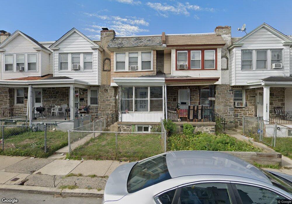
7219 Clinton Rd Upper Darby, PA 19082
Estimated Value: $112,000 - $145,000
3
Beds
1
Bath
1,170
Sq Ft
$109/Sq Ft
Est. Value
About This Home
This home is located at 7219 Clinton Rd, Upper Darby, PA 19082 and is currently estimated at $128,000, approximately $109 per square foot. 7219 Clinton Rd is a home located in Delaware County with nearby schools including Upper Darby High School, Vision Academy Charter School, and Lansdowne Friends School.
Ownership History
Date
Name
Owned For
Owner Type
Purchase Details
Closed on
Aug 27, 2015
Sold by
Thompson Linda B and The Barnard Union Trust
Bought by
Lulah Katz Acquisitions Llc
Current Estimated Value
Home Financials for this Owner
Home Financials are based on the most recent Mortgage that was taken out on this home.
Original Mortgage
$237,500
Interest Rate
3.98%
Mortgage Type
Purchase Money Mortgage
Purchase Details
Closed on
Nov 21, 2013
Sold by
Thompson Linda B
Bought by
Thompson Linda B and The Barnard Union Trust
Purchase Details
Closed on
Mar 19, 2003
Sold by
Hud
Bought by
Thompson William D and Thompson Linda B
Purchase Details
Closed on
Oct 28, 2002
Sold by
Washington Mutual Bank Fa
Bought by
Hud
Purchase Details
Closed on
Feb 5, 2002
Sold by
Scudder Roger C and Scudder Rita E
Bought by
Washington Mutual Home Loans Inc
Create a Home Valuation Report for This Property
The Home Valuation Report is an in-depth analysis detailing your home's value as well as a comparison with similar homes in the area
Home Values in the Area
Average Home Value in this Area
Purchase History
| Date | Buyer | Sale Price | Title Company |
|---|---|---|---|
| Lulah Katz Acquisitions Llc | $83,200 | Attorney | |
| Thompson Linda B | -- | None Available | |
| Thompson William D | $31,500 | Ta Title | |
| Hud | -- | -- | |
| Washington Mutual Home Loans Inc | $1,719 | -- |
Source: Public Records
Mortgage History
| Date | Status | Borrower | Loan Amount |
|---|---|---|---|
| Previous Owner | Lulah Katz Acquisitions Llc | $237,500 |
Source: Public Records
Tax History Compared to Growth
Tax History
| Year | Tax Paid | Tax Assessment Tax Assessment Total Assessment is a certain percentage of the fair market value that is determined by local assessors to be the total taxable value of land and additions on the property. | Land | Improvement |
|---|---|---|---|---|
| 2025 | $2,881 | $68,120 | $13,700 | $54,420 |
| 2024 | $2,881 | $68,120 | $13,700 | $54,420 |
| 2023 | $2,854 | $68,120 | $13,700 | $54,420 |
| 2022 | $2,777 | $68,120 | $13,700 | $54,420 |
| 2021 | $3,744 | $68,120 | $13,700 | $54,420 |
| 2020 | $2,193 | $33,900 | $12,450 | $21,450 |
| 2019 | $2,154 | $33,900 | $12,450 | $21,450 |
| 2018 | $2,130 | $33,900 | $0 | $0 |
| 2017 | $2,074 | $33,900 | $0 | $0 |
| 2016 | $190 | $33,900 | $0 | $0 |
| 2015 | $190 | $33,900 | $0 | $0 |
| 2014 | $190 | $44,800 | $0 | $0 |
Source: Public Records
Map
Nearby Homes
- 7229 Clinton Rd
- 7216 Clinton Rd
- 669 Long Ln
- 660 Copley Rd
- 404 Croyden Rd
- 7247 Guilford Rd
- 607 Littlecroft Rd
- 7155 Radbourne Rd
- 7181 Ruskin Ln
- 7162 Radbourne Rd
- 726 Copley Rd
- 535 Glendale Rd
- 7042 Clinton Rd
- 346 Long Ln
- 506 Hampden Rd
- 6997 Guilford Rd
- 433 Copley Rd
- 243 Coverly Rd
- 432 Grace Rd
- 418 Hampden Rd
- 7221 Clinton Rd
- 7217 Clinton Rd
- 7223 Clinton Rd
- 7215 Clinton Rd
- 7225 Clinton Rd
- 7213 Clinton Rd
- 7227 Clinton Rd
- 7211 Clinton Rd
- 7216 Alderbrook Rd
- 7216 Alderbrook Rd
- 7216 Alderbrook Rd
- 7216 Alderbrook Rd
- 7218 Alderbrook Rd
- 7218 Alderbrook Rd
- 7218 Alderbrook Rd
- 7218 Alderbrook Rd
- 7214 Alderbrook Rd
- 7214 Alderbrook Rd
- 7214 Alderbrook Rd
- 7214 Alderbrook Rd