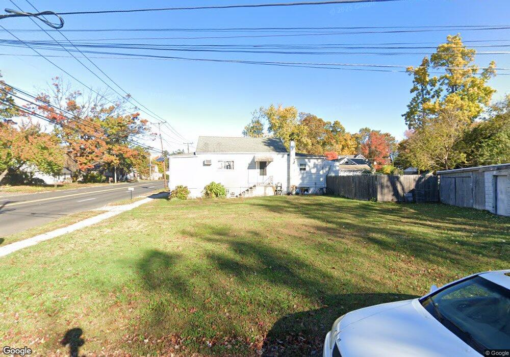
722 Arena Dr Trenton, NJ 08610
Estimated Value: $251,098 - $347,000
--
Bed
--
Bath
900
Sq Ft
$316/Sq Ft
Est. Value
About This Home
This home is located at 722 Arena Dr, Trenton, NJ 08610 and is currently estimated at $284,525, approximately $316 per square foot. 722 Arena Dr is a home located in Mercer County with nearby schools including George E. Wilson Elementary School, Albert E. Grice Middle School, and Hamilton West-Watson High School.
Ownership History
Date
Name
Owned For
Owner Type
Purchase Details
Closed on
Dec 7, 2009
Sold by
Winnick Stanley
Bought by
Frazier Julius J
Current Estimated Value
Home Financials for this Owner
Home Financials are based on the most recent Mortgage that was taken out on this home.
Original Mortgage
$112,917
Outstanding Balance
$74,103
Interest Rate
5.02%
Mortgage Type
FHA
Estimated Equity
$210,422
Create a Home Valuation Report for This Property
The Home Valuation Report is an in-depth analysis detailing your home's value as well as a comparison with similar homes in the area
Home Values in the Area
Average Home Value in this Area
Purchase History
| Date | Buyer | Sale Price | Title Company |
|---|---|---|---|
| Frazier Julius J | $115,000 | Fidelity Natl Title Ins Co |
Source: Public Records
Mortgage History
| Date | Status | Borrower | Loan Amount |
|---|---|---|---|
| Open | Frazier Julius J | $112,917 |
Source: Public Records
Tax History Compared to Growth
Tax History
| Year | Tax Paid | Tax Assessment Tax Assessment Total Assessment is a certain percentage of the fair market value that is determined by local assessors to be the total taxable value of land and additions on the property. | Land | Improvement |
|---|---|---|---|---|
| 2025 | $4,296 | $121,900 | $29,100 | $92,800 |
| 2024 | $4,026 | $121,900 | $29,100 | $92,800 |
| 2023 | $4,026 | $121,900 | $29,100 | $92,800 |
| 2022 | $3,963 | $121,900 | $29,100 | $92,800 |
| 2021 | $4,904 | $121,900 | $29,100 | $92,800 |
| 2020 | $4,465 | $121,900 | $29,100 | $92,800 |
| 2019 | $4,334 | $121,900 | $29,100 | $92,800 |
| 2018 | $4,276 | $121,900 | $29,100 | $92,800 |
| 2017 | $4,086 | $121,900 | $29,100 | $92,800 |
| 2016 | $3,296 | $121,900 | $29,100 | $92,800 |
| 2015 | $3,599 | $69,100 | $19,500 | $49,600 |
| 2014 | $3,552 | $69,100 | $19,500 | $49,600 |
Source: Public Records
Map
Nearby Homes
- 56 Wert Ave
- 77 Wert Ave
- 624 Hunt Ave
- 50 Kenwood Terrace
- 533 Hunt Ave
- 529 Hunt Ave
- 45 Kenwood Terrace
- 252 Churchill Ave
- 164 Lillian Ave
- 408 Berg Ave
- 234 Thropp Ave
- 429 Wilfred Ave
- 204 Thropp Ave
- 158 Churchill Ave
- 323 Wilfred Ave
- 90 Sundance Dr
- 74 Taft Ave
- 156 Maddock Ave
- 125 Sundance Dr
- 229 Wilfred Ave