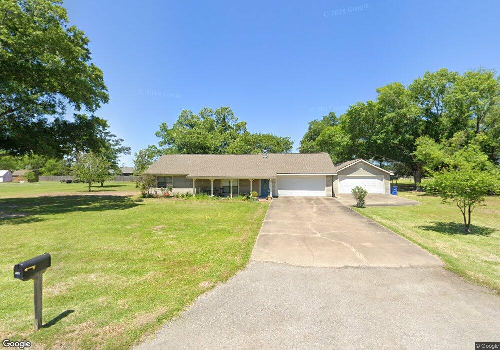
722 Bellview Dr Lake Charles, LA 70611
Estimated Value: $207,000 - $217,000
3
Beds
2
Baths
1,443
Sq Ft
$146/Sq Ft
Est. Value
About This Home
This home is located at 722 Bellview Dr, Lake Charles, LA 70611 and is currently estimated at $211,216, approximately $146 per square foot. 722 Bellview Dr is a home located in Calcasieu Parish with nearby schools including Gillis Elementary School, Moss Bluff Middle School, and Sam Houston High School.
Ownership History
Date
Name
Owned For
Owner Type
Purchase Details
Closed on
Feb 24, 2025
Sold by
Crow David Rubin and Crow Danyelle Dominique
Bought by
Peterson James Scott and Peterson Shawntel Yvonne
Current Estimated Value
Home Financials for this Owner
Home Financials are based on the most recent Mortgage that was taken out on this home.
Original Mortgage
$168,000
Outstanding Balance
$167,150
Interest Rate
6.93%
Mortgage Type
New Conventional
Estimated Equity
$44,066
Create a Home Valuation Report for This Property
The Home Valuation Report is an in-depth analysis detailing your home's value as well as a comparison with similar homes in the area
Home Values in the Area
Average Home Value in this Area
Purchase History
| Date | Buyer | Sale Price | Title Company |
|---|---|---|---|
| Peterson James Scott | $210,000 | None Listed On Document | |
| Peterson James Scott | $210,000 | None Listed On Document |
Source: Public Records
Mortgage History
| Date | Status | Borrower | Loan Amount |
|---|---|---|---|
| Open | Peterson James Scott | $168,000 | |
| Closed | Peterson James Scott | $168,000 |
Source: Public Records
Tax History Compared to Growth
Tax History
| Year | Tax Paid | Tax Assessment Tax Assessment Total Assessment is a certain percentage of the fair market value that is determined by local assessors to be the total taxable value of land and additions on the property. | Land | Improvement |
|---|---|---|---|---|
| 2024 | $1,394 | $12,970 | $2,700 | $10,270 |
| 2023 | $1,394 | $12,970 | $2,700 | $10,270 |
| 2022 | $1,370 | $12,970 | $2,700 | $10,270 |
| 2021 | $1,438 | $12,970 | $2,700 | $10,270 |
| 2020 | $1,288 | $11,830 | $2,590 | $9,240 |
| 2019 | $1,395 | $12,770 | $2,500 | $10,270 |
| 2018 | $577 | $12,770 | $2,500 | $10,270 |
| 2017 | $1,417 | $12,770 | $2,500 | $10,270 |
| 2016 | $1,396 | $12,770 | $2,500 | $10,270 |
| 2015 | $996 | $8,920 | $2,200 | $6,720 |
Source: Public Records
Map
Nearby Homes
- 721 Bellview Dr
- 2161 Belfield Rd
- 670 Amber Dr
- 649 Jonquil Dr
- 512 Gist Ln
- 725 Peridot Ln
- 0 Tbd Crawford Dr
- 1507 Bowen Rd
- 1753 Downing Rd
- 0 Duplechain Ln
- 0 Crawford Dr Unit SWL25003298
- 1890 Esther Dr
- 279 Victoria Dr
- 2449 Duplechin Ln
- 573 Debra Ln
- 995 Joe Miller Rd
- 0 Highway 171 Hwy Unit SWL25101583
- 0 Highway 171 Hwy Unit SWL25002351
- 0 Highway 171 Hwy Unit SWL22005807
- 422 Debra Ln
- 690 Belleview Dr
- 721 Belleview Dr
- 721 Belview Dr
- 723 Caravelle Dr
- 693 Belleview Dr
- 756 Belleview Dr
- 0 Bellview Dr
- 757 Belleview Dr
- 757 Bellview Dr
- 731 Caravelle Dr
- 0 Caravelle Dr Unit 187598
- 0 Caravelle Dr Unit 134643
- 0 Caravelle Dr Unit 182805
- 0 Caravelle Dr
- TBD Caravelle Dr
- 2076 Belfield Rd
- 700 Concord Dr
- 686 Belleview Dr
- 690 Concord Dr
- 2114 Belfield Rd