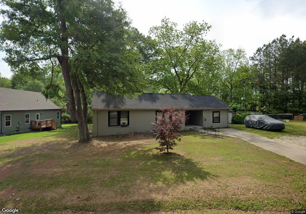
722 Burns Rd Carrollton, GA 30117
Estimated Value: $244,000 - $276,000
4
Beds
2
Baths
1,416
Sq Ft
$187/Sq Ft
Est. Value
About This Home
This home is located at 722 Burns Rd, Carrollton, GA 30117 and is currently estimated at $264,161, approximately $186 per square foot. 722 Burns Rd is a home located in Carroll County with nearby schools including Carrollton Elementary School, Carrollton Upper Elementary School, and Carrollton Middle School.
Ownership History
Date
Name
Owned For
Owner Type
Purchase Details
Closed on
Nov 20, 2008
Sold by
Not Provided
Bought by
Atkinson Jacqueline H
Current Estimated Value
Purchase Details
Closed on
May 6, 2008
Sold by
Morehead James T
Bought by
The Bank Of New York Trust Co
Purchase Details
Closed on
Apr 11, 2007
Sold by
Morehead James T
Bought by
Calhoun Hubert
Purchase Details
Closed on
Dec 13, 2004
Sold by
Calhoun Hubert and Calhoun Patricia H
Bought by
Morehead James T
Home Financials for this Owner
Home Financials are based on the most recent Mortgage that was taken out on this home.
Original Mortgage
$99,200
Interest Rate
5.67%
Mortgage Type
New Conventional
Purchase Details
Closed on
Mar 16, 2004
Sold by
Calhoun Hubert and P H
Bought by
Calhoun Hubert and Calhoun Patricia H
Purchase Details
Closed on
Mar 2, 1989
Bought by
Calhoun Hubert and P H
Create a Home Valuation Report for This Property
The Home Valuation Report is an in-depth analysis detailing your home's value as well as a comparison with similar homes in the area
Home Values in the Area
Average Home Value in this Area
Purchase History
| Date | Buyer | Sale Price | Title Company |
|---|---|---|---|
| Atkinson Jacqueline H | $45,000 | -- | |
| The Bank Of New York Trust Co | $103,000 | -- | |
| Calhoun Hubert | -- | -- | |
| Morehead James T | $91,500 | -- | |
| Morehead James T | $91,500 | -- | |
| Calhoun Hubert | -- | -- | |
| Calhoun Hubert | -- | -- |
Source: Public Records
Mortgage History
| Date | Status | Borrower | Loan Amount |
|---|---|---|---|
| Previous Owner | Morehead James T | $99,200 |
Source: Public Records
Tax History Compared to Growth
Tax History
| Year | Tax Paid | Tax Assessment Tax Assessment Total Assessment is a certain percentage of the fair market value that is determined by local assessors to be the total taxable value of land and additions on the property. | Land | Improvement |
|---|---|---|---|---|
| 2024 | $1,916 | $82,389 | $22,113 | $60,276 |
| 2023 | $1,901 | $76,884 | $22,113 | $54,771 |
| 2022 | $1,492 | $59,095 | $14,742 | $44,353 |
| 2021 | $1,259 | $48,949 | $10,920 | $38,029 |
| 2020 | $1,164 | $44,790 | $10,920 | $33,870 |
| 2019 | $1,101 | $41,620 | $10,920 | $30,700 |
| 2018 | $992 | $37,139 | $10,920 | $26,219 |
| 2017 | $997 | $37,139 | $10,920 | $26,219 |
Source: Public Records
Map
Nearby Homes
- 0 Burns Rd Unit LOT 2 10571612
- 0 Burns Rd Unit LOT 3 10571635
- 0 Burns Rd Unit LOT 1 10571595
- 0 Burns Rd Unit 148013
- 8 Horsley Mill Rd
- 208 Lane Dr
- 208 Lane Dr Unit LOT 62
- 9 Horsley Mill Rd
- 0 Carroll Cir Unit LOTS 4-8 10571562
- 403 Burns Rd
- 114 Bennett Cir
- Plan 2121 at Canterbury Villas
- Plan 2307 at Canterbury Villas
- 204 Chaucer Ln
- Plan 1522 at Canterbury Villas
- Plan 1634 at Canterbury Villas
- Plan 2628 at Canterbury Villas
- 150 Cedar Park Way
- 112 Lane Dr
- 112 Lane Dr Unit LOT 68
- 731 Burns Rd
- 729 Burns Rd
- 727 Burns Rd
- 727 Burns Rd
- 724 Burns Rd
- 738 Burns Rd
- 721 Burns Rd
- 720 Burns Rd
- 741 Burns Rd
- 118 Sunrise Strip
- 120 Sunrise Strip
- 120 Sunrise Strip
- 114 Sunrise Strip
- 124 Sunrise Strip
- 128 Sunrise Strip
- 421 Belva St
- 412 Old Newnan Rd
- 119 Sunrise Strip
- 119 Sunrise Strip
- 0 Sunrise Strip Unit 8839202