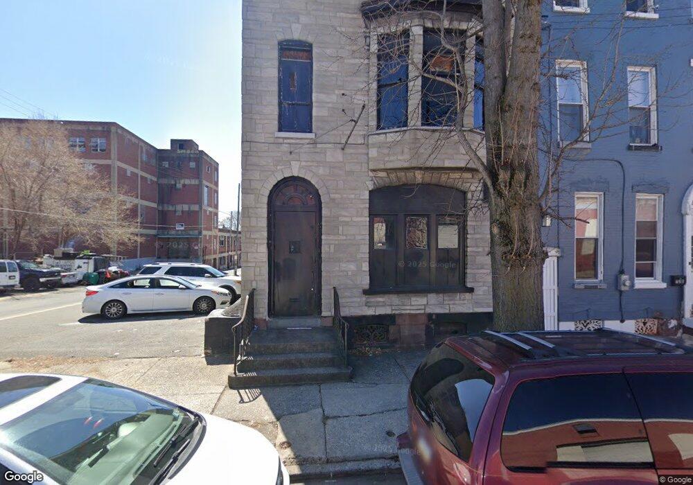
722 Chestnut St Reading, PA 19602
Southeast Reading Neighborhood
--
Bed
--
Bath
5,236
Sq Ft
2,178
Sq Ft Lot
About This Home
This home is located at 722 Chestnut St, Reading, PA 19602. 722 Chestnut St is a home located in Berks County with nearby schools including Amanda E. Stout Elementary School, Southern Middle School, and Reading Senior High School.
Ownership History
Date
Name
Owned For
Owner Type
Purchase Details
Closed on
Dec 14, 2023
Sold by
Recycled Spaces Llc
Bought by
Aion Group Llc
Home Financials for this Owner
Home Financials are based on the most recent Mortgage that was taken out on this home.
Original Mortgage
$135,000
Interest Rate
7.76%
Mortgage Type
Credit Line Revolving
Purchase Details
Closed on
May 31, 2005
Sold by
Blue Ball National Bank
Bought by
Recycled Spaces Llc
Purchase Details
Closed on
Aug 17, 2004
Sold by
Hernandez Pedro A and Hernandez Eduardo
Bought by
Blue Ball National Bank
Create a Home Valuation Report for This Property
The Home Valuation Report is an in-depth analysis detailing your home's value as well as a comparison with similar homes in the area
Home Values in the Area
Average Home Value in this Area
Purchase History
| Date | Buyer | Sale Price | Title Company |
|---|---|---|---|
| Aion Group Llc | $150,000 | None Listed On Document | |
| Recycled Spaces Llc | $31,000 | -- | |
| Blue Ball National Bank | $4,500 | -- |
Source: Public Records
Mortgage History
| Date | Status | Borrower | Loan Amount |
|---|---|---|---|
| Closed | Aion Group Llc | $135,000 |
Source: Public Records
Tax History Compared to Growth
Tax History
| Year | Tax Paid | Tax Assessment Tax Assessment Total Assessment is a certain percentage of the fair market value that is determined by local assessors to be the total taxable value of land and additions on the property. | Land | Improvement |
|---|---|---|---|---|
| 2025 | $548 | $20,200 | $11,000 | $9,200 |
| 2024 | $897 | $20,200 | $11,000 | $9,200 |
| 2023 | $883 | $20,200 | $11,000 | $9,200 |
| 2022 | $883 | $20,200 | $11,000 | $9,200 |
| 2021 | $883 | $20,200 | $11,000 | $9,200 |
| 2020 | $874 | $20,200 | $11,000 | $9,200 |
| 2019 | $874 | $20,200 | $11,000 | $9,200 |
| 2018 | $874 | $20,200 | $11,000 | $9,200 |
| 2017 | $868 | $20,200 | $11,000 | $9,200 |
| 2016 | $496 | $20,200 | $11,000 | $9,200 |
| 2015 | $496 | $20,200 | $11,000 | $9,200 |
| 2014 | $457 | $20,200 | $11,000 | $9,200 |
Source: Public Records
Map
Nearby Homes
- 129 Lemon St
- 730 Franklin St
- 737 Bingaman St
- 816 Franklin St
- 311 S 8th St
- 830 Bingaman St
- 319 S 8th St
- 135 S 6th St
- 234 Orange St
- 22 & 24 Neversink St
- 20 Neversink St
- 646 Bingaman St
- 316 S 10th St
- 464 Spring Garden St
- 529 Bingaman St
- 525 Bingaman St
- 226 S 5th St
- 238 S 5th St
- 933 Cotton St
- 122 Maple St
- 720 Chestnut St
- 718 Chestnut St
- 716 Chestnut St
- 714 Chestnut St
- 712 Chestnut St
- 728 Chestnut St
- 133-135 Lemon St
- 730 Chestnut St
- 732 Chestnut St
- 725 Chestnut St
- 734 Chestnut St
- 736 Chestnut St
- 727 Chestnut St
- 729 Chestnut St
- 731 Chestnut St
- 740 Chestnut St
- 733 Chestnut St
- 742 Chestnut St
- 735 Chestnut St
- 737 Chestnut St