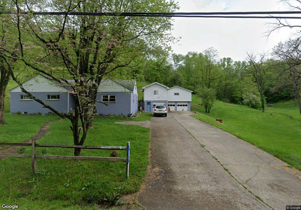
722 Coal River Rd Saint Albans, WV 25177
Estimated Value: $231,000 - $292,000
4
Beds
3
Baths
2,377
Sq Ft
$110/Sq Ft
Est. Value
About This Home
This home is located at 722 Coal River Rd, Saint Albans, WV 25177 and is currently estimated at $262,178, approximately $110 per square foot. 722 Coal River Rd is a home located in Kanawha County with nearby schools including Andrews Heights Elementary School, Hayes Middle School, and Saint Albans High School.
Ownership History
Date
Name
Owned For
Owner Type
Purchase Details
Closed on
Apr 5, 2013
Sold by
Religious Coalition For Commun
Bought by
Jones Martha J
Current Estimated Value
Home Financials for this Owner
Home Financials are based on the most recent Mortgage that was taken out on this home.
Original Mortgage
$127,800
Outstanding Balance
$89,915
Interest Rate
3.55%
Mortgage Type
New Conventional
Estimated Equity
$172,263
Purchase Details
Closed on
Jan 9, 2013
Sold by
Fannie Mae
Bought by
A K Development Llc
Purchase Details
Closed on
Jun 9, 2012
Sold by
Southall Barry L
Bought by
Federal National Mortgage Association
Create a Home Valuation Report for This Property
The Home Valuation Report is an in-depth analysis detailing your home's value as well as a comparison with similar homes in the area
Home Values in the Area
Average Home Value in this Area
Purchase History
| Date | Buyer | Sale Price | Title Company |
|---|---|---|---|
| Jones Martha J | $125,000 | -- | |
| A K Development Llc | $74,400 | -- | |
| Federal National Mortgage Association | $131,282 | -- |
Source: Public Records
Mortgage History
| Date | Status | Borrower | Loan Amount |
|---|---|---|---|
| Open | Jones Martha J | $127,800 |
Source: Public Records
Tax History Compared to Growth
Tax History
| Year | Tax Paid | Tax Assessment Tax Assessment Total Assessment is a certain percentage of the fair market value that is determined by local assessors to be the total taxable value of land and additions on the property. | Land | Improvement |
|---|---|---|---|---|
| 2025 | $1,179 | $113,580 | $17,940 | $95,640 |
| 2024 | $1,179 | $114,420 | $17,520 | $96,900 |
| 2023 | $1,364 | $108,240 | $17,520 | $90,720 |
| 2022 | $1,287 | $102,120 | $17,520 | $84,600 |
| 2021 | $1,214 | $96,360 | $17,520 | $78,840 |
| 2020 | $1,226 | $97,320 | $17,520 | $79,800 |
| 2019 | $122 | $98,580 | $17,520 | $81,060 |
| 2018 | $1,104 | $98,580 | $17,520 | $81,060 |
| 2017 | $1,117 | $99,540 | $17,520 | $82,020 |
| 2016 | $1,120 | $99,600 | $17,520 | $82,080 |
| 2015 | $1,129 | $100,560 | $17,520 | $83,040 |
| 2014 | $1,033 | $93,540 | $17,520 | $76,020 |
Source: Public Records
Map
Nearby Homes
- 1514 Strawberry Rd
- 8 Cobblestone Ln
- 713 High St
- 418 Donna Dr
- 20 Bellwood Dr
- 11500 Coal River Rd
- 12240 Coal River Rd
- 2518 E Parkview Dr
- 414 Lore St
- 67 Central Ave
- 336 Birch St
- 69 Central Ave
- 418 Kanawha St
- 211 Stuart St
- 209 Stuart St
- 101 Whitetail Ln
- 2102 Lith Blvd
- 1333 Summer St
- 2102 Woodhill Place
- 200 Strawberry Rd
- 722 Coal River Rd Unit D
- 722 Coal River Rd
- 722 Coal River Rd
- 722 Coal River Rd
- 722 Coal River Rd Unit D
- 722 Coal River Rd
- 718 Coal River Rd
- 10731 Coal River Rd
- 10974 Coal River Rd
- 708 Teardrop Ln
- 754 Coal River Rd
- 10999 Coal River Rd
- 10715 Coal River Rd
- 102 Teardrop Ln
- 79 Two Notch Way
- 61 Seagull Dr
- 9207 Coal River Rd
- 9207 Coal River Rd
- 712 Coal River Rd
- 723 Coal River Rd