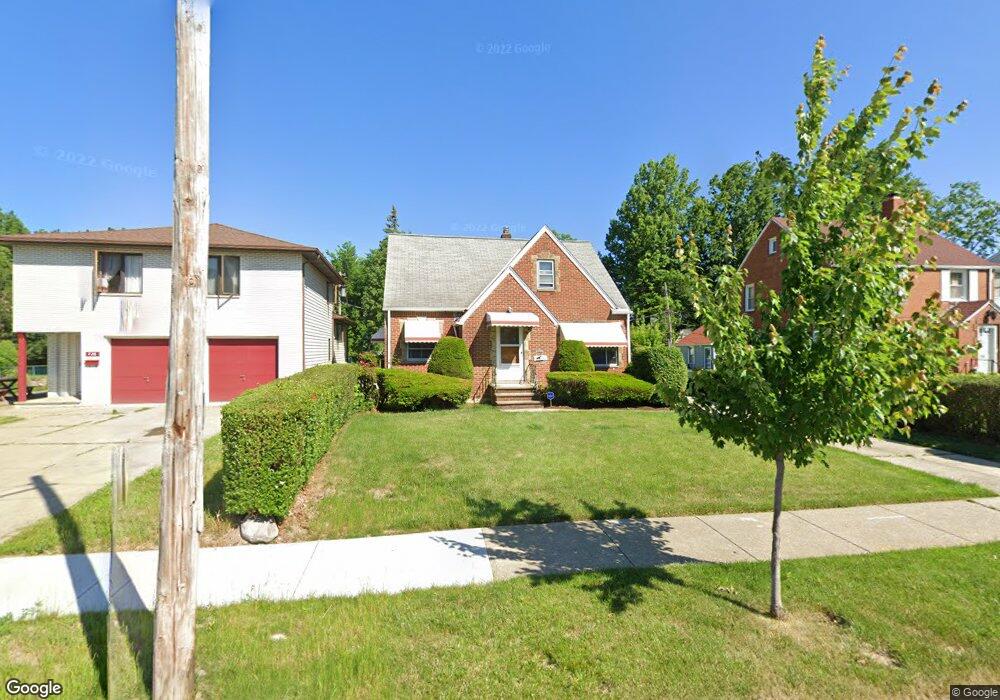
722 E 232nd St Euclid, OH 44123
Estimated Value: $135,261 - $189,000
3
Beds
1
Bath
1,485
Sq Ft
$107/Sq Ft
Est. Value
About This Home
This home is located at 722 E 232nd St, Euclid, OH 44123 and is currently estimated at $158,565, approximately $106 per square foot. 722 E 232nd St is a home located in Cuyahoga County with nearby schools including Arbor Elementary School, Euclid Middle School, and Euclid High School.
Ownership History
Date
Name
Owned For
Owner Type
Purchase Details
Closed on
May 7, 2024
Sold by
Collins Leo and Collins Susie Nell
Bought by
Collins Family Living Trust and Collins
Current Estimated Value
Purchase Details
Closed on
Apr 11, 1991
Sold by
Tomsich Pauline
Bought by
Collins Leo
Purchase Details
Closed on
Apr 1, 1981
Sold by
Tomsich Rudolph and Tomsich Pauline
Bought by
Rudolph Tomsich
Purchase Details
Closed on
Jan 1, 1975
Bought by
Tomsich Rudolph and Tomsich Pauline
Create a Home Valuation Report for This Property
The Home Valuation Report is an in-depth analysis detailing your home's value as well as a comparison with similar homes in the area
Home Values in the Area
Average Home Value in this Area
Purchase History
| Date | Buyer | Sale Price | Title Company |
|---|---|---|---|
| Collins Family Living Trust | -- | None Listed On Document | |
| Collins Leo | $72,000 | -- | |
| Tomsich Pauline | -- | -- | |
| Rudolph Tomsich | -- | -- | |
| Tomsich Rudolph | -- | -- |
Source: Public Records
Tax History
| Year | Tax Paid | Tax Assessment Tax Assessment Total Assessment is a certain percentage of the fair market value that is determined by local assessors to be the total taxable value of land and additions on the property. | Land | Improvement |
|---|---|---|---|---|
| 2025 | $2,504 | $48,195 | $6,090 | $42,105 |
| 2024 | $2,601 | $48,195 | $6,090 | $42,105 |
| 2023 | $1,964 | $32,070 | $4,800 | $27,270 |
| 2022 | $1,952 | $32,060 | $4,800 | $27,270 |
| 2021 | $2,170 | $32,060 | $4,800 | $27,270 |
| 2020 | $1,612 | $24,290 | $3,640 | $20,650 |
| 2019 | $1,462 | $69,400 | $10,400 | $59,000 |
| 2018 | $1,252 | $24,290 | $3,640 | $20,650 |
| 2017 | $1,014 | $17,440 | $2,420 | $15,020 |
| 2016 | $1,065 | $17,440 | $2,420 | $15,020 |
| 2015 | $976 | $17,440 | $2,420 | $15,020 |
| 2014 | $976 | $17,440 | $2,420 | $15,020 |
Source: Public Records
Map
Nearby Homes
- 797 Babbitt Rd Unit 15
- 442 Clearview Dr Unit U9
- 521 Kenwood Dr Unit B-5
- 942 E 236th St
- 22751 Fox Ave
- 422 Clearview Dr Unit J10
- 24431 Hartland Rd
- 890 E 250th St
- 450 Kenwood Dr Unit D-12
- 21971 Crystal Ave
- 421 Kenwood Dr Unit G
- 461 Kenwood Dr Unit T3
- 22931 Arms Ave
- 23198 Gay St
- 21670 Crystal Ave
- 21481 Ball Ave
- 336 E 222nd St
- 21391 Westport Ave
- 285 E 216th St
- 324 E 215th St
- 728 E 232nd St
- 720 E 232nd St
- 730 E 232nd St
- 716 E 232nd St
- 645 Voelker Ave
- 635 Voelker Ave
- 641 Voelker Ave
- 633 Voelker Ave
- 732 E 232nd St
- 631 Voelker Ave
- 723 E 232nd St
- 625 Voelker Ave
- 727 E 232nd St
- 651 Voelker Ave
- 736 E 232nd St
- 717 E 232nd St
- 731 E 232nd St
- 621 Voelker Ave
- 655 Voelker Ave
- 715 E 232nd St
Your Personal Tour Guide
Ask me questions while you tour the home.