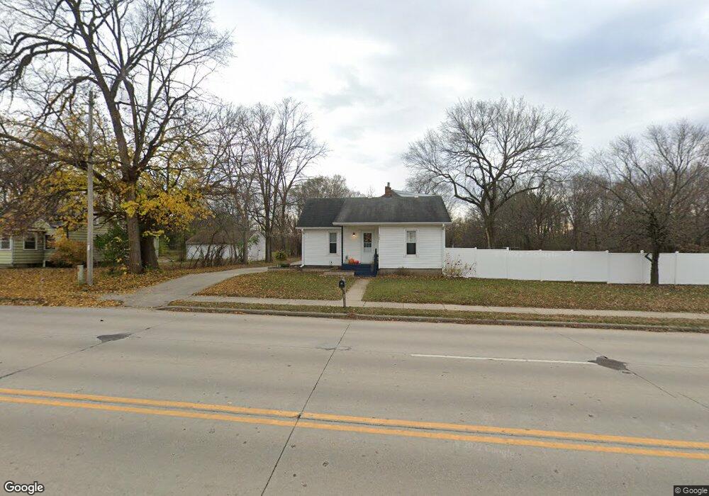
722 E Cranston Rd Beloit, WI 53511
Estimated Value: $207,000 - $266,539
3
Beds
2
Baths
1,126
Sq Ft
$213/Sq Ft
Est. Value
About This Home
This home is located at 722 E Cranston Rd, Beloit, WI 53511 and is currently estimated at $240,385, approximately $213 per square foot. 722 E Cranston Rd is a home located in Rock County with nearby schools including Robinson Elementary School, Aldrich Intermediate School, and Memorial High School.
Ownership History
Date
Name
Owned For
Owner Type
Purchase Details
Closed on
May 19, 2017
Sold by
Merath Calvin Dw and Merath Jamie S
Bought by
Mcnall Dylan and Mcnall Kirsten
Current Estimated Value
Home Financials for this Owner
Home Financials are based on the most recent Mortgage that was taken out on this home.
Original Mortgage
$128,198
Outstanding Balance
$105,844
Interest Rate
4.1%
Mortgage Type
VA
Estimated Equity
$134,541
Create a Home Valuation Report for This Property
The Home Valuation Report is an in-depth analysis detailing your home's value as well as a comparison with similar homes in the area
Home Values in the Area
Average Home Value in this Area
Purchase History
| Date | Buyer | Sale Price | Title Company |
|---|---|---|---|
| Mcnall Dylan | $125,500 | -- |
Source: Public Records
Mortgage History
| Date | Status | Borrower | Loan Amount |
|---|---|---|---|
| Open | Mcnall Dylan | $128,198 |
Source: Public Records
Tax History
| Year | Tax Paid | Tax Assessment Tax Assessment Total Assessment is a certain percentage of the fair market value that is determined by local assessors to be the total taxable value of land and additions on the property. | Land | Improvement |
|---|---|---|---|---|
| 2025 | $2,774 | $180,500 | $12,800 | $167,700 |
| 2024 | $1,966 | $180,500 | $12,800 | $167,700 |
| 2023 | $2,150 | $180,500 | $12,800 | $167,700 |
| 2022 | $2,254 | $125,500 | $10,700 | $114,800 |
| 2021 | $2,818 | $125,500 | $10,700 | $114,800 |
| 2020 | $2,749 | $125,500 | $10,700 | $114,800 |
| 2019 | $2,625 | $125,500 | $10,700 | $114,800 |
| 2018 | $1,900 | $80,600 | $10,700 | $69,900 |
| 2017 | $1,872 | $80,600 | $10,700 | $69,900 |
| 2016 | $1,908 | $80,600 | $10,700 | $69,900 |
| 2015 | $1,807 | $80,600 | $10,700 | $69,900 |
| 2014 | $1,782 | $80,600 | $10,700 | $69,900 |
| 2013 | $1,782 | $80,600 | $10,700 | $69,900 |
Source: Public Records
Map
Nearby Homes
- 826 Sharpes Ct
- 2020 Cottage Ave
- Hwy 81 48 7 Acres
- 3165 W Prairie Grove Ln
- 3980 S Deer Dr
- L17 S Forest View Dr
- 2160 S Wisconsin Ave
- 1942 Mound Ave
- 2107 S Pow Wow Trail
- 1971 Shore Dr
- 2355 N Pow Wow Trail
- 2365 N Pow Wow Trail
- 2380 N Pow Wow Trail
- 2277 Pioneer Dr
- 233 W Dawson Ave
- 1740 Sumac Ct
- 2241 Haborn Dr
- 2243 Haborn Dr
- 1737 Pine St
- 2535 Loma Dr
- 722 E Cranston Rd
- 724 E Cranston Rd
- 715 Cranston Rd
- 736 E Cranston Rd
- 723 E Cranston Rd
- 718 E Cranston Rd
- 716 E Cranston Rd
- 723 Cranston Rd
- 719 Cranston Rd
- 729 Cranston Rd
- 724 Welty Ave
- 728 Welty Ave
- 710 Welty Ave
- 2220 Grace Ave
- 2187 S Genevieve Ave
- 2201 Grace Ave
- 2201 Genevieve Ave
- 812 Cranston Rd
- 808 E Cranston Rd
- 816 Cranston Rd
Your Personal Tour Guide
Ask me questions while you tour the home.