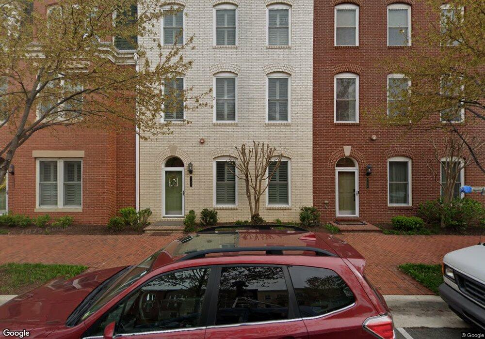
722 E Custis Ave Alexandria, VA 22301
Potomac Yard NeighborhoodEstimated Value: $1,395,000 - $1,564,000
4
Beds
3
Baths
3,280
Sq Ft
$449/Sq Ft
Est. Value
About This Home
This home is located at 722 E Custis Ave, Alexandria, VA 22301 and is currently estimated at $1,474,332, approximately $449 per square foot. 722 E Custis Ave is a home located in Alexandria City with nearby schools including Jefferson-Houston Elementary School, Alexandria City High School, and The Del Ray Montessori School.
Ownership History
Date
Name
Owned For
Owner Type
Purchase Details
Closed on
Sep 29, 2012
Sold by
Pulte Home Corporation
Bought by
Franken Michael T
Current Estimated Value
Home Financials for this Owner
Home Financials are based on the most recent Mortgage that was taken out on this home.
Original Mortgage
$625,500
Outstanding Balance
$435,377
Interest Rate
3.62%
Mortgage Type
New Conventional
Estimated Equity
$1,038,955
Create a Home Valuation Report for This Property
The Home Valuation Report is an in-depth analysis detailing your home's value as well as a comparison with similar homes in the area
Home Values in the Area
Average Home Value in this Area
Purchase History
| Date | Buyer | Sale Price | Title Company |
|---|---|---|---|
| Franken Michael T | $943,950 | -- |
Source: Public Records
Mortgage History
| Date | Status | Borrower | Loan Amount |
|---|---|---|---|
| Open | Franken Michael T | $625,500 |
Source: Public Records
Tax History
| Year | Tax Paid | Tax Assessment Tax Assessment Total Assessment is a certain percentage of the fair market value that is determined by local assessors to be the total taxable value of land and additions on the property. | Land | Improvement |
|---|---|---|---|---|
| 2025 | -- | $1,401,922 | $580,080 | $821,842 |
| 2024 | -- | $1,323,140 | $547,239 | $775,901 |
| 2023 | $0 | $1,286,782 | $531,300 | $755,482 |
| 2022 | $10,465 | $1,225,750 | $506,000 | $719,750 |
| 2021 | $10,465 | $1,165,518 | $481,500 | $684,018 |
| 2020 | $10,567 | $1,074,103 | $450,000 | $624,103 |
| 2019 | $10,465 | $935,163 | $420,000 | $515,163 |
| 2018 | $12,031 | $1,054,769 | $504,000 | $550,769 |
| 2017 | $11,706 | $1,003,328 | $480,000 | $523,328 |
| 2016 | $10,766 | $1,003,328 | $480,000 | $523,328 |
| 2015 | $10,298 | $987,346 | $450,000 | $537,346 |
| 2014 | $10,441 | $1,001,079 | $393,600 | $607,479 |
Source: Public Records
Map
Nearby Homes
- 716 Diamond Ave
- 2113 Main Line Blvd
- 2102 Main Line Blvd
- 1901 Main Line Blvd Unit 102
- 2215 Richmond Hwy Unit 101
- 718 Hawkins Way
- 715 Hawkins Way
- 738 Mckenzie Ave
- 520 E Mount Ida Ave
- 2205 E Randolph Ave
- 1613 Potomac Greens Dr Unit A
- 1804 W Abingdon Dr Unit 201
- 737 Swann Ave Unit 607
- 737 Swann Ave Unit TWO-402
- 1608 W Abingdon Dr Unit 102
- 1718 W Abingdon Dr Unit 301
- 701 Swann Ave Unit 606
- 701 Swann Ave Unit 507
- 701 Swann Ave Unit 402
- 527 E Duncan Ave
- 722 E Custis Ave Unit MEMORIAL STREET
- 720 E Custis Ave
- 724 E Custis Ave
- 718 E Custis Ave
- 726 E Custis Ave
- 728 E Custis Ave
- 714 E Custis Ave
- 712 E Custis Ave
- 712 E Curtis Ave
- 729 Annie Rose Ave
- 723 Annie Rose Ave
- 725 Annie Rose Ave
- 727 Annie Rose Ave
- 2200 Potomac Ave
- 721 Annie Rose Ave
- 710 E Custis Ave
- 717 Annie Rose Ave
- 2202 Potomac Ave
- 2204 Potomac Ave
- 715 Annie Rose Ave
Your Personal Tour Guide
Ask me questions while you tour the home.