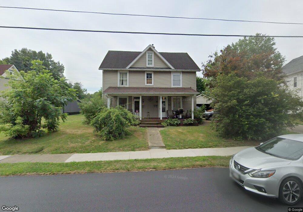
722 E Gorgas St Louisville, OH 44641
Estimated Value: $128,688 - $197,000
4
Beds
2
Baths
2,380
Sq Ft
$69/Sq Ft
Est. Value
About This Home
This home is located at 722 E Gorgas St, Louisville, OH 44641 and is currently estimated at $163,172, approximately $68 per square foot. 722 E Gorgas St is a home located in Stark County with nearby schools including Louisville High School and St. Thomas Aquinas High School & Middle School.
Ownership History
Date
Name
Owned For
Owner Type
Purchase Details
Closed on
Jul 28, 2000
Sold by
Giavasis Cynthia L
Bought by
Kauffman Dale and Kauffman Karen A
Current Estimated Value
Purchase Details
Closed on
Dec 13, 1995
Sold by
Haren Marvin G
Bought by
Giavasis George A and Giavasis Cynthia
Home Financials for this Owner
Home Financials are based on the most recent Mortgage that was taken out on this home.
Original Mortgage
$31,700
Outstanding Balance
$654
Interest Rate
7.45%
Mortgage Type
New Conventional
Estimated Equity
$162,518
Create a Home Valuation Report for This Property
The Home Valuation Report is an in-depth analysis detailing your home's value as well as a comparison with similar homes in the area
Home Values in the Area
Average Home Value in this Area
Purchase History
| Date | Buyer | Sale Price | Title Company |
|---|---|---|---|
| Kauffman Dale | $75,000 | -- | |
| Giavasis George A | $43,000 | -- |
Source: Public Records
Mortgage History
| Date | Status | Borrower | Loan Amount |
|---|---|---|---|
| Open | Giavasis George A | $31,700 |
Source: Public Records
Tax History Compared to Growth
Tax History
| Year | Tax Paid | Tax Assessment Tax Assessment Total Assessment is a certain percentage of the fair market value that is determined by local assessors to be the total taxable value of land and additions on the property. | Land | Improvement |
|---|---|---|---|---|
| 2025 | -- | $37,210 | $12,390 | $24,820 |
| 2024 | -- | $37,210 | $12,390 | $24,820 |
| 2023 | $1,327 | $30,140 | $9,770 | $20,370 |
| 2022 | $1,332 | $30,140 | $9,770 | $20,370 |
| 2021 | $1,336 | $30,140 | $9,770 | $20,370 |
| 2020 | $1,154 | $28,180 | $8,820 | $19,360 |
| 2019 | $829 | $20,100 | $7,880 | $12,220 |
| 2018 | $826 | $20,100 | $7,880 | $12,220 |
| 2017 | $739 | $17,340 | $6,340 | $11,000 |
| 2016 | $754 | $17,340 | $6,340 | $11,000 |
| 2015 | $756 | $17,340 | $6,340 | $11,000 |
| 2014 | $734 | $15,650 | $5,740 | $9,910 |
| 2013 | $370 | $15,650 | $5,740 | $9,910 |
Source: Public Records
Map
Nearby Homes
- 728 E Broad St
- 520 S Silver St
- 308 Superior St
- 641 S Nickelplate St
- 204 E Broad St
- 107 E Broad St
- 325 Lincoln Ave
- 0 Michigan Blvd
- 1170 Winding Ridge Ave
- 1812 E Broad St
- 910 Crosswyck Cir
- 300 Kennedy St
- 428 Honeycrisp Dr NE
- 3047 Mcintosh Dr NE
- 432 Honeycrisp Dr NE
- 2962 Mcintosh Dr NE
- 2963 Mcintosh Dr NE
- 430 Honeycrisp Dr NE
- 2957 Mcintosh Dr NE
- 908 Sand Lot Cir
- 726 E Gorgas St
- 716 E Gorgas St
- 808 E Gorgas St
- 717 E Gorgas St
- 725 E Gorgas St
- 709 E Gorgas St
- 803 E Gorgas St
- 816 E Gorgas St
- 703 E Gorgas St
- 319 S Silver St
- 822 E Gorgas St
- 321 S Silver St
- 223 S Silver St
- 323 S Silver St
- 217 S Silver St
- 710 Schaffer Ct
- 333 S Silver St
- 714 Schaffer Ct
- 211 S Silver St
- 704 Schaffer Ct