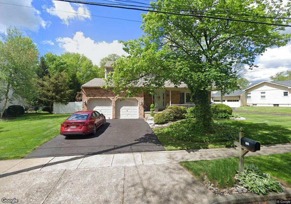
722 Fee Ave Langhorne, PA 19047
Estimated Value: $528,000 - $640,991
4
Beds
3
Baths
2,382
Sq Ft
$239/Sq Ft
Est. Value
About This Home
This home is located at 722 Fee Ave, Langhorne, PA 19047 and is currently estimated at $569,248, approximately $238 per square foot. 722 Fee Ave is a home located in Bucks County with nearby schools including Hoover Elementary School, Maple Point Middle School, and Neshaminy High School.
Ownership History
Date
Name
Owned For
Owner Type
Purchase Details
Closed on
Dec 28, 2017
Sold by
Walker Rugghia Marie and Cousart Marie
Bought by
Cousart Marie
Current Estimated Value
Home Financials for this Owner
Home Financials are based on the most recent Mortgage that was taken out on this home.
Original Mortgage
$242,000
Outstanding Balance
$204,115
Interest Rate
3.92%
Mortgage Type
Stand Alone First
Estimated Equity
$365,133
Purchase Details
Closed on
Feb 5, 1992
Sold by
Mcgrath John and Mcgrath Denise
Bought by
Walker-Rugghia Marie
Create a Home Valuation Report for This Property
The Home Valuation Report is an in-depth analysis detailing your home's value as well as a comparison with similar homes in the area
Home Values in the Area
Average Home Value in this Area
Purchase History
| Date | Buyer | Sale Price | Title Company |
|---|---|---|---|
| Cousart Marie | -- | Cross Keys Abstract & Assura | |
| Walker-Rugghia Marie | $158,000 | -- |
Source: Public Records
Mortgage History
| Date | Status | Borrower | Loan Amount |
|---|---|---|---|
| Open | Cousart Marie | $242,000 |
Source: Public Records
Tax History Compared to Growth
Tax History
| Year | Tax Paid | Tax Assessment Tax Assessment Total Assessment is a certain percentage of the fair market value that is determined by local assessors to be the total taxable value of land and additions on the property. | Land | Improvement |
|---|---|---|---|---|
| 2025 | $7,237 | $33,240 | $5,080 | $28,160 |
| 2024 | $7,237 | $33,240 | $5,080 | $28,160 |
| 2023 | $7,122 | $33,240 | $5,080 | $28,160 |
| 2022 | $6,935 | $33,240 | $5,080 | $28,160 |
| 2021 | $6,935 | $33,240 | $5,080 | $28,160 |
| 2020 | $6,851 | $33,240 | $5,080 | $28,160 |
| 2019 | $6,699 | $33,240 | $5,080 | $28,160 |
| 2018 | $6,576 | $33,240 | $5,080 | $28,160 |
| 2017 | $6,408 | $33,240 | $5,080 | $28,160 |
| 2016 | $6,408 | $33,240 | $5,080 | $28,160 |
| 2015 | $6,597 | $33,240 | $5,080 | $28,160 |
| 2014 | $6,597 | $33,240 | $5,080 | $28,160 |
Source: Public Records
Map
Nearby Homes
- 1314 Poplar St
- 2823 Avenue E
- 2814 Avenue E
- 710 Fox Ct
- 1557 Fairview Ave
- 1632 Winter Ave
- 751 Duxbury Dr
- 1605 Old Lincoln Hwy
- 1060 Old Lincoln Hwy
- 565 Hulmeville Rd
- 731 Highland Ave
- 1210 Brownsville Rd
- 801 E Parker St Unit B2
- 225 Playwicki St
- 166 N Hawthorne Ave
- 230 Playwicki St
- 440 Dehaven Ave
- 1021 W Maple Ave
- 13 Golf Club Dr
- 6561 Neshaminy Valley Dr