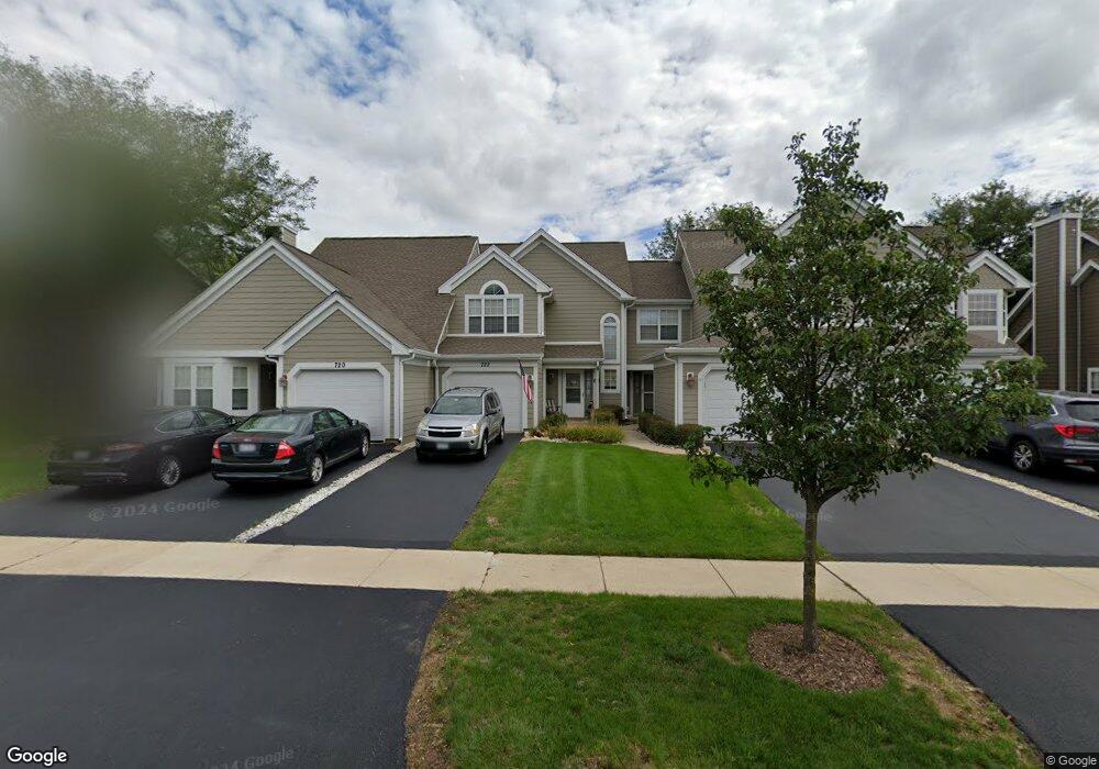
722 Kingsbridge Dr Carol Stream, IL 60188
Estimated Value: $300,000 - $318,000
2
Beds
2
Baths
1,366
Sq Ft
$225/Sq Ft
Est. Value
About This Home
This home is located at 722 Kingsbridge Dr, Carol Stream, IL 60188 and is currently estimated at $306,668, approximately $224 per square foot. 722 Kingsbridge Dr is a home located in DuPage County with nearby schools including Cloverdale Elementary School, Jay Stream Middle School, and Glenbard North High School.
Ownership History
Date
Name
Owned For
Owner Type
Purchase Details
Closed on
Aug 2, 2001
Sold by
Valintis Joseph A and Valintis Dorothy J
Bought by
Valintis Joseph A and Valintis Dorothy J
Current Estimated Value
Purchase Details
Closed on
Jul 13, 2001
Sold by
Manibog Eric A
Bought by
Valintis Joseph and Valintis Dorothy
Purchase Details
Closed on
Oct 26, 1998
Sold by
Obrien Thomas F
Bought by
Manibog Eric A
Home Financials for this Owner
Home Financials are based on the most recent Mortgage that was taken out on this home.
Original Mortgage
$99,200
Interest Rate
6.75%
Purchase Details
Closed on
Oct 20, 1998
Sold by
Obrien Corrie L and Mohs Corrie L
Bought by
Obrien Thomas F
Home Financials for this Owner
Home Financials are based on the most recent Mortgage that was taken out on this home.
Original Mortgage
$99,200
Interest Rate
6.75%
Create a Home Valuation Report for This Property
The Home Valuation Report is an in-depth analysis detailing your home's value as well as a comparison with similar homes in the area
Home Values in the Area
Average Home Value in this Area
Purchase History
| Date | Buyer | Sale Price | Title Company |
|---|---|---|---|
| Valintis Joseph A | -- | -- | |
| Valintis Joseph | -- | Premier Title | |
| Manibog Eric A | -- | -- | |
| Obrien Thomas F | $124,000 | -- |
Source: Public Records
Mortgage History
| Date | Status | Borrower | Loan Amount |
|---|---|---|---|
| Previous Owner | Manibog Eric A | $99,200 |
Source: Public Records
Tax History Compared to Growth
Tax History
| Year | Tax Paid | Tax Assessment Tax Assessment Total Assessment is a certain percentage of the fair market value that is determined by local assessors to be the total taxable value of land and additions on the property. | Land | Improvement |
|---|---|---|---|---|
| 2024 | $5,888 | $76,633 | $16,906 | $59,727 |
| 2023 | $5,547 | $70,080 | $15,460 | $54,620 |
| 2022 | $6,107 | $72,200 | $15,360 | $56,840 |
| 2021 | $5,289 | $68,590 | $14,590 | $54,000 |
| 2020 | $5,714 | $66,910 | $14,230 | $52,680 |
| 2019 | $5,289 | $62,170 | $14,400 | $47,770 |
| 2018 | $4,707 | $56,670 | $14,020 | $42,650 |
| 2017 | $4,433 | $52,520 | $12,990 | $39,530 |
| 2016 | $4,180 | $48,600 | $12,020 | $36,580 |
| 2015 | $4,068 | $45,360 | $11,220 | $34,140 |
| 2014 | $4,143 | $45,360 | $11,220 | $34,140 |
| 2013 | $4,373 | $48,860 | $12,080 | $36,780 |
Source: Public Records
Map
Nearby Homes
- 615 Kingsbridge Dr
- 1390 Merrimac Ln N
- 1168 Chalet Dr
- 1083 Country Glen Ln
- 3935 Shoreline Dr
- 489 Canterbury Dr Unit 15E
- 1309 Coldspring Rd Unit 162
- 1028 Bedford Dr
- 385 Wexford Ct Unit 32
- 1861 Grosse Pointe Cir
- 1885 Grosse Pointe Ct
- 1063 Parkview Cir
- 1824 Isle Royal Ln
- 768 Provincetown Dr Unit 16
- 1925 Grosse Pointe Ct
- 3860 Brookbank Dr
- 388 Canyon Trail
- 3867 Springlake Dr
- 1358 Woodlake Dr
- 877 Malibu Ct
- 724 Kingsbridge Dr Unit 10
- 720 Kingsbridge Dr
- 726 Kingsbridge Dr
- 710 Kingsbridge Dr
- 732 Kingsbridge Dr Unit 10
- 708 Kingsbridge Dr
- 734 Kingsbridge Dr
- 706 Kingsbridge Dr
- 736 Kingsbridge Dr
- 1174 Edington Ct
- 1170 Edington Ct
- 704 Kingsbridge Dr
- 1168 Edington Ct
- 1176 Edington Ct Unit 10
- 738 Kingsbridge Dr
- 1166 Edington Ct
- 1178 Edington Ct Unit 34C
- 725 Kingsbridge Dr
- 723 Kingsbridge Dr
- 723 Kingsbridge Dr Unit 723