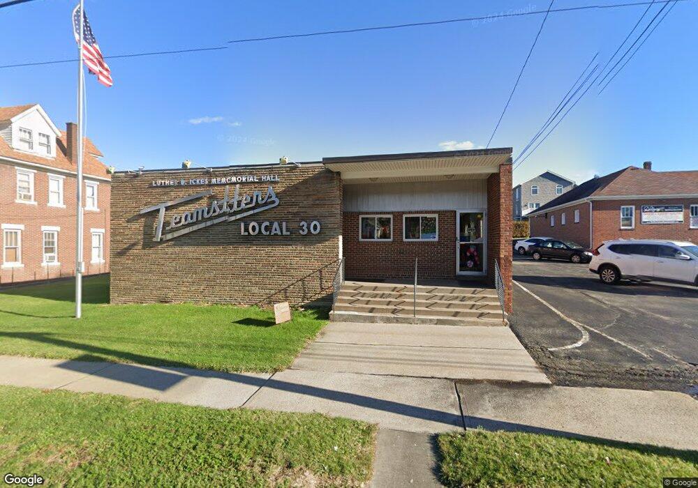
722 Lowry Ave Greensburg, PA 15601
Hempfield Township NeighborhoodEstimated Value: $83,227 - $232,000
--
Bed
--
Bath
1,560
Sq Ft
$113/Sq Ft
Est. Value
About This Home
This home is located at 722 Lowry Ave, Greensburg, PA 15601 and is currently estimated at $176,307, approximately $113 per square foot. 722 Lowry Ave is a home located in Westmoreland County with nearby schools including West Point Elementary School, Wendover Middle School, and Hempfield Area Senior High School.
Ownership History
Date
Name
Owned For
Owner Type
Purchase Details
Closed on
May 15, 2009
Sold by
Thiel Donald Rocco
Bought by
Thiel Donald Rocco and Thiel Tina M
Current Estimated Value
Home Financials for this Owner
Home Financials are based on the most recent Mortgage that was taken out on this home.
Original Mortgage
$102,500
Interest Rate
4.93%
Mortgage Type
Stand Alone Refi Refinance Of Original Loan
Create a Home Valuation Report for This Property
The Home Valuation Report is an in-depth analysis detailing your home's value as well as a comparison with similar homes in the area
Home Values in the Area
Average Home Value in this Area
Purchase History
| Date | Buyer | Sale Price | Title Company |
|---|---|---|---|
| Thiel Donald Rocco | -- | None Available |
Source: Public Records
Mortgage History
| Date | Status | Borrower | Loan Amount |
|---|---|---|---|
| Closed | Thiel Donald Rocco | $102,500 |
Source: Public Records
Tax History Compared to Growth
Tax History
| Year | Tax Paid | Tax Assessment Tax Assessment Total Assessment is a certain percentage of the fair market value that is determined by local assessors to be the total taxable value of land and additions on the property. | Land | Improvement |
|---|---|---|---|---|
| 2025 | $2,228 | $18,230 | $850 | $17,380 |
| 2024 | $2,137 | $18,230 | $850 | $17,380 |
| 2023 | $1,968 | $18,230 | $850 | $17,380 |
| 2022 | $1,968 | $18,230 | $850 | $17,380 |
| 2021 | $1,968 | $18,230 | $850 | $17,380 |
| 2020 | $1,968 | $18,230 | $850 | $17,380 |
| 2019 | $1,959 | $18,230 | $850 | $17,380 |
| 2018 | $1,936 | $18,230 | $850 | $17,380 |
| 2017 | $1,891 | $18,230 | $850 | $17,380 |
| 2016 | $1,798 | $18,230 | $850 | $17,380 |
| 2015 | $1,798 | $18,230 | $850 | $17,380 |
| 2014 | $1,770 | $18,230 | $850 | $17,380 |
Source: Public Records
Map
Nearby Homes
- 630 Mount Pleasant Rd
- 464 Willow Ave
- 600 Short St
- 447 Steck St
- 520 Highland Ave
- 558 Hemlock St
- 557 Hemlock St
- 552 Hemlock St
- 601-607 Southwest Ave
- 1032 Highland Ave
- 506 S Urania Ave
- 308 Guthrie St
- 624 Sidney St
- 439 S Maple Ave
- 252 Hudson Ave
- 919 Sunset Dr
- 410 Bach Ave
- 516 Hemlock St
- 540 Chestnut St
- 707 Green St
- 701 Yancey St
- 701 Yancey St
- 707 Yancey St
- 720 Yancey St
- 715 Yancey St
- 710 Allen St
- 717 Yancey St
- 714 Allen St
- 714 Allen St
- 721 Yancey St
- 812 Thornton Ave
- 599 Sells Ln Unit C
- 599 Sells Ln Unit C
- 861 Thornton Ave
- 816 Thornton Ave
- 807 Yancey St
- 809 Mount Pleasant Rd
- 717 Allen St
- 805 Thornton Ave
- 805 Thornton Ave
