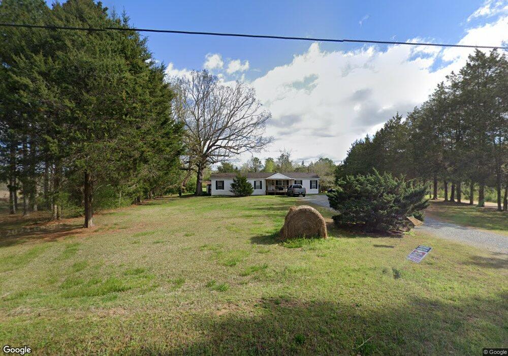
722 Melson Rd SW Cave Spring, GA 30124
Estimated Value: $344,000 - $443,000
--
Bed
1
Bath
2,259
Sq Ft
$181/Sq Ft
Est. Value
About This Home
This home is located at 722 Melson Rd SW, Cave Spring, GA 30124 and is currently estimated at $409,365, approximately $181 per square foot. 722 Melson Rd SW is a home with nearby schools including Coosa Middle School and Coosa High School.
Ownership History
Date
Name
Owned For
Owner Type
Purchase Details
Closed on
Nov 15, 1983
Bought by
P and R
Current Estimated Value
Purchase Details
Closed on
Nov 1, 1983
Bought by
P and R
Purchase Details
Closed on
Sep 25, 1978
Sold by
Firist Nation Bank Of Cobb Co
Bought by
Anderson Richard R
Purchase Details
Closed on
May 3, 1977
Sold by
Babb J C
Bought by
Firist Nation Bank Of Cobb Co
Purchase Details
Closed on
Jul 1, 1975
Bought by
Babb J C
Create a Home Valuation Report for This Property
The Home Valuation Report is an in-depth analysis detailing your home's value as well as a comparison with similar homes in the area
Home Values in the Area
Average Home Value in this Area
Purchase History
| Date | Buyer | Sale Price | Title Company |
|---|---|---|---|
| P | -- | -- | |
| Harris Richard Lynn | $60,200 | -- | |
| P | -- | -- | |
| Anderson Richard R | $43,000 | -- | |
| Firist Nation Bank Of Cobb Co | -- | -- | |
| Babb J C | -- | -- |
Source: Public Records
Tax History Compared to Growth
Tax History
| Year | Tax Paid | Tax Assessment Tax Assessment Total Assessment is a certain percentage of the fair market value that is determined by local assessors to be the total taxable value of land and additions on the property. | Land | Improvement |
|---|---|---|---|---|
| 2024 | $2,281 | $150,140 | $45,520 | $104,620 |
| 2023 | $2,052 | $140,970 | $45,520 | $95,450 |
| 2022 | $2,425 | $208,272 | $127,426 | $80,846 |
| 2021 | $2,592 | $165,379 | $91,511 | $73,868 |
| 2020 | $2,550 | $152,435 | $81,003 | $71,432 |
| 2019 | $2,457 | $149,901 | $81,003 | $68,898 |
| 2018 | $2,397 | $136,729 | $70,496 | $66,233 |
| 2017 | $2,318 | $133,152 | $70,496 | $62,656 |
| 2016 | $2,264 | $129,722 | $70,480 | $59,242 |
| 2015 | -- | $129,722 | $70,480 | $59,242 |
| 2014 | -- | $129,402 | $70,160 | $59,242 |
Source: Public Records
Map
Nearby Homes
- 0 Melson Rd SW Unit 7676052
- 0 Melson Rd SW Unit 10636997
- 5598 Fosters Mill Rd
- 0 Mill Rd Unit 10629874
- 0 Mill Rd Unit 7670319
- 5677 Fosters Mill Rd SW
- 57 Mill St
- 0 McGee Bend Rd SW Unit 10351960
- 104 Fincher St
- 22 River St SW
- 8876 Cave Spring Rd SW
- 8876 Cave Spring
- 7 Herschel Mize Dr SW
- 7 Herschel Mize Dr
- 907 Gadsden Rd SW
- 8006 Blacks Bluff Rd SW
- 0 George Rd SW Unit 10567389
- 0 George Rd SW Unit 7618177
- 8203 Blacks Bluff Rd SW
- 2053 Buttermilk Rd SW
- 660 Melson Rd SW
- 610 Melson Rd SW
- 675 Melson Rd SW
- 920 Melson Rd SW
- 920 Melson Rd SW
- 532 Melson Rd SW
- 909 Melson Rd SW
- 432 Melson Rd SW
- 4196 Fosters Mill Rd SW
- 1059 Melson Rd SW
- 1025 Melson Rd SW
- 595 Melson Rd SW
- 402 Melson Rd SW
- 4380 Fosters Mill Rd SW
- Off Of Blacks Bluff Rd
- 4624 Fosters Mill Rd SW
- 4480 Fosters Mill Rd SW
- 4279 Fosters Mill Rd SW
- 1171A Melson Rd SW
- 4586 Fosters Mill Rd SW