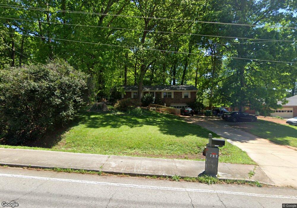
722 Rowland Rd Stone Mountain, GA 30083
Estimated Value: $170,000 - $262,000
3
Beds
2
Baths
1,555
Sq Ft
$148/Sq Ft
Est. Value
About This Home
This home is located at 722 Rowland Rd, Stone Mountain, GA 30083 and is currently estimated at $230,333, approximately $148 per square foot. 722 Rowland Rd is a home located in DeKalb County with nearby schools including Allgood Elementary School, Freedom Middle School, and Clarkston High School.
Ownership History
Date
Name
Owned For
Owner Type
Purchase Details
Closed on
Jan 25, 2008
Sold by
Patel Hemant and Patel Minaksie
Bought by
Patel Hemant and Patel Minaksie
Current Estimated Value
Home Financials for this Owner
Home Financials are based on the most recent Mortgage that was taken out on this home.
Original Mortgage
$113,000
Interest Rate
6.12%
Mortgage Type
New Conventional
Purchase Details
Closed on
Feb 29, 1996
Sold by
Boone Elmer C Ruby L
Bought by
Patel Herman Minaksie
Create a Home Valuation Report for This Property
The Home Valuation Report is an in-depth analysis detailing your home's value as well as a comparison with similar homes in the area
Home Values in the Area
Average Home Value in this Area
Purchase History
| Date | Buyer | Sale Price | Title Company |
|---|---|---|---|
| Patel Hemant | -- | -- | |
| Patel Herman Minaksie | $89,900 | -- |
Source: Public Records
Mortgage History
| Date | Status | Borrower | Loan Amount |
|---|---|---|---|
| Closed | Patel Hemant | $113,000 | |
| Closed | Patel Herman Minaksie | $0 |
Source: Public Records
Tax History Compared to Growth
Tax History
| Year | Tax Paid | Tax Assessment Tax Assessment Total Assessment is a certain percentage of the fair market value that is determined by local assessors to be the total taxable value of land and additions on the property. | Land | Improvement |
|---|---|---|---|---|
| 2025 | $1,975 | $77,760 | $20,000 | $57,760 |
| 2024 | $2,273 | $90,840 | $20,000 | $70,840 |
| 2023 | $2,273 | $103,920 | $15,200 | $88,720 |
| 2022 | $2,040 | $84,800 | $15,200 | $69,600 |
| 2021 | $1,439 | $58,760 | $3,640 | $55,120 |
| 2020 | $1,390 | $56,480 | $3,640 | $52,840 |
| 2019 | $1,334 | $54,040 | $3,640 | $50,400 |
| 2018 | $954 | $49,960 | $3,640 | $46,320 |
| 2017 | $997 | $39,200 | $3,640 | $35,560 |
| 2016 | $719 | $27,400 | $3,640 | $23,760 |
| 2014 | $383 | $10,960 | $3,600 | $7,360 |
Source: Public Records
Map
Nearby Homes
- 708 Delanie Way
- 736 Valley Creek Dr
- 4603 Ruby Rd
- 811 Corundum Ct
- 4564 Fountainhead Dr
- 4428 Nantucket Cove
- 4820 Banner Elk Dr
- 573 Allgood Rd
- 534 Woodcrest Manor Dr
- 885 Granite Springs Ln
- 4595 Garden Hills Dr
- 4654 Hope Springs Rd
- 488 Barclay Ct
- 4561 Garden Hills Dr
- 4584 Garden Hills Dr
- 4616 Garden Hills Dr Unit 1
- 4238 Rue Saint Michel
- 498 Prince of Wales
- 486 Prince of Wales
- 550 S Rays Rd
- 732 Rowland Rd
- 4474 Ruby Rd
- 4482 Ruby Rd
- 730 Rowland Rd
- 4464 Ruby Rd
- 709 Rowland Rd
- 4647 Allgood Springs Dr
- 4490 Ruby Rd
- 701 Rowland Rd Unit 2
- 4498 Ruby Rd
- 4639 Allgood Springs Dr Unit 2
- 686 Rowland Rd
- 693 Rowland Rd
- 727 Corundum Ct
- 4491 Ruby Rd Unit 1
- 4491 Ruby Rd Unit 2
- 685 Rowland Rd
- 4631 Allgood Springs Dr
- 741 Rowland Rd
- 700 Delanie Way Unit 2