Estimated Value: $139,321 - $167,000
2
Beds
1
Bath
842
Sq Ft
$181/Sq Ft
Est. Value
About This Home
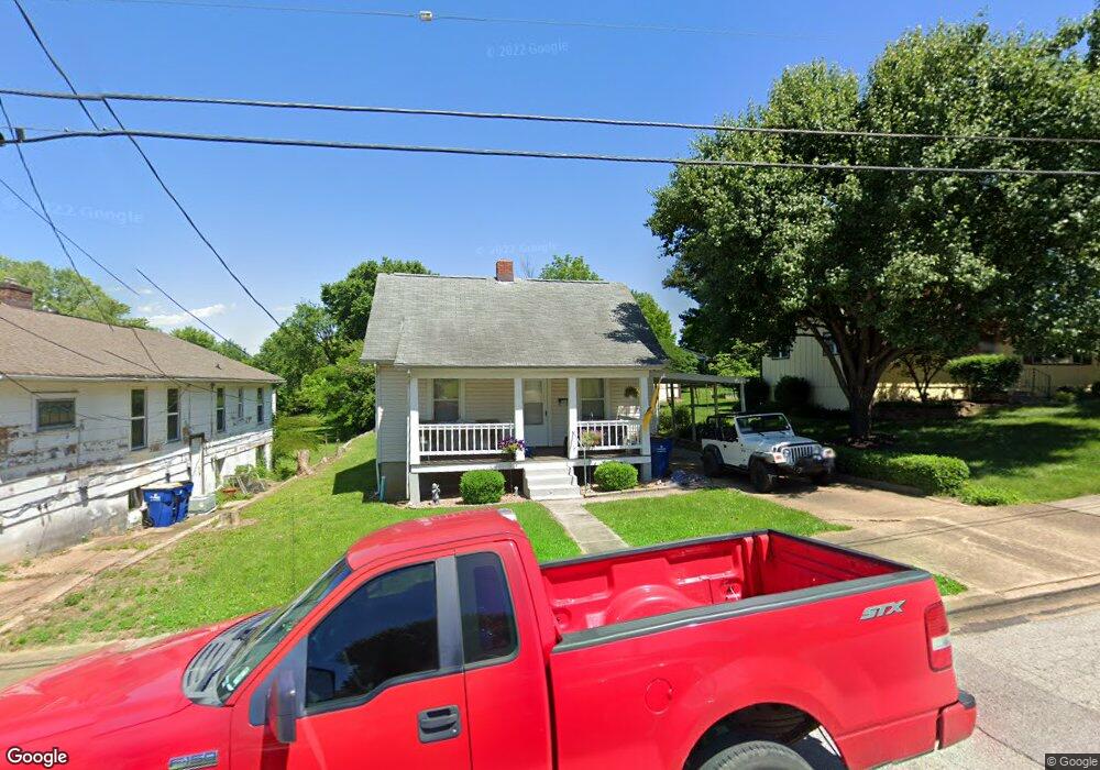
This home is located at 722 S Oak St, Union, MO 63084 and is currently estimated at $152,440, approximately $181 per square foot. 722 S Oak St is a home located in Franklin County with nearby schools including Union High School and Immaculate Conception School.
Ownership History
Date
Name
Owned For
Owner Type
Purchase Details
Closed on
Mar 3, 2010
Sold by
Bequette Nicholas S and Bequette Dawn R
Bought by
Platt Brian and Platt Shannon
Current Estimated Value
Home Financials for this Owner
Home Financials are based on the most recent Mortgage that was taken out on this home.
Original Mortgage
$52,500
Outstanding Balance
$16,118
Interest Rate
4.95%
Mortgage Type
New Conventional
Estimated Equity
$136,322
Purchase Details
Closed on
Oct 7, 2007
Sold by
Owens Erma and Sullivan Lori A
Bought by
Bequette Nicholas S and Bequette Dawn R
Home Financials for this Owner
Home Financials are based on the most recent Mortgage that was taken out on this home.
Original Mortgage
$34,000
Interest Rate
6.47%
Mortgage Type
Unknown
Create a Home Valuation Report for This Property
The Home Valuation Report is an in-depth analysis detailing your home's value as well as a comparison with similar homes in the area
Home Values in the Area
Average Home Value in this Area
Purchase History
| Date | Buyer | Sale Price | Title Company |
|---|---|---|---|
| Platt Brian | -- | None Available | |
| Bequette Nicholas S | -- | None Available |
Source: Public Records
Mortgage History
| Date | Status | Borrower | Loan Amount |
|---|---|---|---|
| Open | Platt Brian | $52,500 | |
| Previous Owner | Bequette Nicholas S | $34,000 |
Source: Public Records
Tax History
| Year | Tax Paid | Tax Assessment Tax Assessment Total Assessment is a certain percentage of the fair market value that is determined by local assessors to be the total taxable value of land and additions on the property. | Land | Improvement |
|---|---|---|---|---|
| 2025 | $829 | $13,904 | $0 | $0 |
| 2024 | $829 | $13,336 | $0 | $0 |
| 2023 | $804 | $13,336 | $0 | $0 |
| 2022 | $706 | $11,698 | $0 | $0 |
| 2021 | $708 | $11,698 | $0 | $0 |
| 2020 | $650 | $10,573 | $0 | $0 |
| 2019 | $648 | $10,573 | $0 | $0 |
| 2018 | $587 | $10,051 | $0 | $0 |
| 2017 | $589 | $10,051 | $0 | $0 |
| 2016 | $604 | $10,076 | $0 | $0 |
| 2015 | $594 | $10,076 | $0 | $0 |
| 2014 | $602 | $10,201 | $0 | $0 |
Source: Public Records
Map
Nearby Homes
- 613 S Jefferson Ave
- 605 S Jefferson Ave
- 3 Hoffert St
- 408 Hall Ave
- 300 Bourbeuse Rd
- 614 E State St
- 724 E State St
- 154 Joel Ave
- Lot 2 E State Highway 47
- Lot 1 E State Highway 47
- 413 W State St
- N Highway 47 E State Highway 47
- 613 W State St
- 702 Clearview Dr Unit 1
- 0 Lot 4 Clearview Dr Unit 19010507
- 0 Lot 6 Clearview Dr Unit 19010511
- 0 Clearview Unit 19010495
- 0 Lot 5 Clearview Dr Unit 19010510
- 0 Lot 3 Clearview Dr Unit MIS26011988
- 207 E Park Ave
- 724 S Oak St
- 800 S Oak St
- 715 S Oak St
- 719 S Oak St
- 707 S Oak St
- 801 S Oak St
- 303 Garrick Place
- 718 S Oak St Unit 720
- 705 S Oak St
- 805 S Oak St
- 804 S Oak St
- 714 S Oak St Unit 716
- 316 South St
- 700 S Oak St
- 700 S Oak St
- 700 S Oak St
- 287 E Porterford Rd
- 400 South St
- 608 S Jefferson Ave
- 302 Garrick Place
Your Personal Tour Guide
Ask me questions while you tour the home.