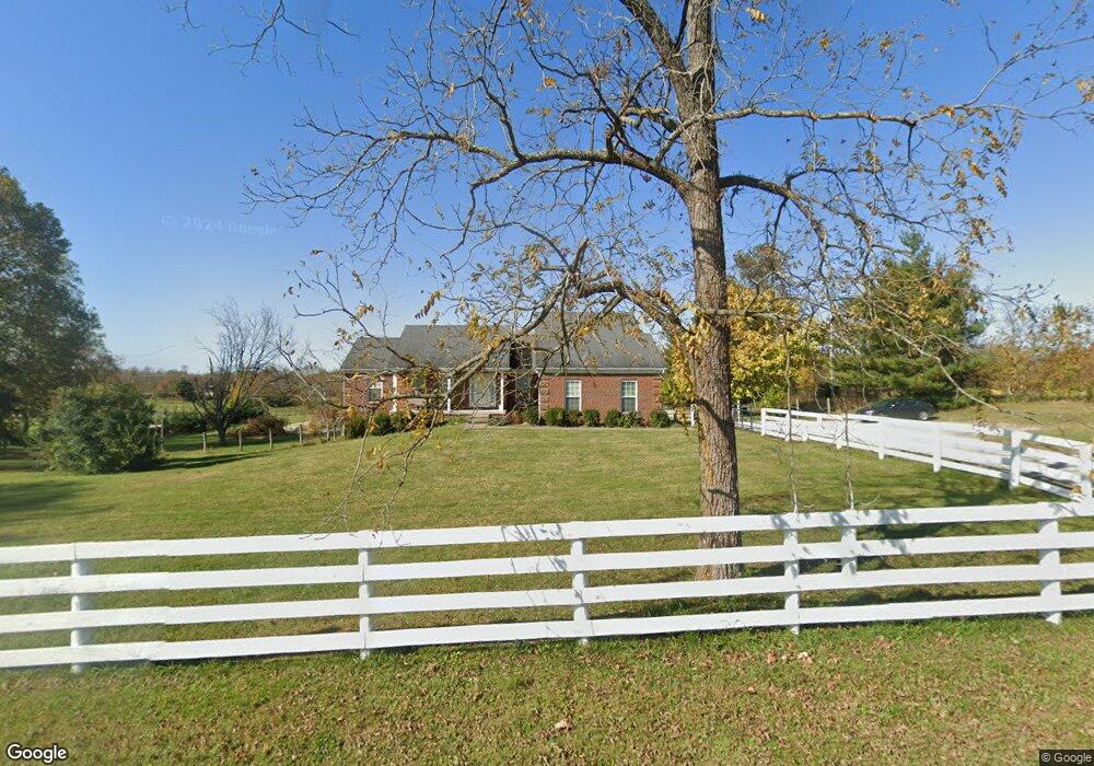
722 Sims Pike Georgetown, KY 40324
Muddy Ford NeighborhoodEstimated Value: $476,000 - $602,000
Studio
--
Bath
1,608
Sq Ft
$330/Sq Ft
Est. Value
About This Home
This home is located at 722 Sims Pike, Georgetown, KY 40324 and is currently estimated at $531,302, approximately $330 per square foot. 722 Sims Pike is a home located in Scott County with nearby schools including Northern Elementary School, Scott County Middle School, and Scott County High School.
Ownership History
Date
Name
Owned For
Owner Type
Purchase Details
Closed on
Jun 4, 2024
Sold by
Slone James M and Slone Victoria
Bought by
James M Slone Jr Living Trust and Slone
Current Estimated Value
Purchase Details
Closed on
Nov 20, 2020
Sold by
Willholte Terry S and Willholte Rebecca
Bought by
Slone Investment Properties Llc
Home Financials for this Owner
Home Financials are based on the most recent Mortgage that was taken out on this home.
Original Mortgage
$340,000
Interest Rate
2.8%
Mortgage Type
Commercial
Purchase Details
Closed on
Aug 19, 2009
Sold by
Pratt Phillip R and Pratt Martha Jane
Bought by
Slone James M and Barnes Erin W
Home Financials for this Owner
Home Financials are based on the most recent Mortgage that was taken out on this home.
Original Mortgage
$80,000
Interest Rate
5.19%
Mortgage Type
Purchase Money Mortgage
Create a Home Valuation Report for This Property
The Home Valuation Report is an in-depth analysis detailing your home's value as well as a comparison with similar homes in the area
Home Values in the Area
Average Home Value in this Area
Purchase History
| Date | Buyer | Sale Price | Title Company |
|---|---|---|---|
| James M Slone Jr Living Trust | -- | None Listed On Document | |
| Slone Investment Properties Llc | $425,000 | None Available | |
| Slone James M | $100,000 | None Available |
Source: Public Records
Mortgage History
| Date | Status | Borrower | Loan Amount |
|---|---|---|---|
| Previous Owner | Slone Investment Properties Llc | $340,000 | |
| Previous Owner | Slone James M | $80,000 |
Source: Public Records
Tax History
| Year | Tax Paid | Tax Assessment Tax Assessment Total Assessment is a certain percentage of the fair market value that is determined by local assessors to be the total taxable value of land and additions on the property. | Land | Improvement |
|---|---|---|---|---|
| 2025 | $4,064 | $456,300 | $0 | $0 |
| 2024 | $2,928 | $325,600 | $0 | $0 |
| 2023 | $2,857 | $315,100 | $75,000 | $240,100 |
| 2022 | $2,679 | $315,100 | $75,000 | $240,100 |
| 2021 | $2,627 | $299,500 | $65,000 | $234,500 |
| 2020 | $2,376 | $276,600 | $65,000 | $211,600 |
| 2019 | $2,372 | $271,760 | $0 | $0 |
| 2018 | $2,272 | $261,760 | $0 | $0 |
| 2017 | $2,214 | $253,876 | $0 | $0 |
| 2016 | $2,044 | $253,876 | $0 | $0 |
| 2015 | $2,031 | $253,900 | $0 | $0 |
| 2014 | $1,854 | $242,620 | $0 | $0 |
| 2011 | $1,764 | $242,620 | $0 | $0 |
Source: Public Records
Map
Nearby Homes
- 446 Anderson Rd
- 161 Blackberry Ln
- 173 Blackberry Ln
- 167 Blackberry Ln
- 155 Blackberry Ln
- 165 Blackberry Ln
- 279 Harbor Village Dr
- 1105 Old Delaplain Rd
- 237-281 Harbor Village Dr
- 237 Harbor Village Dr
- 241 Harbor Village Dr
- 249-281 Cherry Blossom Way
- 245 Harbor Village Dr
- 116 Harborside Ct
- 103 Harborside Ct
- 247 Harbor Village Dr
- 248 Harbor Village Dr
- 122 Wise Path
- 180 Lakeshore Cir
- 261 Harbor Village Dr
Your Personal Tour Guide
Ask me questions while you tour the home.