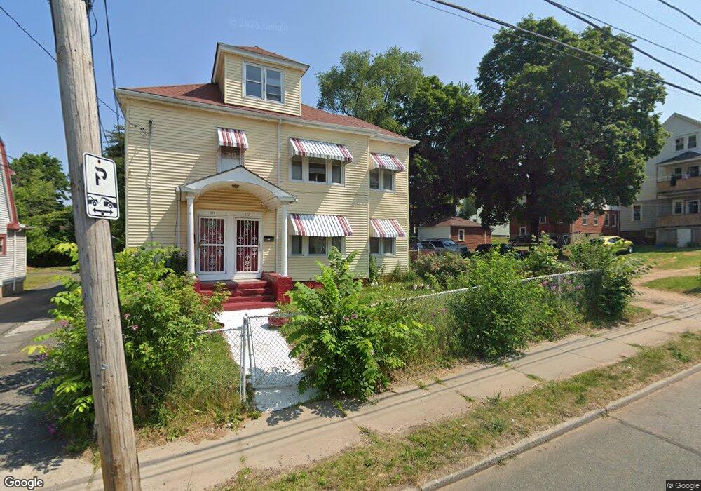
722 Tower Ave Unit 724 Hartford, CT 06112
Blue Hills NeighborhoodEstimated Value: $302,993 - $518,000
6
Beds
2
Baths
4,275
Sq Ft
$98/Sq Ft
Est. Value
About This Home
This home is located at 722 Tower Ave Unit 724, Hartford, CT 06112 and is currently estimated at $417,998, approximately $97 per square foot. 722 Tower Ave Unit 724 is a home located in Hartford County with nearby schools including Rawson School, Breakthrough Magnet School - North Campus, and West Middle School.
Ownership History
Date
Name
Owned For
Owner Type
Purchase Details
Closed on
Oct 2, 1989
Sold by
Waite Delroy B
Bought by
Girodier Jean B
Current Estimated Value
Home Financials for this Owner
Home Financials are based on the most recent Mortgage that was taken out on this home.
Original Mortgage
$152,800
Interest Rate
9.92%
Mortgage Type
Purchase Money Mortgage
Create a Home Valuation Report for This Property
The Home Valuation Report is an in-depth analysis detailing your home's value as well as a comparison with similar homes in the area
Home Values in the Area
Average Home Value in this Area
Purchase History
| Date | Buyer | Sale Price | Title Company |
|---|---|---|---|
| Girodier Jean B | $191,000 | -- |
Source: Public Records
Mortgage History
| Date | Status | Borrower | Loan Amount |
|---|---|---|---|
| Open | Girodier Jean B | $125,000 | |
| Closed | Girodier Jean B | $152,800 |
Source: Public Records
Tax History Compared to Growth
Tax History
| Year | Tax Paid | Tax Assessment Tax Assessment Total Assessment is a certain percentage of the fair market value that is determined by local assessors to be the total taxable value of land and additions on the property. | Land | Improvement |
|---|---|---|---|---|
| 2024 | $8,676 | $125,832 | $6,799 | $119,033 |
| 2023 | $8,676 | $125,832 | $6,799 | $119,033 |
| 2022 | $5,726 | $125,832 | $6,799 | $119,033 |
| 2021 | $5,726 | $77,070 | $8,015 | $69,055 |
| 2020 | $5,726 | $77,070 | $8,015 | $69,055 |
| 2019 | $5,726 | $77,070 | $8,015 | $69,055 |
| 2018 | $5,533 | $74,472 | $7,745 | $66,727 |
| 2016 | $5,023 | $67,609 | $7,376 | $60,233 |
| 2015 | $4,784 | $64,397 | $7,025 | $57,372 |
| 2014 | $4,667 | $62,823 | $6,854 | $55,969 |
Source: Public Records
Map
Nearby Homes
- 11 Pershing St Unit 13
- 355 Cornwall St Unit 357
- 90 Manchester St
- 86 Hartland St
- 36 Baltic St Unit 38
- 70 Burnham St Unit 72
- 97 E Burnham St
- 179 Manchester St
- 152 Burnham St
- 117 E Pershing St
- 34 Gilbert Ave
- 180 Andover St
- 175 E Pershing St
- 157 Pembroke St Unit 159
- 144 Thomaston St
- 180 Brookline Ave
- 171 N Canaan St
- 52 Greenwood Ave
- 287 Westland St
- 84 Love Ln Unit 86
- 726 Tower Ave
- 527 Blue Hills Ave Unit 529
- 730 Tower Ave
- 531 Blue Hills Ave Unit 533
- 734 Tower Ave
- 539 Blue Hills Ave Unit 541
- 535 Blue Hills Ave Unit 537
- 738 Tower Ave
- 17 Litchfield St
- 543 Blue Hills Ave Unit 545
- 21 Litchfield St
- 742 Tower Ave Unit 744
- 547 Blue Hills Ave Unit 549
- 538 Blue Hills Ave Unit 540
- 11 Litchfield St Unit 13
- 553 Blue Hills Ave
- 29 Litchfield St
- 746 Tower Ave
- 536 Blue Hills Ave
- 25 Litchfield St