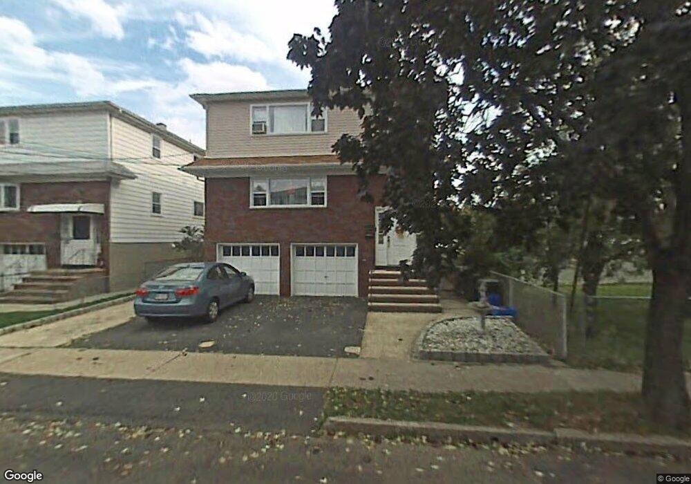
722 Tyler St Lyndhurst, NJ 07071
Estimated Value: $863,000 - $954,000
Studio
--
Bath
2,364
Sq Ft
$380/Sq Ft
Est. Value
About This Home
This home is located at 722 Tyler St, Lyndhurst, NJ 07071 and is currently estimated at $898,255, approximately $379 per square foot. 722 Tyler St is a home located in Bergen County with nearby schools including Lyndhurst High School and Sacred Heart School.
Ownership History
Date
Name
Owned For
Owner Type
Purchase Details
Closed on
Jul 18, 2016
Sold by
Gentilesco Joanne and Rodrigues Joanne
Bought by
Hafez Mohamed A and Hafez Jacqueline A
Current Estimated Value
Purchase Details
Closed on
Jun 9, 2000
Purchase Details
Closed on
Apr 11, 1994
Sold by
Joyce Stephanie
Bought by
Rodrigues Antonio and Rodrigues Jose
Home Financials for this Owner
Home Financials are based on the most recent Mortgage that was taken out on this home.
Original Mortgage
$160,000
Interest Rate
7.45%
Create a Home Valuation Report for This Property
The Home Valuation Report is an in-depth analysis detailing your home's value as well as a comparison with similar homes in the area
Home Values in the Area
Average Home Value in this Area
Purchase History
| Date | Buyer | Sale Price | Title Company |
|---|---|---|---|
| Hafez Mohamed A | $495,000 | First American Title Insuran | |
| -- | $100 | -- | |
| Rodrigues Jose M | -- | -- | |
| Rodrigues Antonio | $232,500 | -- |
Source: Public Records
Mortgage History
| Date | Status | Borrower | Loan Amount |
|---|---|---|---|
| Previous Owner | Rodrigues Antonio | $160,000 |
Source: Public Records
Tax History
| Year | Tax Paid | Tax Assessment Tax Assessment Total Assessment is a certain percentage of the fair market value that is determined by local assessors to be the total taxable value of land and additions on the property. | Land | Improvement |
|---|---|---|---|---|
| 2025 | $13,108 | $633,600 | $265,400 | $368,200 |
| 2024 | $12,663 | $628,400 | $262,400 | $366,000 |
| 2023 | $11,384 | $623,200 | $259,400 | $363,800 |
| 2022 | $11,384 | $358,900 | $160,200 | $198,700 |
| 2021 | $10,911 | $358,900 | $160,200 | $198,700 |
| 2020 | $10,674 | $358,900 | $160,200 | $198,700 |
| 2019 | $10,595 | $358,900 | $160,200 | $198,700 |
| 2018 | $10,681 | $358,900 | $160,200 | $198,700 |
| 2017 | $10,412 | $358,900 | $160,200 | $198,700 |
| 2016 | $10,178 | $358,900 | $160,200 | $198,700 |
| 2015 | $9,859 | $358,900 | $160,200 | $198,700 |
| 2014 | $9,730 | $358,900 | $160,200 | $198,700 |
Source: Public Records
Map
Nearby Homes
- 715 Tyler St
- 715 Stuyvesant Ave
- 825 Riverside Ave Unit 207
- 609 Chase Ave
- 521 Weart Ave
- 416 Kingsland Ave
- 471 Harding Ave
- 230 New St
- 117 Lincoln Ave
- 105 Jauncey Ave
- 651 Riverside Ave Unit A7
- 433 Chase Ave
- 14 River Rd Unit F
- 773 5th St
- 25 River Rd Unit A-18
- 25 River Rd Unit B11
- 25 River Rd Unit 18-B
- 103 River Rd Unit A1
- 752 Ridge Rd
- 105 River Rd Unit C1
- 718 Tyler St
- 329 Thomas Ave
- 331 Thomas Ave
- 721 Lincoln St
- 335 Thomas Ave
- 710 Tyler St
- 710 Tyler St Unit 1
- 717 Lincoln St
- 325 Thomas Ave
- 719 Tyler St
- 339 Thomas Ave
- 711 Lincoln St
- 711 Lincoln St Unit 1st Floor
- 711 Tyler St
- 326 Sanford Ave
- 330 Sanford Ave
- 321 Thomas Ave
- 320 Sanford Ave
- 328 Thomas Ave
- 332 Sanford Ave
Your Personal Tour Guide
Ask me questions while you tour the home.