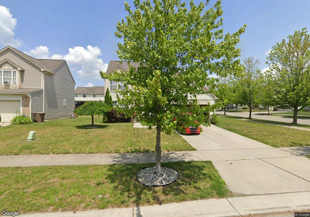
722 W Margaret Ln Unit 201 Pontiac, MI 48341
Estimated Value: $210,297 - $283,000
3
Beds
3
Baths
1,685
Sq Ft
$147/Sq Ft
Est. Value
About This Home
This home is located at 722 W Margaret Ln Unit 201, Pontiac, MI 48341 and is currently estimated at $247,324, approximately $146 per square foot. 722 W Margaret Ln Unit 201 is a home located in Oakland County with nearby schools including Walt Whitman Elementary School, Pontiac Middle School, and Pontiac High School.
Ownership History
Date
Name
Owned For
Owner Type
Purchase Details
Closed on
Feb 25, 2010
Sold by
Burk Todd and Burk Christine
Bought by
Broadnax Derrick and Broadnax Dana
Current Estimated Value
Home Financials for this Owner
Home Financials are based on the most recent Mortgage that was taken out on this home.
Original Mortgage
$73,548
Outstanding Balance
$48,819
Interest Rate
5.01%
Mortgage Type
VA
Estimated Equity
$198,505
Purchase Details
Closed on
Sep 29, 2008
Sold by
Us Bank Na
Bought by
Hsbc Bank Usa Na
Purchase Details
Closed on
May 27, 2008
Sold by
Robinson Kimberly R
Bought by
Us Bank Na and Home Equity Loan Trust 2005-He2
Purchase Details
Closed on
Dec 19, 2003
Sold by
Parks At Stonegate Pointe Llc
Bought by
Robinson Kimberly R
Purchase Details
Closed on
Jun 3, 2003
Sold by
Eltel Associates Llc
Bought by
The Parks At Stonegate Pointe Llc
Create a Home Valuation Report for This Property
The Home Valuation Report is an in-depth analysis detailing your home's value as well as a comparison with similar homes in the area
Home Values in the Area
Average Home Value in this Area
Purchase History
| Date | Buyer | Sale Price | Title Company |
|---|---|---|---|
| Broadnax Derrick | $72,000 | Multiple | |
| Hsbc Bank Usa Na | -- | E Title Agency | |
| Us Bank Na | $102,000 | None Available | |
| Robinson Kimberly R | $177,900 | -- | |
| The Parks At Stonegate Pointe Llc | -- | -- |
Source: Public Records
Mortgage History
| Date | Status | Borrower | Loan Amount |
|---|---|---|---|
| Open | Broadnax Derrick | $73,548 |
Source: Public Records
Tax History Compared to Growth
Tax History
| Year | Tax Paid | Tax Assessment Tax Assessment Total Assessment is a certain percentage of the fair market value that is determined by local assessors to be the total taxable value of land and additions on the property. | Land | Improvement |
|---|---|---|---|---|
| 2024 | $2,031 | $97,760 | $0 | $0 |
| 2023 | $1,935 | $91,760 | $0 | $0 |
| 2022 | $1,930 | $83,500 | $0 | $0 |
| 2021 | $1,872 | $77,020 | $0 | $0 |
| 2020 | $1,759 | $70,290 | $0 | $0 |
| 2019 | $1,824 | $61,310 | $0 | $0 |
| 2018 | $1,769 | $55,260 | $0 | $0 |
| 2017 | $2,898 | $51,150 | $0 | $0 |
| 2016 | $1,712 | $44,350 | $0 | $0 |
| 2015 | -- | $36,670 | $0 | $0 |
| 2014 | -- | $30,810 | $0 | $0 |
| 2011 | -- | $32,570 | $0 | $0 |
Source: Public Records
Map
Nearby Homes
- 663 Lewa Downs Dr Unit 98
- 253 Lasseigne St
- 247 Lasseigne St
- 258 Stonegate E Unit 103
- 76 Spokane Dr
- 331 Elizabeth Lake Rd
- 79 Spokane Dr
- 321 Tom Ave Unit 70
- 117 Murphy Ave
- 119 N Genesee Ave
- 129 Osceola Dr
- 94 Dwight Ave
- 27 Elizabeth Lake Rd
- 113 Osceola Dr
- 14 Utica Rd
- 88 Thorpe St
- 66 N Telegraph Rd
- 44 W End Ave
- 69 Lincoln St
- 39 Osceola Dr
- 722 W Margaret Ln # 201
- 726 W Margaret Ln Unit 202
- 721 Arusha Dr Unit 200
- 730 W Margaret Ln Unit 203
- 725 Arusha Dr Unit 199
- 314 David St Unit 183
- 308 David St Unit 182
- 729 Arusha Dr Unit 198
- 721 W Margaret Ln Unit 214
- 320 David St Unit 184
- 734 W Margaret Ln Unit 204
- 304 David St Unit 181
- 725 W Margaret Ln Unit 213
- 729 W Margaret Ln Unit 212
- 733 Arusha Dr
- 324 David St Unit 185
- 300 David St Unit 180
- 738 W Margaret Ln
- 733 W Margaret Ln Unit 211
- 737 Arusha Dr Unit 196
