Estimated Value: $326,112 - $337,000
Studio
--
Bath
1,566
Sq Ft
$211/Sq Ft
Est. Value
About This Home
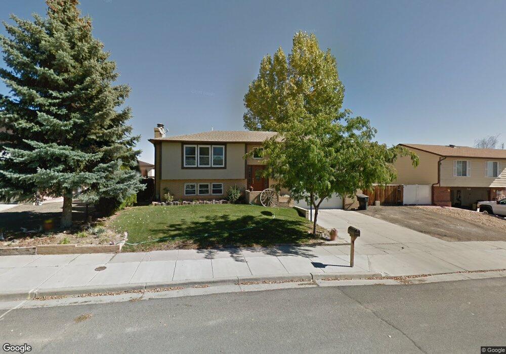
This home is located at 722 Windsor Cir, Price, UT 84501 and is currently estimated at $330,278, approximately $210 per square foot. 722 Windsor Cir is a home located in Carbon County with nearby schools including Castle Heights School, Mont Harmon Junior High School, and Carbon High School.
Ownership History
Date
Name
Owned For
Owner Type
Purchase Details
Closed on
Nov 5, 2009
Sold by
Huff Brad
Bought by
Huff Brad and Huff Mike
Current Estimated Value
Purchase Details
Closed on
Apr 7, 2009
Sold by
Huff Arlene
Bought by
Huff Arlene and Huff Brad
Create a Home Valuation Report for This Property
The Home Valuation Report is an in-depth analysis detailing your home's value as well as a comparison with similar homes in the area
Purchase History
| Date | Buyer | Sale Price | Title Company |
|---|---|---|---|
| Huff Brad | -- | South Eastern Utah Title Co | |
| Huff Arlene | -- | South Eastern Utah Title Co |
Source: Public Records
Tax History
| Year | Tax Paid | Tax Assessment Tax Assessment Total Assessment is a certain percentage of the fair market value that is determined by local assessors to be the total taxable value of land and additions on the property. | Land | Improvement |
|---|---|---|---|---|
| 2025 | $3,149 | $227,198 | $24,124 | $203,074 |
| 2024 | $2,063 | $168,177 | $13,200 | $154,977 |
| 2023 | $2,155 | $185,747 | $11,630 | $174,117 |
| 2022 | $2,056 | $156,600 | $8,667 | $147,933 |
| 2021 | $1,743 | $207,880 | $15,759 | $192,121 |
| 2020 | $1,562 | $93,236 | $0 | $0 |
| 2019 | $1,225 | $75,524 | $0 | $0 |
| 2018 | $1,194 | $75,524 | $0 | $0 |
| 2017 | $1,177 | $75,524 | $0 | $0 |
| 2016 | $998 | $75,524 | $0 | $0 |
| 2015 | $998 | $75,524 | $0 | $0 |
| 2014 | $948 | $72,480 | $0 | $0 |
| 2013 | $961 | $72,480 | $0 | $0 |
Source: Public Records
Map
Nearby Homes
- 1535 Sagewood Rd
- 835 Essex Cir
- 330 N Pinewood Cir
- 688 Birch Cir
- 546 Windsor Rd
- 831 N 1820 E Unit 66
- 1830 E 840 N Unit 80
- 1841 E 8th N Unit 78
- 1840 E 840 N Unit 81
- 1829 E 840 N Unit 87
- 1855 E 8th N Unit 77
- 1858 E 840 N Unit 82
- 1843 E 840 N Unit 86
- 1348 Sagewood Rd
- 1857 E 840 N Unit 85
- 1871 E 840 N Unit 84
- 838 N 1880 E Unit 73
- 854 N 1880 E Unit 72
- 868 N 1880 E Unit 71
- 1875 E 880 N
- 722 Windsor Cir
- 718 Windsor Cir
- 718 Windsor Cir
- 736 Windsor Cir
- 723 Molyneux Dr
- 735 Molyneux Dr
- 750 Windsor Cir
- 727 Windsor Cir
- 709 Molyneux Dr
- 715 Windsor Cir
- 741 Windsor Rd
- 749 Molyneux Dr
- 703 Windsor Cir
- 703 Windsor Rd
- 688 Windsor Rd
- 763 Molyneux Dr
- 1630 Oxford Rd
- 726 Molyneux Dr
- 755 Windsor Cir
- 714 Molyneux Dr
Your Personal Tour Guide
Ask me questions while you tour the home.