Estimated Value: $310,000 - $364,000
3
Beds
2
Baths
1,661
Sq Ft
$204/Sq Ft
Est. Value
About This Home
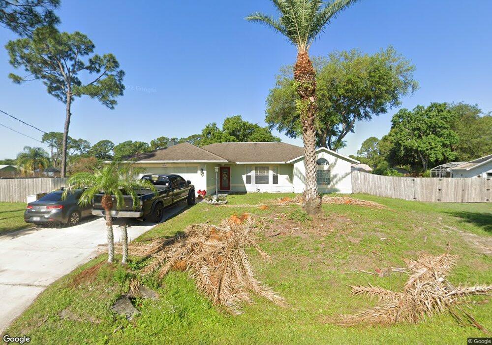
This home is located at 7220 Milton Ave, Cocoa, FL 32927 and is currently estimated at $338,879, approximately $204 per square foot. 7220 Milton Ave is a home located in Brevard County with nearby schools including Enterprise Elementary School, Space Coast Junior/Senior High School, and Sculptor Charter School.
Ownership History
Date
Name
Owned For
Owner Type
Purchase Details
Closed on
May 29, 2018
Sold by
Murray William B and Murray Jennifer J
Bought by
Murray Wiiliam B and Murray Jennifer J
Current Estimated Value
Purchase Details
Closed on
Mar 19, 2001
Sold by
Nationscredit Mtg Corp Fl
Bought by
Murray William B and Marohnic Jennifer
Home Financials for this Owner
Home Financials are based on the most recent Mortgage that was taken out on this home.
Original Mortgage
$79,705
Interest Rate
7.02%
Purchase Details
Closed on
Sep 19, 2000
Sold by
Clerk Circuit Court
Bought by
Nationscredit Mtg Corp Fl
Create a Home Valuation Report for This Property
The Home Valuation Report is an in-depth analysis detailing your home's value as well as a comparison with similar homes in the area
Home Values in the Area
Average Home Value in this Area
Purchase History
| Date | Buyer | Sale Price | Title Company |
|---|---|---|---|
| Murray Wiiliam B | -- | Attorney | |
| Murray William B | $83,900 | -- | |
| Nationscredit Mtg Corp Fl | -- | -- |
Source: Public Records
Mortgage History
| Date | Status | Borrower | Loan Amount |
|---|---|---|---|
| Previous Owner | Murray William B | $79,705 |
Source: Public Records
Tax History
| Year | Tax Paid | Tax Assessment Tax Assessment Total Assessment is a certain percentage of the fair market value that is determined by local assessors to be the total taxable value of land and additions on the property. | Land | Improvement |
|---|---|---|---|---|
| 2025 | $1,571 | $115,850 | -- | -- |
| 2024 | $1,533 | $112,590 | -- | -- |
| 2023 | $1,533 | $109,320 | $0 | $0 |
| 2022 | $1,430 | $106,140 | $0 | $0 |
| 2021 | $1,433 | $103,050 | $0 | $0 |
| 2020 | $1,371 | $101,630 | $0 | $0 |
| 2019 | $1,308 | $99,350 | $0 | $0 |
| 2018 | $1,302 | $97,500 | $0 | $0 |
| 2017 | $1,184 | $88,150 | $0 | $0 |
| 2016 | $1,184 | $86,340 | $18,000 | $68,340 |
| 2015 | $1,197 | $85,740 | $15,000 | $70,740 |
| 2014 | $1,197 | $85,060 | $11,000 | $74,060 |
Source: Public Records
Map
Nearby Homes
- 7200 Oakwood Ave
- 7368 Crepe Myrtle Ct
- 7419 Hackberry Rd
- 7429 Hackberry Rd
- 7230 Venus Ave
- 5680 Brandon St
- 7635 Fringe Place
- 7606 Fringe Place
- 5555 Brandon St
- 7065 Hundred Acre Dr
- 6990 Bryant Rd
- 5303 Yaupon Holly Dr
- 5242 Yaupon Holly Dr
- 5165 Patricia St
- 5150 Melody St
- 6815 Bryant Rd
- 5155 Mayflower St
- 5200 Frisco St
- 6760 Cairo Rd
- 5080 Mayflower St
- 7210 Milton
- 7230 Milton Ave
- 7235 Kimball Ave
- 7215 Kimball Ave
- 5685 Friendly St
- 7215 Milton Ave
- 7235 Milton Ave Unit 7
- 7235 Milton Ave
- 5695 Friendly St
- 7205 Kimball Ave
- 7205 Milton Ave
- 5665 Friendly St
- 7150 Milton Ave
- 7220 Bevil Ave
- 5655 Friendly St
- 5655 Friendly
- 7210 Bevil Ave Unit 7
- 7210 Bevil Ave
- 7230 Bevil Ave
- 7230 Kimball Ave
Your Personal Tour Guide
Ask me questions while you tour the home.