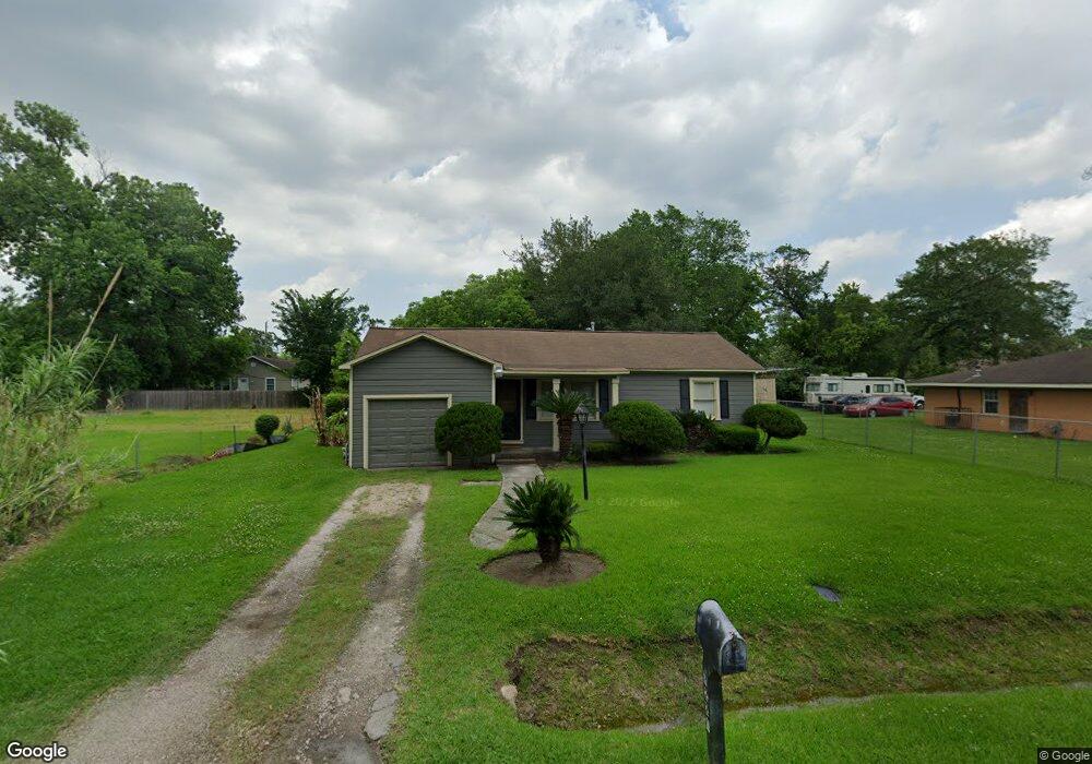
7221 Carothers St Houston, TX 77028
Trinity-Houston Gardens NeighborhoodEstimated Value: $122,220 - $127,000
2
Beds
1
Bath
936
Sq Ft
$134/Sq Ft
Est. Value
About This Home
This home is located at 7221 Carothers St, Houston, TX 77028 and is currently estimated at $125,305, approximately $133 per square foot. 7221 Carothers St is a home located in Harris County with nearby schools including McGowen Elementary School, Key Middle, and Kashmere High School.
Ownership History
Date
Name
Owned For
Owner Type
Purchase Details
Closed on
Oct 11, 2002
Sold by
Robinson Dan Fredric and Garrett Clara G
Bought by
Bullock Brent C
Current Estimated Value
Home Financials for this Owner
Home Financials are based on the most recent Mortgage that was taken out on this home.
Original Mortgage
$23,750
Interest Rate
6.2%
Create a Home Valuation Report for This Property
The Home Valuation Report is an in-depth analysis detailing your home's value as well as a comparison with similar homes in the area
Home Values in the Area
Average Home Value in this Area
Purchase History
| Date | Buyer | Sale Price | Title Company |
|---|---|---|---|
| Bullock Brent C | -- | -- |
Source: Public Records
Mortgage History
| Date | Status | Borrower | Loan Amount |
|---|---|---|---|
| Closed | Bullock Brent C | $23,750 |
Source: Public Records
Tax History Compared to Growth
Tax History
| Year | Tax Paid | Tax Assessment Tax Assessment Total Assessment is a certain percentage of the fair market value that is determined by local assessors to be the total taxable value of land and additions on the property. | Land | Improvement |
|---|---|---|---|---|
| 2025 | $740 | $87,488 | $40,250 | $47,238 |
| 2024 | $740 | $87,488 | $40,250 | $47,238 |
| 2023 | $740 | $68,524 | $40,250 | $28,274 |
| 2022 | $1,509 | $68,524 | $40,250 | $28,274 |
| 2021 | $1,631 | $69,974 | $25,156 | $44,818 |
| 2020 | $1,594 | $69,974 | $25,156 | $44,818 |
| 2019 | $1,514 | $59,838 | $17,609 | $42,229 |
| 2018 | $1,061 | $66,966 | $17,609 | $49,357 |
| 2017 | $1,638 | $66,966 | $17,609 | $49,357 |
| 2016 | $1,489 | $66,966 | $17,609 | $49,357 |
| 2015 | $826 | $66,966 | $17,609 | $49,357 |
| 2014 | $826 | $66,966 | $17,609 | $49,357 |
Source: Public Records
Map
Nearby Homes
- 7140 Orville St
- 7309 Orville St
- 7307 W Knoll St
- 7100 W Knoll St
- 7214 Weyburn St
- 8100 Homestead Rd
- 7325 Ley Rd
- 7010 S Hall St
- 7101 Weyburn St Unit C
- 7413 W Knoll St
- 7206 Bywood St
- 7327 Ley Rd
- 7126 Bywood A and B St
- 7126 Bywood St
- 7002 S Hall St
- 7429 W Knoll St
- 6842 Carothers St
- 6838 Carothers St
- 6908 Larkstone St
- 6908 S Hall St
- 7225 Carothers St
- 7234 W Knoll St
- 7213 Carothers St
- 7226 W Knoll St
- 7238 W Knoll St
- 6902 Carothers St
- 6910 Carothers St
- 7209 Carothers St
- 7232 Carothers St
- 7218 W Knoll St
- 7236 Carothers St
- 7301 Carothers St
- 7302 W Knoll St
- 7222 Carothers St
- 6918 W Knoll St
- 7214 W Knoll St
- 7205 Carothers St
- 7228 W Knoll St
- 7229 W Knoll St
- 7306 W Knoll St