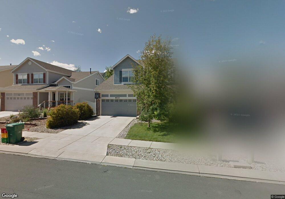
7224 Amber Ridge Dr Colorado Springs, CO 80922
Springs Ranch NeighborhoodEstimated Value: $458,000 - $523,000
3
Beds
3
Baths
1,952
Sq Ft
$245/Sq Ft
Est. Value
About This Home
This home is located at 7224 Amber Ridge Dr, Colorado Springs, CO 80922 and is currently estimated at $478,745, approximately $245 per square foot. 7224 Amber Ridge Dr is a home located in El Paso County with nearby schools including Springs Ranch Elementary School, Horizon Middle School, and Sand Creek High School.
Ownership History
Date
Name
Owned For
Owner Type
Purchase Details
Closed on
Jul 29, 2020
Sold by
Fisher Nathan D
Bought by
Fisher Heesun and Fisher Nathan D
Current Estimated Value
Home Financials for this Owner
Home Financials are based on the most recent Mortgage that was taken out on this home.
Original Mortgage
$210,000
Outstanding Balance
$186,629
Interest Rate
3.1%
Mortgage Type
New Conventional
Estimated Equity
$292,116
Purchase Details
Closed on
Jul 8, 2004
Sold by
Richmond American Homes Of Colorado Inc
Bought by
Fisher Nathan D
Home Financials for this Owner
Home Financials are based on the most recent Mortgage that was taken out on this home.
Original Mortgage
$169,550
Interest Rate
6.37%
Mortgage Type
Unknown
Create a Home Valuation Report for This Property
The Home Valuation Report is an in-depth analysis detailing your home's value as well as a comparison with similar homes in the area
Home Values in the Area
Average Home Value in this Area
Purchase History
| Date | Buyer | Sale Price | Title Company |
|---|---|---|---|
| Fisher Heesun | -- | Unified Title Co | |
| Fisher Nathan D | $211,950 | Stewart Title |
Source: Public Records
Mortgage History
| Date | Status | Borrower | Loan Amount |
|---|---|---|---|
| Open | Fisher Heesun | $210,000 | |
| Previous Owner | Fisher Nathan D | $169,550 | |
| Closed | Fisher Nathan D | $21,195 |
Source: Public Records
Tax History Compared to Growth
Tax History
| Year | Tax Paid | Tax Assessment Tax Assessment Total Assessment is a certain percentage of the fair market value that is determined by local assessors to be the total taxable value of land and additions on the property. | Land | Improvement |
|---|---|---|---|---|
| 2025 | $1,724 | $33,190 | -- | -- |
| 2024 | $1,625 | $32,850 | $4,620 | $28,230 |
| 2023 | $1,625 | $32,850 | $4,620 | $28,230 |
| 2022 | $1,404 | $24,080 | $4,170 | $19,910 |
| 2021 | $1,464 | $24,780 | $4,290 | $20,490 |
| 2020 | $1,301 | $21,760 | $3,580 | $18,180 |
| 2019 | $1,287 | $21,760 | $3,580 | $18,180 |
| 2018 | $1,092 | $18,100 | $3,020 | $15,080 |
| 2017 | $1,098 | $18,100 | $3,020 | $15,080 |
| 2016 | $1,160 | $18,860 | $2,950 | $15,910 |
| 2015 | $1,161 | $18,860 | $2,950 | $15,910 |
| 2014 | $1,117 | $17,790 | $2,790 | $15,000 |
Source: Public Records
Map
Nearby Homes
- 7215 Amber Ridge Dr
- 4404 Poplar Brook Dr
- 4126 Fellsland Dr
- 4144 Poplar Brook Dr
- 4148 Heathmoor Dr
- 4325 Crow Creek Dr
- 7104 Ash Creek Heights Unit 203
- 4489 Crow Creek Dr
- 4352 Canteen Trail
- 4529 Crow Creek Dr
- 7084 Ash Creek Heights Unit 201
- 4013 Pronghorn Meadows Cir
- 3850 Springs Ranch Dr
- 6925 Ash Creek Heights Unit 103
- 4307 Addax Ct
- 4354 Round Hill Dr
- 7004 Ash Creek Heights Unit 201
- 6984 Ash Creek Heights Unit 204
- 3880 Happy Jack Dr
- 4174 Gray Fox Heights
- 7214 Amber Ridge Dr
- 7234 Amber Ridge Dr
- 7204 Amber Ridge Dr
- 7244 Amber Ridge Dr
- 4265 Ashby Field Dr
- 4273 Ashby Field Dr
- 4257 Ashby Field Dr
- 7194 Amber Ridge Dr
- 4281 Ashby Field Dr
- 7225 Amber Ridge Dr
- 4249 Ashby Field Dr
- 7254 Amber Ridge Dr
- 7235 Amber Ridge Dr
- 7184 Amber Ridge Dr
- 7245 Amber Ridge Dr
- 7205 Amber Ridge Dr
- 4289 Ashby Field Dr
- 4241 Ashby Field Dr
- 7195 Amber Ridge Dr
- 4404 Ranch Creek Dr