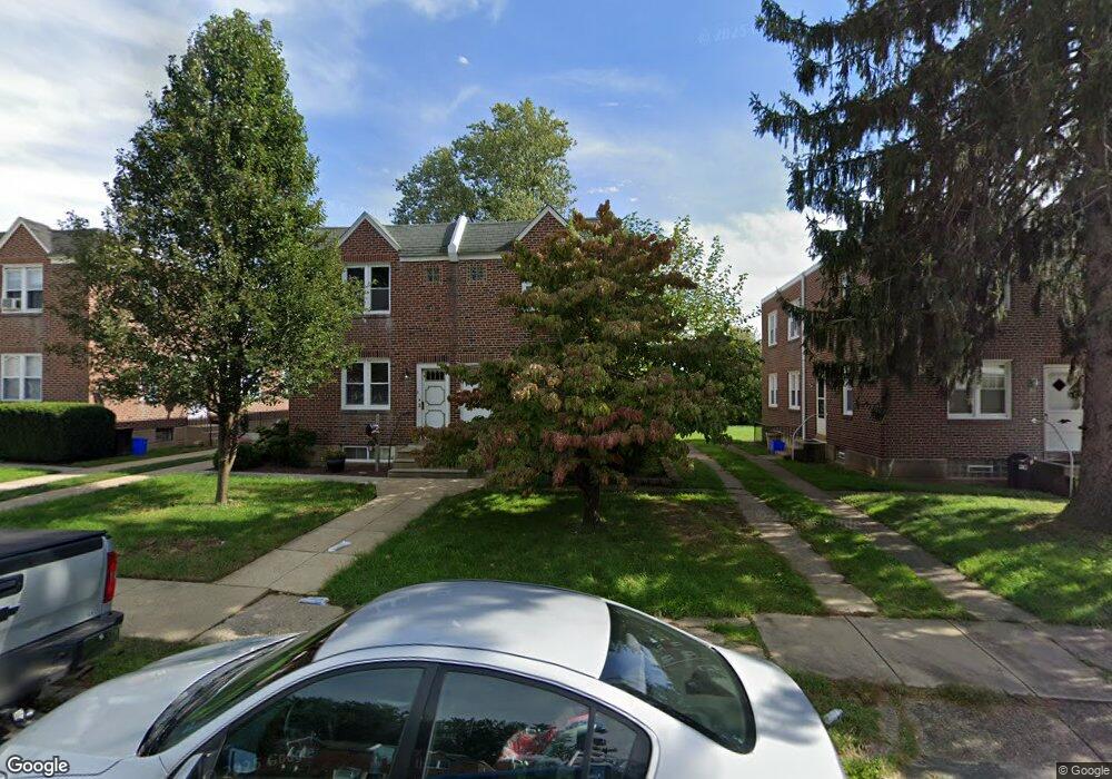
7225 Dungan Rd Philadelphia, PA 19111
Castor Gardens NeighborhoodEstimated Value: $303,000 - $356,681
--
Bed
2
Baths
1,280
Sq Ft
$254/Sq Ft
Est. Value
About This Home
This home is located at 7225 Dungan Rd, Philadelphia, PA 19111 and is currently estimated at $325,560, approximately $254 per square foot. 7225 Dungan Rd is a home located in Philadelphia County with nearby schools including Kennedy C. Crossan School, Castor Gardens Middle School, and Northeast High School.
Ownership History
Date
Name
Owned For
Owner Type
Purchase Details
Closed on
Sep 20, 2005
Sold by
Mcglinchey Timothy and Mcglinchey Allison M
Bought by
Mcglinchey Timothy P and Mcglinchey Allison M
Current Estimated Value
Home Financials for this Owner
Home Financials are based on the most recent Mortgage that was taken out on this home.
Original Mortgage
$122,500
Outstanding Balance
$65,373
Interest Rate
5.81%
Mortgage Type
Commercial
Estimated Equity
$260,187
Purchase Details
Closed on
Jan 31, 2005
Sold by
Leonard Daniel E
Bought by
Mcglinchey Timothy and Genco Allison M
Home Financials for this Owner
Home Financials are based on the most recent Mortgage that was taken out on this home.
Original Mortgage
$117,900
Interest Rate
4.5%
Mortgage Type
Commercial
Create a Home Valuation Report for This Property
The Home Valuation Report is an in-depth analysis detailing your home's value as well as a comparison with similar homes in the area
Home Values in the Area
Average Home Value in this Area
Purchase History
| Date | Buyer | Sale Price | Title Company |
|---|---|---|---|
| Mcglinchey Timothy P | -- | First American Title Ins Co | |
| Mcglinchey Timothy | $131,000 | -- |
Source: Public Records
Mortgage History
| Date | Status | Borrower | Loan Amount |
|---|---|---|---|
| Open | Mcglinchey Timothy P | $122,500 | |
| Closed | Mcglinchey Timothy | $117,900 |
Source: Public Records
Tax History Compared to Growth
Tax History
| Year | Tax Paid | Tax Assessment Tax Assessment Total Assessment is a certain percentage of the fair market value that is determined by local assessors to be the total taxable value of land and additions on the property. | Land | Improvement |
|---|---|---|---|---|
| 2025 | $2,126 | $315,900 | $63,180 | $252,720 |
| 2024 | $2,126 | $315,900 | $63,180 | $252,720 |
| 2023 | $2,126 | $151,900 | $45,500 | $106,400 |
| 2022 | $2,126 | $151,900 | $45,500 | $106,400 |
| 2021 | $2,126 | $0 | $0 | $0 |
| 2020 | $2,126 | $0 | $0 | $0 |
| 2019 | $2,041 | $0 | $0 | $0 |
| 2018 | $2,072 | $0 | $0 | $0 |
| 2017 | $2,072 | $0 | $0 | $0 |
| 2016 | $2,072 | $0 | $0 | $0 |
| 2015 | $1,983 | $0 | $0 | $0 |
| 2014 | -- | $148,000 | $62,977 | $85,023 |
| 2012 | -- | $21,152 | $3,430 | $17,722 |
Source: Public Records
Map
Nearby Homes
- 7146-50 Montour St
- 1012 Saint Vincent St
- 1207 Cottman Ave
- 7352 Dungan Rd
- 7137 Lawndale Ave
- 7333 Tabor Ave
- 1423 Bleigh Ave
- 829 Disston St
- 1431-35 Vista St
- 1116 Friendship St
- 1055 Tyson Ave
- 1016 Cottman Ave
- 1019 Disston St
- 7418 Tabor Ave
- 7020 Oxford Ave
- 1114 Brighton St
- 7524 Whitaker Ave
- 1304 Faunce St
- 1412 Faunce St
- 7333-35 Rising Sun Ave
- 7227 Dungan Rd
- 7229 Dungan Rd
- 7221 Dungan Rd
- 7231 Dungan Rd
- 7223 Dungan Rd
- 7223 Dungan Rd Unit 1
- 7213 Dungan Rd
- 7233 Dungan Rd
- 7211 Dungan Rd
- 7235 Dungan Rd
- 7214 Whitaker Ave
- 7216 Whitaker Ave
- 7218 Whitaker Ave
- 7212 Whitaker Ave
- 7209 Dungan Rd
- 7209 Dungan Rd Unit 1ST FL
- 7220 Whitaker Ave
- 7237 Dungan Rd
- 7210 Whitaker Ave
- 7222 Whitaker Ave