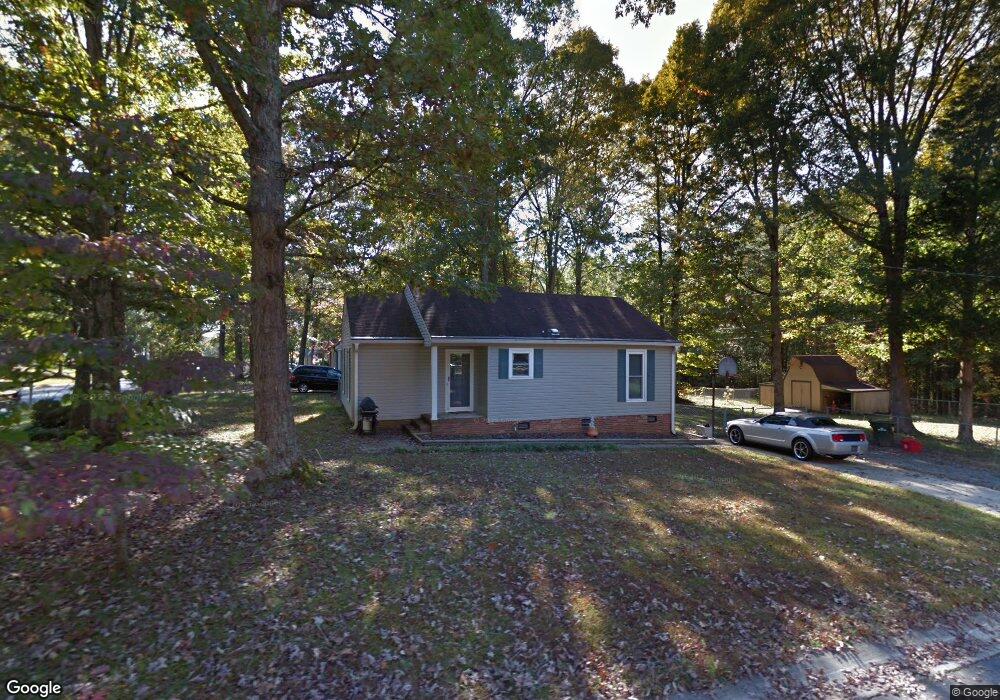
7225 Lancashire Dr Mint Hill, NC 28227
Estimated Value: $246,000 - $276,892
2
Beds
2
Baths
1,018
Sq Ft
$259/Sq Ft
Est. Value
About This Home
This home is located at 7225 Lancashire Dr, Mint Hill, NC 28227 and is currently estimated at $263,723, approximately $259 per square foot. 7225 Lancashire Dr is a home located in Mecklenburg County with nearby schools including Lebanon Road Elementary, Northeast Middle, and Independence High.
Ownership History
Date
Name
Owned For
Owner Type
Purchase Details
Closed on
Oct 15, 2020
Sold by
Crocker Laurie L
Bought by
Husband Alan M
Current Estimated Value
Purchase Details
Closed on
May 7, 2019
Sold by
Husband Alan M
Bought by
Husband Alan M and Crocker Laurie L
Purchase Details
Closed on
Nov 17, 2016
Sold by
Gray Jeffery A and Gray Anna O
Bought by
Husband Alan M
Home Financials for this Owner
Home Financials are based on the most recent Mortgage that was taken out on this home.
Original Mortgage
$100,800
Interest Rate
3.42%
Mortgage Type
New Conventional
Purchase Details
Closed on
Oct 16, 2001
Sold by
Gray Anna O and Outlaw Anna Belle
Bought by
Gray Anna O and Gray Jeffery A
Create a Home Valuation Report for This Property
The Home Valuation Report is an in-depth analysis detailing your home's value as well as a comparison with similar homes in the area
Home Values in the Area
Average Home Value in this Area
Purchase History
| Date | Buyer | Sale Price | Title Company |
|---|---|---|---|
| Husband Alan M | -- | None Available | |
| Husband Alan M | -- | None Available | |
| Husband Alan M | $112,000 | None Available | |
| Gray Anna O | -- | -- |
Source: Public Records
Mortgage History
| Date | Status | Borrower | Loan Amount |
|---|---|---|---|
| Previous Owner | Husband Alan M | $100,800 |
Source: Public Records
Tax History Compared to Growth
Tax History
| Year | Tax Paid | Tax Assessment Tax Assessment Total Assessment is a certain percentage of the fair market value that is determined by local assessors to be the total taxable value of land and additions on the property. | Land | Improvement |
|---|---|---|---|---|
| 2025 | $923 | $246,800 | $60,000 | $186,800 |
| 2024 | $923 | $246,800 | $60,000 | $186,800 |
| 2023 | $889 | $241,900 | $60,000 | $181,900 |
| 2022 | $1,276 | $141,800 | $35,000 | $106,800 |
| 2021 | $1,276 | $141,800 | $35,000 | $106,800 |
| 2020 | $1,276 | $141,800 | $35,000 | $106,800 |
| 2019 | $1,270 | $141,800 | $35,000 | $106,800 |
| 2018 | $871 | $77,200 | $16,200 | $61,000 |
| 2017 | $862 | $77,200 | $16,200 | $61,000 |
| 2016 | $859 | $77,200 | $16,200 | $61,000 |
| 2015 | $855 | $77,200 | $16,200 | $61,000 |
| 2014 | $853 | $77,200 | $16,200 | $61,000 |
Source: Public Records
Map
Nearby Homes
- 10301 Stornoway Ct
- 7717 Davis Rd
- 7528 Lancashire Dr
- 10100 Cromarty Ln
- 6141 Wilgrove Mint Hill Rd
- 9637 Heartwood Ln
- 6040 Wilgrove Mint Hill Rd
- 9836 Albemarle Rd
- 8914 Driftwood Commons Ct
- 9703 Ardley Park Way Unit 23
- 6606 Old Meadow Rd
- 8409 Olde Stonegate Ln
- 9036 Trailhead Ct
- 6340 Ellesmere Ct
- 8416 Olde Stonegate Ln
- 8531 Willhill Rd
- 9232 Chislehurst Rd
- 1565 Nia Rd
- 7827 Kuck Rd
- 8705 Mullis Forest Ct
- 7219 Lancashire Dr
- 7301 Lancashire Dr
- 7213 Lancashire Dr
- 10200 Cairnsmore Place Unit 9
- 7309 Lancashire Dr
- 7207 Lancashire Dr
- 7212 Lancashire Dr
- 7302 Lancashire Dr
- 10206 Cairnsmore Place
- 10206 Cairnsmore Place Unit 10
- 7310 Lancashire Dr
- 7315 Lancashire Dr
- 7201 Lancashire Dr
- 7206 Lancashire Dr
- 7206 Lancashire Dr Unit 7
- 10212 Cairnsmore Place
- 7318 Lancashire Dr
- 7200 Lancashire Dr
- 7131 Lancashire Dr
- 10201 Adaire Cir