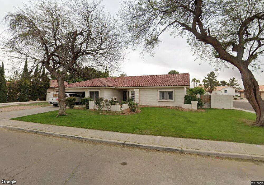
7227 W Columbine Dr Peoria, AZ 85381
Estimated Value: $578,044 - $719,000
--
Bed
4
Baths
2,206
Sq Ft
$299/Sq Ft
Est. Value
About This Home
This home is located at 7227 W Columbine Dr, Peoria, AZ 85381 and is currently estimated at $660,511, approximately $299 per square foot. 7227 W Columbine Dr is a home located in Maricopa County with nearby schools including Oakwood Elementary School, Cactus High School, and Legacy Traditional School - Glendale.
Ownership History
Date
Name
Owned For
Owner Type
Purchase Details
Closed on
May 4, 1999
Sold by
Chiocca Albert D and Chiocca Anita L
Bought by
Delprincipe Cary and Delprincipe Diana L
Current Estimated Value
Home Financials for this Owner
Home Financials are based on the most recent Mortgage that was taken out on this home.
Original Mortgage
$168,000
Outstanding Balance
$42,977
Interest Rate
6.92%
Mortgage Type
New Conventional
Estimated Equity
$617,534
Create a Home Valuation Report for This Property
The Home Valuation Report is an in-depth analysis detailing your home's value as well as a comparison with similar homes in the area
Home Values in the Area
Average Home Value in this Area
Purchase History
| Date | Buyer | Sale Price | Title Company |
|---|---|---|---|
| Delprincipe Cary | $210,000 | Capital Title Agency |
Source: Public Records
Mortgage History
| Date | Status | Borrower | Loan Amount |
|---|---|---|---|
| Open | Delprincipe Cary | $168,000 |
Source: Public Records
Tax History Compared to Growth
Tax History
| Year | Tax Paid | Tax Assessment Tax Assessment Total Assessment is a certain percentage of the fair market value that is determined by local assessors to be the total taxable value of land and additions on the property. | Land | Improvement |
|---|---|---|---|---|
| 2025 | $2,594 | $34,260 | -- | -- |
| 2024 | $2,627 | $32,629 | -- | -- |
| 2023 | $2,627 | $50,160 | $10,030 | $40,130 |
| 2022 | $2,572 | $38,430 | $7,680 | $30,750 |
| 2021 | $2,754 | $34,120 | $6,820 | $27,300 |
| 2020 | $2,780 | $33,900 | $6,780 | $27,120 |
| 2019 | $2,689 | $32,630 | $6,520 | $26,110 |
| 2018 | $2,601 | $32,710 | $6,540 | $26,170 |
| 2017 | $2,602 | $28,310 | $5,660 | $22,650 |
| 2016 | $2,576 | $28,360 | $5,670 | $22,690 |
| 2015 | $2,403 | $26,920 | $5,380 | $21,540 |
Source: Public Records
Map
Nearby Homes
- 7214 W Columbine Dr
- 7220 W Larkspur Dr
- 7233 W Corrine Dr
- 7126 W Columbine Dr
- 12709 N 72nd Ave
- 7418 W Corrine Dr
- 7301 W Sweetwater Ave
- 7266 W Cherry Hills Dr
- 7157 W Cherry Hills Dr
- 7191 W Surrey Ave
- 7113 W Sunnyside Dr
- 7126 W Jenan Dr
- 7326 W Pershing Ave
- 13051 N 75th Dr
- 7537 W Dreyfus Dr
- 7638 W Shaw Butte Dr
- 7225 W Canterbury Dr
- 6849 W Wethersfield Rd
- 6845 W Charter Oak Rd
- 7544 W Dreyfus Dr
- 7221 W Columbine Dr
- 7226 W Bloomfield Rd
- 12470 N 72nd Dr
- 12460 N 72nd Dr
- 7226 W Columbine Dr
- 7220 W Bloomfield Rd
- 7220 W Columbine Dr
- 12510 N 72nd Dr
- 7215 W Columbine Dr
- 12450 N 72nd Dr
- 12520 N 72nd Dr
- 7214 W Bloomfield Rd
- 12465 N 73rd Ave
- 7262 W Bloomfield Rd
- 12359 N 72nd Dr
- 7208 W Columbine Dr
- 7221 W Larkspur Dr
- 7209 W Columbine Dr
- 7215 W Larkspur Dr
- 12467 N 73rd Ave