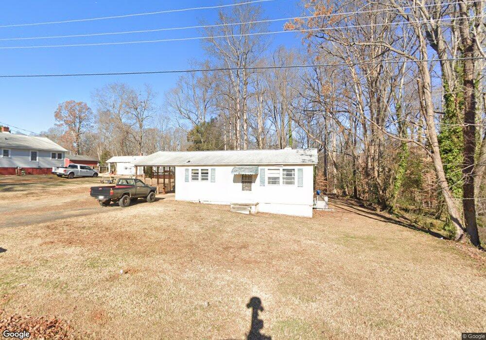
723 Martha Ave Lowell, NC 28098
Estimated Value: $129,000 - $173,000
2
Beds
1
Bath
768
Sq Ft
$195/Sq Ft
Est. Value
About This Home
This home is located at 723 Martha Ave, Lowell, NC 28098 and is currently estimated at $149,963, approximately $195 per square foot. 723 Martha Ave is a home located in Gaston County with nearby schools including Lowell Elementary School, Holbrook Middle School, and Ashbrook High School.
Ownership History
Date
Name
Owned For
Owner Type
Purchase Details
Closed on
May 12, 2021
Sold by
Gates Edward A and Gates Judy R
Bought by
Branham Duane Allan
Current Estimated Value
Home Financials for this Owner
Home Financials are based on the most recent Mortgage that was taken out on this home.
Original Mortgage
$66,500
Outstanding Balance
$50,346
Interest Rate
3.1%
Mortgage Type
New Conventional
Estimated Equity
$99,617
Purchase Details
Closed on
Jul 6, 1972
Bought by
Gates Edward A and Gates Judy R
Create a Home Valuation Report for This Property
The Home Valuation Report is an in-depth analysis detailing your home's value as well as a comparison with similar homes in the area
Home Values in the Area
Average Home Value in this Area
Purchase History
| Date | Buyer | Sale Price | Title Company |
|---|---|---|---|
| Branham Duane Allan | $70,000 | None Available | |
| Gates Edward A | -- | -- |
Source: Public Records
Mortgage History
| Date | Status | Borrower | Loan Amount |
|---|---|---|---|
| Open | Branham Duane Allan | $66,500 |
Source: Public Records
Tax History
| Year | Tax Paid | Tax Assessment Tax Assessment Total Assessment is a certain percentage of the fair market value that is determined by local assessors to be the total taxable value of land and additions on the property. | Land | Improvement |
|---|---|---|---|---|
| 2025 | $1,226 | $114,690 | $16,000 | $98,690 |
| 2024 | $1,226 | $114,690 | $16,000 | $98,690 |
| 2023 | $1,359 | $114,690 | $16,000 | $98,690 |
| 2022 | $837 | $59,380 | $16,000 | $43,380 |
| 2021 | $784 | $59,380 | $16,000 | $43,380 |
| 2020 | $748 | $59,380 | $16,000 | $43,380 |
| 2019 | $754 | $59,380 | $16,000 | $43,380 |
| 2018 | $628 | $48,315 | $14,400 | $33,915 |
| 2017 | $628 | $48,315 | $14,400 | $33,915 |
| 2016 | $628 | $48,315 | $0 | $0 |
| 2014 | $604 | $46,441 | $14,000 | $32,441 |
Source: Public Records
Map
Nearby Homes
- 503 Caroline Ave
- 308 Rankin Ave
- 704 McAdenville Rd
- 7 Stowe St
- 356 Main St
- 1033 Marguerite Dr
- 211 Seigle St Unit 37-38
- 546 River View Dr
- 00 W 1st St
- 500 Gann St Unit 51-56
- 116 Kenworthy Ave
- 1402 Richmond Dr Unit 1
- 5128 Meadow Woods Dr
- 1102 Catawba Run Rd
- 1009 Preston Dr
- 188 Main St
- 8009 Camden Crossing
- 8004 Camden Crossing
- 623 Turner Rd
- 602 Green Chapman Rd
- 721 Martha Ave
- 717 Martha Ave
- 805 Martha Ave
- 302 Gittens St
- 301 Gittens St
- 711 Martha Ave
- 716 Martha Ave
- 307 Gittens St
- 806 Martha Ave
- 712 Martha Ave
- 124 S Elm St
- 319 Caroline Ave
- 315 Caroline Ave
- 125 S Pine St
- 707 Martha Ave
- 710 Martha Ave
- 311 Gittens St
- 311 Caroline Ave
- 121 S Elm St
- 703 Martha Ave
Your Personal Tour Guide
Ask me questions while you tour the home.