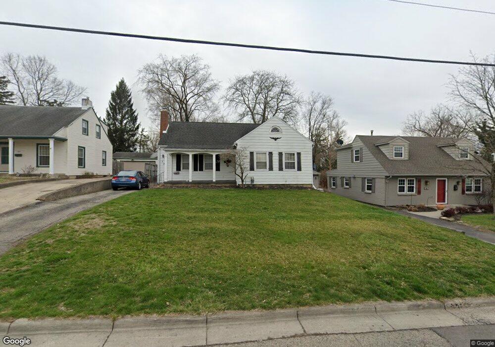
723 W Harding Rd Springfield, OH 45504
Estimated Value: $229,000 - $244,000
3
Beds
3
Baths
1,564
Sq Ft
$149/Sq Ft
Est. Value
About This Home
This home is located at 723 W Harding Rd, Springfield, OH 45504 and is currently estimated at $233,790, approximately $149 per square foot. 723 W Harding Rd is a home located in Clark County with nearby schools including Snowhill Elementary School, Roosevelt Middle School, and Springfield High School.
Ownership History
Date
Name
Owned For
Owner Type
Purchase Details
Closed on
Mar 11, 2004
Sold by
Weaver Christopher M and Weaver Jennifer L
Bought by
Pullins Tony C
Current Estimated Value
Home Financials for this Owner
Home Financials are based on the most recent Mortgage that was taken out on this home.
Original Mortgage
$114,700
Outstanding Balance
$52,778
Interest Rate
5.78%
Mortgage Type
FHA
Estimated Equity
$181,012
Purchase Details
Closed on
Dec 29, 1998
Sold by
Zaletski Melissa H and Harwood Rebecca
Bought by
Weaver Christopher M and Weaver Jennifer L
Home Financials for this Owner
Home Financials are based on the most recent Mortgage that was taken out on this home.
Original Mortgage
$94,223
Interest Rate
6.95%
Mortgage Type
FHA
Create a Home Valuation Report for This Property
The Home Valuation Report is an in-depth analysis detailing your home's value as well as a comparison with similar homes in the area
Home Values in the Area
Average Home Value in this Area
Purchase History
| Date | Buyer | Sale Price | Title Company |
|---|---|---|---|
| Pullins Tony C | $116,500 | -- | |
| Weaver Christopher M | $95,000 | -- |
Source: Public Records
Mortgage History
| Date | Status | Borrower | Loan Amount |
|---|---|---|---|
| Open | Pullins Tony C | $114,700 | |
| Previous Owner | Weaver Christopher M | $94,223 |
Source: Public Records
Tax History
| Year | Tax Paid | Tax Assessment Tax Assessment Total Assessment is a certain percentage of the fair market value that is determined by local assessors to be the total taxable value of land and additions on the property. | Land | Improvement |
|---|---|---|---|---|
| 2025 | $2,744 | $74,660 | $8,020 | $66,640 |
| 2024 | $2,630 | $54,570 | $7,450 | $47,120 |
| 2023 | $2,630 | $54,570 | $7,450 | $47,120 |
| 2022 | $2,694 | $54,570 | $7,450 | $47,120 |
| 2021 | $2,026 | $37,900 | $5,730 | $32,170 |
| 2020 | $2,031 | $37,900 | $5,730 | $32,170 |
| 2019 | $2,036 | $37,900 | $5,730 | $32,170 |
| 2018 | $1,926 | $34,430 | $4,980 | $29,450 |
| 2017 | $1,924 | $38,896 | $4,981 | $33,915 |
| 2016 | $1,927 | $38,896 | $4,981 | $33,915 |
| 2015 | $1,945 | $38,896 | $4,981 | $33,915 |
| 2014 | $1,936 | $38,896 | $4,981 | $33,915 |
| 2013 | $1,916 | $38,896 | $4,981 | $33,915 |
Source: Public Records
Map
Nearby Homes
- 656 Mayhill Rd
- 735 Tanglewood Dr
- 1617 Northgate Rd
- 522 Northwood Dr
- 1425 Sheaff Rd
- 1734 Audubon Park Dr
- 820 W 1st St
- 1329 Lamar Dr
- 1215 Northgate Rd
- 1708 Brookhollow Dr
- 327 Ardmore Rd
- 264 S Broadmoor Blvd
- 1224 Beverly Ave
- 25 Englewood Rd
- 1015 Hillcrest Ave
- 0 E McCreight Ave
- 1330 Garfield Ave
- 1107 N Fountain Ave
- 0 E Home Rd
- 24 Bill Edwards Dr
- 721 W Harding Rd
- 731 W Harding Rd
- 735 W Harding Rd
- 707 W Harding Rd
- 720 Riverside Dr
- 730 Riverside Dr
- 1730 Saint Paris Pike
- 710 Riverside Dr
- 718 W Harding Rd
- 801 W Harding Rd
- 800 Riverside Dr
- 710 W Harding Rd
- 1750 Saint Paris Pike
- 652 Riverside Dr
- 804 Riverside Dr
- 654 W Harding Rd
- 0 Saint Paris Pike
- 648 Riverside Dr
- 745 Riverside Dr
- 648 W Harding Rd
Your Personal Tour Guide
Ask me questions while you tour the home.