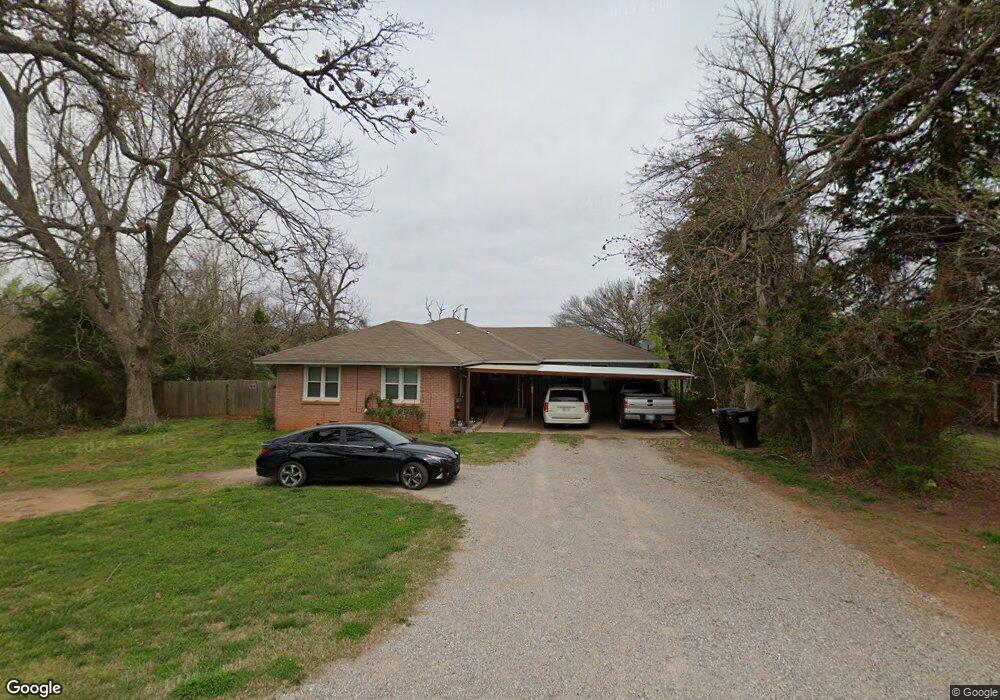
723 W Pitman St McLoud, OK 74851
Estimated Value: $170,569 - $191,000
3
Beds
1
Bath
1,823
Sq Ft
$99/Sq Ft
Est. Value
About This Home
This home is located at 723 W Pitman St, McLoud, OK 74851 and is currently estimated at $180,892, approximately $99 per square foot. 723 W Pitman St is a home located in Pottawatomie County with nearby schools including McLoud Intermediate School, McLoud Elementary School, and McLoud Junior High School.
Ownership History
Date
Name
Owned For
Owner Type
Purchase Details
Closed on
Sep 15, 2008
Sold by
Perez Ariel and Perez Jennie V
Bought by
Sayre Kenneth Ray and Sayre Yvonne Sharon
Current Estimated Value
Home Financials for this Owner
Home Financials are based on the most recent Mortgage that was taken out on this home.
Original Mortgage
$67,200
Outstanding Balance
$44,502
Interest Rate
6.6%
Mortgage Type
Purchase Money Mortgage
Estimated Equity
$136,390
Purchase Details
Closed on
Sep 23, 1996
Sold by
Pittman James and Pittman Emma
Bought by
Perez Ariel and Perez Jennie
Create a Home Valuation Report for This Property
The Home Valuation Report is an in-depth analysis detailing your home's value as well as a comparison with similar homes in the area
Home Values in the Area
Average Home Value in this Area
Purchase History
| Date | Buyer | Sale Price | Title Company |
|---|---|---|---|
| Sayre Kenneth Ray | $84,000 | Lawyers Title Of Ok City Inc | |
| Perez Ariel | $40,000 | -- |
Source: Public Records
Mortgage History
| Date | Status | Borrower | Loan Amount |
|---|---|---|---|
| Open | Sayre Kenneth Ray | $67,200 |
Source: Public Records
Tax History
| Year | Tax Paid | Tax Assessment Tax Assessment Total Assessment is a certain percentage of the fair market value that is determined by local assessors to be the total taxable value of land and additions on the property. | Land | Improvement |
|---|---|---|---|---|
| 2025 | $1,015 | $12,436 | $412 | $12,024 |
| 2024 | $975 | $12,074 | $400 | $11,674 |
| 2023 | $975 | $11,723 | $360 | $11,363 |
| 2022 | $976 | $11,589 | $360 | $11,229 |
| 2021 | $1,229 | $11,589 | $360 | $11,229 |
| 2020 | $915 | $10,924 | $360 | $10,564 |
| 2019 | $914 | $10,606 | $360 | $10,246 |
| 2018 | $939 | $10,297 | $360 | $9,937 |
| 2017 | $921 | $9,997 | $360 | $9,637 |
| 2016 | $799 | $9,706 | $360 | $9,346 |
| 2015 | $723 | $9,424 | $360 | $9,064 |
| 2014 | $723 | $9,149 | $360 | $8,789 |
Source: Public Records
Map
Nearby Homes
- 922 W Hinchley Ave
- 827 W Broadway Ave
- 211 S 6th St
- 0 Thomas Blvd Unit 1205900
- 407 Jarman Dr
- 141 Folsom Dr
- 400 S Main St
- 13430 Dewberry Rd
- 13421 Juneberry Dr
- 13429 Juneberry Dr
- 29805 SE 29th St
- 113 Summer Oaks Dr
- 101 W Oak Hill Dr
- 3129 Janet Ln Unit HAR
- 30280 Stephens Dr
- 115 Thornbrue Dr
- 22072 Melissa Ln
- 22085 Melissa Ln
- 29273 Spur Cir
- 29261 Spur Cir
Your Personal Tour Guide
Ask me questions while you tour the home.