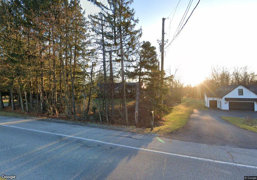
7230 Carlisle Rd Dover, PA 17315
Warrington Township NeighborhoodEstimated Value: $328,000 - $505,901
3
Beds
3
Baths
1,946
Sq Ft
$218/Sq Ft
Est. Value
About This Home
This home is located at 7230 Carlisle Rd, Dover, PA 17315 and is currently estimated at $424,475, approximately $218 per square foot. 7230 Carlisle Rd is a home with nearby schools including Northern Middle School, Northern High School, and Lighthouse Christian School.
Ownership History
Date
Name
Owned For
Owner Type
Purchase Details
Closed on
Jul 29, 2020
Sold by
Burkey Donald W and Burkey Beverly J
Bought by
Ray Nathan J and Ray Lori A
Current Estimated Value
Home Financials for this Owner
Home Financials are based on the most recent Mortgage that was taken out on this home.
Original Mortgage
$68,400
Outstanding Balance
$60,788
Interest Rate
3.1%
Mortgage Type
Future Advance Clause Open End Mortgage
Estimated Equity
$363,687
Create a Home Valuation Report for This Property
The Home Valuation Report is an in-depth analysis detailing your home's value as well as a comparison with similar homes in the area
Home Values in the Area
Average Home Value in this Area
Purchase History
| Date | Buyer | Sale Price | Title Company |
|---|---|---|---|
| Ray Nathan J | -- | White Rose Setmnt Svcs Inc |
Source: Public Records
Mortgage History
| Date | Status | Borrower | Loan Amount |
|---|---|---|---|
| Open | Ray Nathan J | $68,400 |
Source: Public Records
Tax History Compared to Growth
Tax History
| Year | Tax Paid | Tax Assessment Tax Assessment Total Assessment is a certain percentage of the fair market value that is determined by local assessors to be the total taxable value of land and additions on the property. | Land | Improvement |
|---|---|---|---|---|
| 2025 | $7,078 | $259,820 | $46,720 | $213,100 |
| 2024 | $7,001 | $259,820 | $46,720 | $213,100 |
| 2023 | $970 | $36,720 | $36,720 | $0 |
| 2022 | $949 | $36,720 | $36,720 | $0 |
| 2021 | $887 | $36,720 | $36,720 | $0 |
| 2020 | $866 | $36,720 | $36,720 | $0 |
| 2019 | $39 | $1,680 | $1,680 | $0 |
| 2018 | $38 | $1,680 | $1,680 | $0 |
| 2017 | $38 | $1,680 | $1,680 | $0 |
| 2016 | $0 | $1,680 | $1,680 | $0 |
| 2015 | -- | $1,530 | $1,530 | $0 |
| 2014 | -- | $1,390 | $1,390 | $0 |
Source: Public Records
Map
Nearby Homes
- 0 W Camping Area Rd
- 540 Zeigler Rd
- 810 Zeigler Rd
- Tract #1 Carlisle Rd
- 6200 Old Carlisle Rd
- 8395 Carlisle Rd
- 270 S Winding Rd
- 6031 Mountain Rd
- 5790 Carlisle Rd
- 5840 Old Carlisle Rd
- 2530 Sky Top Trail
- 5790 Mountain Rd
- 480 Mount Airy Rd Unit 13
- 45 Honey Rd
- 2895 Blackberry Rd
- 329 Mount Airy Rd
- 1735 Temple School Rd
- 1967 Pinetown Rd
- 450 Stone Jug Rd
- 1500 Ridge Rd
- 7250 Carlisle Rd
- 260 Big Rock Dr
- 280 Big Rock Dr
- 66 Big Mt Rd
- 290 Big Rock Dr
- 71 Big Mount Rd
- 71 Big Mt Rd
- 7215 Carlisle Rd
- 7220 Carlisle Rd
- 265 Big Rock Dr
- 245 Big Rock Dr
- 7190 Carlisle Rd
- Lot 10 Popcorn Ln
- 129 Big Mt Rd
- 435 W Camping Area Rd
- 7280 Carlisle Rd
- 0 Big Rock Dr
- 7290 Carlisle Rd
- 655 E Camping Area Rd
- 156 Big Mt Rd
