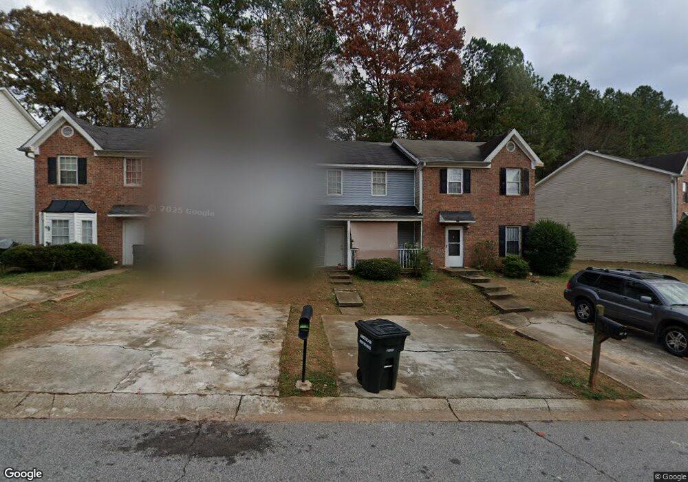
7231 Crestside Dr Unit 7231 Austell, GA 30168
Estimated Value: $144,451 - $191,000
3
Beds
3
Baths
1,200
Sq Ft
$134/Sq Ft
Est. Value
About This Home
This home is located at 7231 Crestside Dr Unit 7231, Austell, GA 30168 and is currently estimated at $160,363, approximately $133 per square foot. 7231 Crestside Dr Unit 7231 is a home located in Cobb County with nearby schools including Bryant Elementary School, Lindley Middle School, and Pebblebrook High School.
Ownership History
Date
Name
Owned For
Owner Type
Purchase Details
Closed on
Mar 28, 2007
Sold by
Deutsche Bk Natl Trust
Bought by
Myers Dougal R
Current Estimated Value
Home Financials for this Owner
Home Financials are based on the most recent Mortgage that was taken out on this home.
Original Mortgage
$40,000
Outstanding Balance
$23,702
Interest Rate
6.15%
Mortgage Type
New Conventional
Estimated Equity
$136,661
Purchase Details
Closed on
May 31, 2005
Sold by
Anderson Lawrence E and Anderson Bonnie
Bought by
Ward Charles and Ward Cheryle
Home Financials for this Owner
Home Financials are based on the most recent Mortgage that was taken out on this home.
Original Mortgage
$100,800
Interest Rate
8.88%
Mortgage Type
New Conventional
Purchase Details
Closed on
Jul 31, 2000
Sold by
London Barnett W
Bought by
Anderson Lawrence E and Anderson Bonnie B
Home Financials for this Owner
Home Financials are based on the most recent Mortgage that was taken out on this home.
Original Mortgage
$63,000
Interest Rate
8.23%
Mortgage Type
New Conventional
Create a Home Valuation Report for This Property
The Home Valuation Report is an in-depth analysis detailing your home's value as well as a comparison with similar homes in the area
Home Values in the Area
Average Home Value in this Area
Purchase History
| Date | Buyer | Sale Price | Title Company |
|---|---|---|---|
| Myers Dougal R | $50,000 | -- | |
| Ward Charles | $112,000 | -- | |
| Anderson Lawrence E | $70,000 | -- |
Source: Public Records
Mortgage History
| Date | Status | Borrower | Loan Amount |
|---|---|---|---|
| Open | Myers Dougal R | $40,000 | |
| Previous Owner | Ward Charles | $100,800 | |
| Previous Owner | Anderson Lawrence E | $63,000 |
Source: Public Records
Tax History
| Year | Tax Paid | Tax Assessment Tax Assessment Total Assessment is a certain percentage of the fair market value that is determined by local assessors to be the total taxable value of land and additions on the property. | Land | Improvement |
|---|---|---|---|---|
| 2025 | $1,436 | $47,644 | $11,200 | $36,444 |
| 2024 | $1,720 | $57,048 | $11,200 | $45,848 |
| 2023 | $1,390 | $46,108 | $6,000 | $40,108 |
Source: Public Records
Map
Nearby Homes
- 7238 Crestside Dr Unit 79
- 7224 Crestside Dr Unit 1
- 776 Crestside Ct
- 6964 Chasewater Ln
- 7244 Rockhouse Rd Unit 7
- 1173 Summerstone Trace
- 760 Wade Farm Dr
- 7254 Silverton Trail
- 1273 Summerstone Trace
- 1195 Park Center Cir
- 1194 Park Center Cir
- 1190 Park Center Cir
- 1090 Blair Bridge Rd
- 1163 Park Center Cir
- 0 Hembree Ln Unit 10633605
- 00 Hembree Ln
- 6938 Oakhill Cir
- 1329 Ling Dr
- 7080 Fringe Flower Dr Unit 18
- 6794 Hembree Dr
- 7231 Crestside Dr Unit 1
- 7229 Crestside Dr
- 7229 Crestside Dr Unit 7229
- 7233 Crestside Dr
- 7227 Crestside Dr
- 7227 Crestside Dr Unit 7227
- 7237 Crestside Dr
- 7275 Crestside Dr Unit 60
- 7240 Crestside Dr
- 7275 Crestside Dr
- 7225 Crestside Dr Unit 1
- 7239 Crestside Dr
- 7239 Crestside Dr Unit 7239
- 7223 Crestside Dr
- 7223 Crestside Dr Unit 7223
- 7241 Crestside Dr
- 759 Crestside Ct
- 761 Crestside Ct
- 764 Crestside Ct
- 764 Crestside Ct Unit 757
Your Personal Tour Guide
Ask me questions while you tour the home.