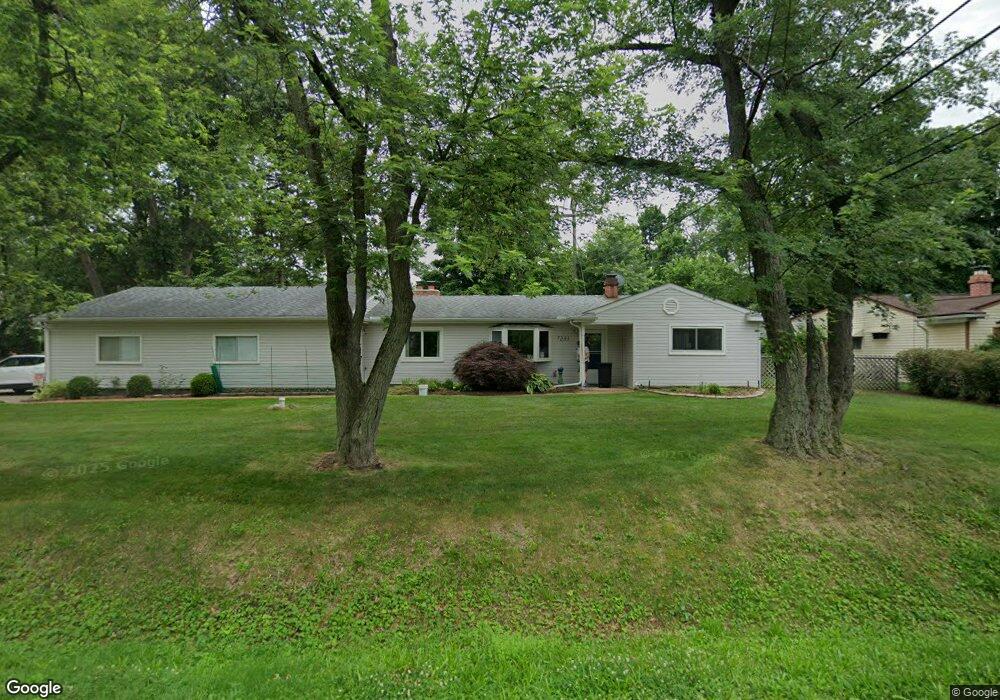
7231 Richardson Rd Unit Bldg-Unit West Bloomfield, MI 48323
Estimated Value: $254,000 - $292,000
2
Beds
2
Baths
1,118
Sq Ft
$246/Sq Ft
Est. Value
About This Home
This home is located at 7231 Richardson Rd Unit Bldg-Unit, West Bloomfield, MI 48323 and is currently estimated at $274,600, approximately $245 per square foot. 7231 Richardson Rd Unit Bldg-Unit is a home located in Oakland County with nearby schools including Walled Lake Central High School and St. Matthew Lutheran School.
Ownership History
Date
Name
Owned For
Owner Type
Purchase Details
Closed on
Jan 6, 2020
Sold by
Fried Russell and Fried Tamara
Bought by
Hill Michael and Hill Martha
Current Estimated Value
Home Financials for this Owner
Home Financials are based on the most recent Mortgage that was taken out on this home.
Original Mortgage
$70,100
Outstanding Balance
$61,936
Interest Rate
3.6%
Mortgage Type
New Conventional
Estimated Equity
$212,664
Purchase Details
Closed on
Apr 30, 2018
Sold by
Palm Matthew S
Bought by
Fried Russell and Fried Tamara
Purchase Details
Closed on
Nov 24, 2014
Sold by
Slawek James H and Slawek Nicole C
Bought by
Palm Matthew S
Home Financials for this Owner
Home Financials are based on the most recent Mortgage that was taken out on this home.
Original Mortgage
$119,790
Interest Rate
3.62%
Mortgage Type
FHA
Purchase Details
Closed on
Mar 26, 2004
Sold by
Vlisides Elias S and Flanigan Leah K
Bought by
Slawek James H and Krug Nicole C
Home Financials for this Owner
Home Financials are based on the most recent Mortgage that was taken out on this home.
Original Mortgage
$141,876
Interest Rate
5.85%
Mortgage Type
FHA
Purchase Details
Closed on
Jan 23, 2003
Sold by
Vlisides Elias S and Vlisides Becky H
Bought by
Becky Vlisides Elias S and Becky Vlides H
Purchase Details
Closed on
May 30, 1997
Sold by
Vlisides Elias S
Bought by
Vlisides Elias S
Home Financials for this Owner
Home Financials are based on the most recent Mortgage that was taken out on this home.
Original Mortgage
$69,000
Interest Rate
8%
Purchase Details
Closed on
Sep 30, 1994
Sold by
Strine Eugene H
Bought by
Vlisides Elias S and Vlisides Becky
Home Financials for this Owner
Home Financials are based on the most recent Mortgage that was taken out on this home.
Original Mortgage
$69,200
Interest Rate
6%
Create a Home Valuation Report for This Property
The Home Valuation Report is an in-depth analysis detailing your home's value as well as a comparison with similar homes in the area
Home Values in the Area
Average Home Value in this Area
Purchase History
| Date | Buyer | Sale Price | Title Company |
|---|---|---|---|
| Hill Michael | $173,000 | Liberty Title | |
| Fried Russell | $162,000 | None Available | |
| Palm Matthew S | $122,000 | Capital Title Ins Agency | |
| Slawek James H | $143,000 | Devon Title Agency | |
| Becky Vlisides Elias S | -- | Title One Inc | |
| Vlisides Elias S | -- | -- | |
| Vlisides Elias S | $86,500 | -- |
Source: Public Records
Mortgage History
| Date | Status | Borrower | Loan Amount |
|---|---|---|---|
| Open | Hill Michael | $70,100 | |
| Previous Owner | Palm Matthew S | $119,790 | |
| Previous Owner | Slawek James H | $141,876 | |
| Previous Owner | Vlisides Elias S | $69,000 | |
| Previous Owner | Vlisides Elias S | $69,200 |
Source: Public Records
Tax History Compared to Growth
Tax History
| Year | Tax Paid | Tax Assessment Tax Assessment Total Assessment is a certain percentage of the fair market value that is determined by local assessors to be the total taxable value of land and additions on the property. | Land | Improvement |
|---|---|---|---|---|
| 2024 | $2,143 | $111,850 | $0 | $0 |
| 2022 | $2,020 | $90,050 | $33,510 | $56,540 |
| 2021 | $4,286 | $81,990 | $0 | $0 |
| 2020 | $1,589 | $80,930 | $33,510 | $47,420 |
| 2018 | $2,001 | $70,790 | $29,000 | $41,790 |
| 2015 | -- | $54,780 | $0 | $0 |
| 2014 | -- | $50,650 | $0 | $0 |
| 2011 | -- | $44,410 | $0 | $0 |
Source: Public Records
Map
Nearby Homes
- 4245 Bunker Ave
- 4212 Greendale Ave
- 7337 Richardson Rd
- 4335 Crestdale Ave
- 6978 Colony Dr
- 7381 Crestmore St
- 6903 Dandison Blvd
- 3991 Fieldview Ave
- 4442 Borland St
- 3965 Carrick Ave
- 4066 Green Lake Rd
- 0000 Langtoft
- 6980 Hambro St
- 3950 Bradmore Ave
- 7359 Woodlore Dr
- 6675 Langtoft St
- 6768 Buckland Ave
- 3632 Fieldview Ave
- 7369 Sweetbriar
- 4540 Rolling Pine Ct
- 7231 Richardson Rd
- 7241 Richardson Rd Unit Bldg-Unit
- 4220 Bunker Ave
- 4223 Forbush Ave
- 7175 Richardson Rd
- 4240 Bunker Ave
- 7220 Richardson Rd
- 7242 Richardson Rd
- 4260 Bunker Ave
- 4171 Bunker Ave
- 4263 Forbush Ave
- 4174 Bunker Ave
- 4163 Forbush Ave
- 4234 Crestdale Ave
- 4254 Crestdale Ave
- 7165 Richardson Rd
- 7252 Richardson Rd
- 4240 Crestdale Ave Unit Bldg-Unit
- 4240 Crestdale Ave
- 4170 Crestdale Ave