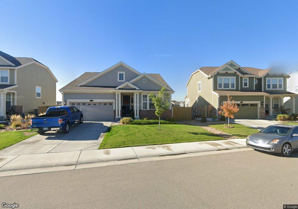
7232 E 133rd Cir Thornton, CO 80602
Estimated Value: $626,825 - $691,000
3
Beds
3
Baths
1,774
Sq Ft
$373/Sq Ft
Est. Value
About This Home
This home is located at 7232 E 133rd Cir, Thornton, CO 80602 and is currently estimated at $661,706, approximately $373 per square foot. 7232 E 133rd Cir is a home with nearby schools including West Ridge Elementary School, Rodger Quist Middle School, and Riverdale Ridge High School.
Ownership History
Date
Name
Owned For
Owner Type
Purchase Details
Closed on
Dec 30, 2020
Sold by
Bradburn Northern Associates Llc
Bought by
Urban Land Conservancy
Current Estimated Value
Purchase Details
Closed on
Mar 16, 2016
Sold by
Lennar Colorado Llc
Bought by
Cooper John James and Cooper Kim Lavette
Home Financials for this Owner
Home Financials are based on the most recent Mortgage that was taken out on this home.
Original Mortgage
$412,883
Interest Rate
3.62%
Mortgage Type
FHA
Create a Home Valuation Report for This Property
The Home Valuation Report is an in-depth analysis detailing your home's value as well as a comparison with similar homes in the area
Purchase History
| Date | Buyer | Sale Price | Title Company |
|---|---|---|---|
| Urban Land Conservancy | -- | Land Title Guarantee Co | |
| Cooper John James | $420,500 | North American Title |
Source: Public Records
Mortgage History
| Date | Status | Borrower | Loan Amount |
|---|---|---|---|
| Previous Owner | Cooper John James | $412,883 |
Source: Public Records
Tax History
| Year | Tax Paid | Tax Assessment Tax Assessment Total Assessment is a certain percentage of the fair market value that is determined by local assessors to be the total taxable value of land and additions on the property. | Land | Improvement |
|---|---|---|---|---|
| 2025 | $7,496 | $45,630 | $8,500 | $37,130 |
| 2024 | $7,496 | $41,940 | $7,810 | $34,130 |
| 2023 | $7,407 | $47,080 | $7,440 | $39,640 |
| 2022 | $6,017 | $34,860 | $6,600 | $28,260 |
| 2021 | $5,855 | $34,860 | $6,600 | $28,260 |
| 2020 | $5,745 | $35,160 | $6,790 | $28,370 |
| 2019 | $5,861 | $35,160 | $6,790 | $28,370 |
| 2018 | $4,600 | $28,280 | $6,840 | $21,440 |
| 2017 | $4,597 | $28,280 | $6,840 | $21,440 |
| 2016 | $184 | $1,220 | $1,220 | $0 |
| 2015 | $184 | $1,220 | $1,220 | $0 |
| 2014 | $2 | $10 | $10 | $0 |
Source: Public Records
Map
Nearby Homes
- 13336 Olive St
- 13380 Oneida St
- 6883 E 132nd Place
- 12901 Spruce St
- 12891 Spruce St
- 13022 Tamarac Place
- 8194 E 132nd Place
- 13200 Uinta St
- 12814 Newport Way
- 13455 Magnolia Ct
- 8222 E 129th Place
- 13407 Valentia St
- 8055 E 128th Place
- 7875 E 136th Dr
- 13190 Kearney St
- 12735 Ulster St
- 12729 Ulster St
- 12754 Leyden St Unit E
- 8386 E 132nd Dr
- 12774 Leyden St Unit D
- 7222 E 133rd Cir
- 7252 E 133rd Cir
- 7212 E 133rd Cir
- 7212 E 133rd Cir
- 13250 Olive Way
- 7225 E 133rd Cir
- 7235 E 133rd Cir
- 7215 E 133rd Cir
- 7202 E 133rd Cir
- 7262 E 133rd Cir
- 13334 Olive Way
- 7272 E 133 Rd Cir
- 7205 E 133rd Cir
- 7245 E 133rd Cir
- 7255 E 133rd Cir
- 13346 Olive Way
- 13350 Olive Way
- 13240 Olive Way
- 7202 E 132nd Ave
- 7228 E 132nd Ave
Your Personal Tour Guide
Ask me questions while you tour the home.