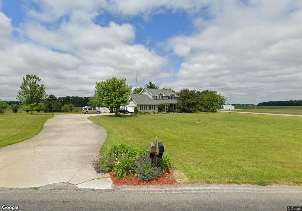
7235 Hellwarth Rd Celina, OH 45822
Estimated Value: $321,000 - $411,000
3
Beds
3
Baths
2,192
Sq Ft
$175/Sq Ft
Est. Value
About This Home
This home is located at 7235 Hellwarth Rd, Celina, OH 45822 and is currently estimated at $383,576, approximately $174 per square foot. 7235 Hellwarth Rd is a home located in Mercer County with nearby schools including Celina Middle School, Celina High School, and Immaculate Conception School.
Ownership History
Date
Name
Owned For
Owner Type
Purchase Details
Closed on
Feb 19, 2005
Sold by
Phillips Lindsey
Bought by
Avers John A and Rose Avers E
Current Estimated Value
Home Financials for this Owner
Home Financials are based on the most recent Mortgage that was taken out on this home.
Original Mortgage
$125,000
Outstanding Balance
$61,183
Interest Rate
5.7%
Mortgage Type
New Conventional
Estimated Equity
$322,393
Create a Home Valuation Report for This Property
The Home Valuation Report is an in-depth analysis detailing your home's value as well as a comparison with similar homes in the area
Home Values in the Area
Average Home Value in this Area
Purchase History
| Date | Buyer | Sale Price | Title Company |
|---|---|---|---|
| Avers John A | $175,000 | None Available |
Source: Public Records
Mortgage History
| Date | Status | Borrower | Loan Amount |
|---|---|---|---|
| Open | Avers John A | $125,000 |
Source: Public Records
Tax History
| Year | Tax Paid | Tax Assessment Tax Assessment Total Assessment is a certain percentage of the fair market value that is determined by local assessors to be the total taxable value of land and additions on the property. | Land | Improvement |
|---|---|---|---|---|
| 2025 | $4,265 | $107,660 | $11,970 | $95,690 |
| 2024 | $4,273 | $107,660 | $11,970 | $95,690 |
| 2023 | $4,265 | $107,660 | $11,970 | $95,690 |
| 2022 | $3,577 | $78,230 | $10,120 | $68,110 |
| 2021 | $3,586 | $78,230 | $10,120 | $68,110 |
| 2020 | $1,533 | $78,230 | $10,120 | $68,110 |
| 2019 | $2,651 | $63,040 | $8,300 | $54,740 |
| 2018 | $2,754 | $63,040 | $8,300 | $54,740 |
| 2017 | $2,650 | $63,040 | $8,300 | $54,740 |
| 2016 | $2,564 | $59,680 | $8,370 | $51,310 |
| 2015 | $2,493 | $59,680 | $8,370 | $51,310 |
| 2014 | $2,499 | $59,680 | $8,370 | $51,310 |
| 2013 | $2,490 | $55,720 | $7,770 | $47,950 |
Source: Public Records
Map
Nearby Homes
- 4295 William Ave
- 6764 Silver Lakes Dr
- 0 Anderson 13&14 & Roadway 12&13 Unit 1044236
- 0 Springer 1-6 & Roadway 14-16 Unit 1044131
- 0 Anderson Lots 10 11 & 12 Ln Unit 1044138
- 0 Harbor Lots 26 27 & 38 Dr Unit 1044287
- 0 Harbor Lots 24 & 25 Dr Unit 1044267
- 1312 Michael Ave
- 116 S Elm St
- 1001 N Sugar St
- 908 N Sugar St
- 906 N Sugar St
- 905 N Walnut St
- 115 Touvelle St
- 680 N Main St
- 120 E Blake St
- 206 Magnolia St
- 609 N Cherry St
- 308 Dogwood Dr
- 316 Dogwood Dr
- 4460 Fairground Rd
- 7207 Hellwarth Rd
- 7238 Hellwarth Rd
- 4515 Fairground Rd
- 4440 Fairground Rd
- 7227 Hellwarth Rd
- 4536 Fairground Rd
- 4531 Fairground Rd
- 7278 Hellwarth Rd
- 7169 Hellwarth Rd
- 7176 Hellwarth Rd
- 4429 Fairground Rd
- 4552 Fairground Rd
- 7143 Hellwarth Rd
- 7144 Hellwarth Rd
- 7184 Hellwarth Rd
- 4382 Fairground Rd
- 7130 Hellwarth Rd
- 4581 Fairground Rd
- 4610 Fairground Rd
Your Personal Tour Guide
Ask me questions while you tour the home.