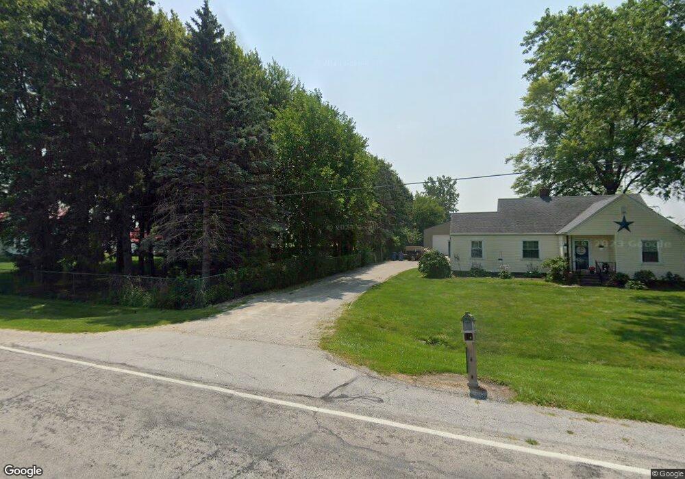
7236 Cedar Point Rd Oregon, OH 43616
Estimated Value: $228,000 - $267,000
3
Beds
1
Bath
1,864
Sq Ft
$131/Sq Ft
Est. Value
About This Home
This home is located at 7236 Cedar Point Rd, Oregon, OH 43616 and is currently estimated at $244,906, approximately $131 per square foot. 7236 Cedar Point Rd is a home located in Lucas County.
Ownership History
Date
Name
Owned For
Owner Type
Purchase Details
Closed on
Apr 25, 2014
Sold by
Howard Gerald R and Howard Karen L
Bought by
Halka Brian and Halka Luann
Current Estimated Value
Home Financials for this Owner
Home Financials are based on the most recent Mortgage that was taken out on this home.
Original Mortgage
$87,387
Outstanding Balance
$65,616
Interest Rate
4.25%
Mortgage Type
FHA
Estimated Equity
$179,290
Purchase Details
Closed on
Sep 2, 2011
Sold by
Vericrest Financial Inc
Bought by
Howard Gerald R and Howard Karen L
Purchase Details
Closed on
Feb 7, 2011
Sold by
Villarreal Frank M and Villarreal Cynthia R
Bought by
Vericrest Financial Inc and Vericrest Opportunity Loan Trust 2010-Np
Purchase Details
Closed on
May 31, 2005
Sold by
Peters William E and Peters Linda L A
Bought by
Villarreal Frank M and Villarreal Cynthia R
Home Financials for this Owner
Home Financials are based on the most recent Mortgage that was taken out on this home.
Original Mortgage
$105,000
Interest Rate
5.82%
Mortgage Type
Fannie Mae Freddie Mac
Create a Home Valuation Report for This Property
The Home Valuation Report is an in-depth analysis detailing your home's value as well as a comparison with similar homes in the area
Purchase History
| Date | Buyer | Sale Price | Title Company |
|---|---|---|---|
| Halka Brian | $89,000 | None Available | |
| Howard Gerald R | $87,500 | Attorney | |
| Vericrest Financial Inc | $76,667 | None Available | |
| Villarreal Frank M | $140,000 | Louisville Title Agency For |
Source: Public Records
Mortgage History
| Date | Status | Borrower | Loan Amount |
|---|---|---|---|
| Open | Halka Brian | $87,387 | |
| Previous Owner | Villarreal Frank M | $105,000 |
Source: Public Records
Tax History
| Year | Tax Paid | Tax Assessment Tax Assessment Total Assessment is a certain percentage of the fair market value that is determined by local assessors to be the total taxable value of land and additions on the property. | Land | Improvement |
|---|---|---|---|---|
| 2025 | -- | $72,100 | $9,695 | $62,405 |
| 2024 | $1,974 | $72,100 | $9,695 | $62,405 |
| 2023 | $4,099 | $62,440 | $3,570 | $58,870 |
| 2022 | $4,090 | $62,440 | $3,570 | $58,870 |
| 2021 | $4,113 | $62,440 | $3,570 | $58,870 |
| 2020 | $3,701 | $51,275 | $2,975 | $48,300 |
| 2019 | $3,531 | $51,275 | $2,975 | $48,300 |
| 2018 | $3,040 | $51,275 | $2,975 | $48,300 |
| 2017 | $3,013 | $41,370 | $1,365 | $40,005 |
| 2016 | $2,578 | $102,400 | $3,900 | $98,500 |
| 2015 | $2,563 | $102,400 | $3,900 | $98,500 |
| 2014 | $2,378 | $35,850 | $1,370 | $34,480 |
| 2013 | $2,378 | $35,850 | $1,370 | $34,480 |
Source: Public Records
Map
Nearby Homes
- 1031 N Cousino Rd
- 8246 Cedar Point Rd
- 6028 Bayshore Rd
- 1944 Ashcroft Dr
- 1561 N Stadium Rd
- 5914 Kacy Ln
- 5882 Kacy Ln
- 455 Cody
- 454 Cody Dr
- 5560 Eagles Landing Dr
- 5524 Eagles Landing Dr
- 5281 Eagles Landing Dr
- 5313 Eagles Landing Dr
- 5548 Eagles Landing Dr
- 5514 Eagles Landing Dr
- 7330 Jerusalem Rd
- 9015 Seaman Rd
- 5415 Seaman Rd
- 1536 N Wynn Rd
- 2046 Duchesse Dr
- 7228 Cedar Point Rd
- 7250 Cedar Point Rd
- 7310 Cedar Point Rd
- 7314 Cedar Point Rd
- 1101 N North Curtice Rd
- 7520 Cedar Point Rd
- 7535 Cedar Point Rd
- 7600 Cedar Point Rd
- 7538 Cedar Point Rd
- 7602 Cedar Point Rd
- 6850 Cedar Point Rd
- 24330 N Curtice Rd
- 6802 Cedar Point Rd
- 7608 Cedar Point Rd
- 6752 Cedar Point Rd
- 750 N North Curtice Rd
- 730 N North Curtice Rd
- 730 N Curtice Rd
- 7701 Cedar Point Rd
- 700 N North Curtice Rd
Your Personal Tour Guide
Ask me questions while you tour the home.