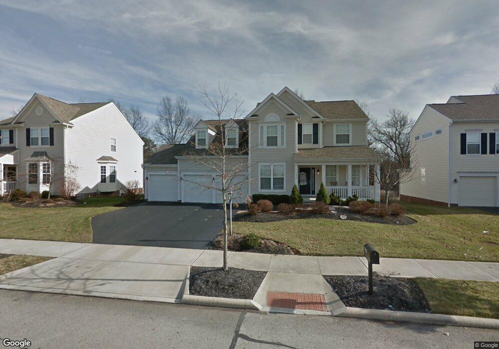
7238 Upper Clarenton Dr S New Albany, OH 43054
Estimated Value: $741,367 - $806,000
4
Beds
3
Baths
3,042
Sq Ft
$251/Sq Ft
Est. Value
About This Home
This home is located at 7238 Upper Clarenton Dr S, New Albany, OH 43054 and is currently estimated at $764,092, approximately $251 per square foot. 7238 Upper Clarenton Dr S is a home with nearby schools including New Albany Primary School, New Albany Intermediate School, and New Albany Middle School.
Ownership History
Date
Name
Owned For
Owner Type
Purchase Details
Closed on
Nov 23, 2009
Sold by
M/I Homes Of Central Ohio Llc
Bought by
Jackson Scotty B and Jackson Carol S
Current Estimated Value
Home Financials for this Owner
Home Financials are based on the most recent Mortgage that was taken out on this home.
Original Mortgage
$312,300
Outstanding Balance
$203,398
Interest Rate
4.95%
Mortgage Type
VA
Estimated Equity
$560,694
Create a Home Valuation Report for This Property
The Home Valuation Report is an in-depth analysis detailing your home's value as well as a comparison with similar homes in the area
Home Values in the Area
Average Home Value in this Area
Purchase History
| Date | Buyer | Sale Price | Title Company |
|---|---|---|---|
| Jackson Scotty B | $347,100 | Transohio |
Source: Public Records
Mortgage History
| Date | Status | Borrower | Loan Amount |
|---|---|---|---|
| Open | Jackson Scotty B | $312,300 |
Source: Public Records
Tax History Compared to Growth
Tax History
| Year | Tax Paid | Tax Assessment Tax Assessment Total Assessment is a certain percentage of the fair market value that is determined by local assessors to be the total taxable value of land and additions on the property. | Land | Improvement |
|---|---|---|---|---|
| 2024 | $13,291 | $213,640 | $45,500 | $168,140 |
| 2023 | $12,596 | $213,640 | $45,500 | $168,140 |
| 2022 | $13,223 | $170,870 | $40,250 | $130,620 |
| 2021 | $12,726 | $170,870 | $40,250 | $130,620 |
| 2020 | $12,664 | $170,870 | $40,250 | $130,620 |
| 2019 | $12,087 | $148,580 | $35,000 | $113,580 |
| 2018 | $10,737 | $148,580 | $35,000 | $113,580 |
| 2017 | $10,752 | $148,580 | $35,000 | $113,580 |
| 2016 | $9,512 | $107,770 | $28,810 | $78,960 |
| 2015 | $9,099 | $107,770 | $28,810 | $78,960 |
| 2014 | $8,935 | $107,770 | $28,810 | $78,960 |
| 2013 | $347 | $2,730 | $2,730 | $0 |
Source: Public Records
Map
Nearby Homes
- 7125 Longfield Ct
- 7301 Wood Edge Ln
- 7090 Dean Farm Rd
- 7385 Wood Edge Ln
- 7361 Wood Edge Ln
- 8600 Steeple Wood Dr
- 6879 E Walnut St
- 7075 Maynard Place
- 7477 New Albany Links Dr
- 5685 Jersey Dr
- 7072 Maynard Place E
- 0 Luna Unit Lot 10 225003340
- 0 Luna Unit Lot 9 225003339
- 0 Moonstone Unit Lot 12 225003342
- 0 Moonstone Unit Lot 11 225003341
- 0 Moonstone Unit Lot 5 225003337
- 0 Moonstone Unit LOT 4 225003335
- 0 Moonstone Unit LOT 3 225003334
- 0 Moonstone Unit LOT 2 225003333
- 0 Moonstone Unit LOT 1 225003332
- 7228 Upper Clarenton Dr S
- 7248 Upper Clarenton Dr S
- 7258 Upper Clarenton Dr S
- 7218 Upper Clarenton Dr S
- 7235 Upper Clarenton Dr S
- 8442 Galdino Dr
- 7205 Upper Clarenton Dr S
- 7268 Upper Clarenton Dr S
- 8432 Galdino Dr
- 8431 Galdino Dr
- 7198 Upper Clarenton Dr S
- Lot 9 Longfield Ct
- 7278 Upper Clarenton Dr S
- 8443 Kiernan Dr
- 7185 Upper Clarenton Dr S
- Lot 8 Longfield Ct
- 8422 Galdino Dr
- 8421 Galdino Dr
- 8421 Galdino Dr Unit 43
- 7188 Upper Clarenton Dr S