Estimated Value: $560,000 - $657,000
2
Beds
2
Baths
2,200
Sq Ft
$267/Sq Ft
Est. Value
About This Home
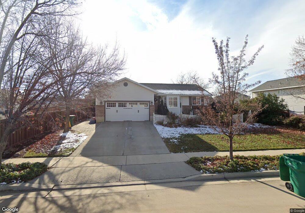
This home is located at 724 Airport Dr, Lehi, UT 84043 and is currently estimated at $587,197, approximately $266 per square foot. 724 Airport Dr is a home located in Utah County with nearby schools including Sego Lily Elementary School, Lehi Junior High School, and Skyridge High School.
Ownership History
Date
Name
Owned For
Owner Type
Purchase Details
Closed on
Jul 9, 2025
Sold by
Struthers Kim C and Struthers Geanie Michele
Bought by
Dalley Alexander and Dalley Rachel
Current Estimated Value
Home Financials for this Owner
Home Financials are based on the most recent Mortgage that was taken out on this home.
Original Mortgage
$480,250
Outstanding Balance
$479,443
Interest Rate
6.89%
Mortgage Type
New Conventional
Estimated Equity
$107,754
Purchase Details
Closed on
Sep 26, 2001
Sold by
Struthers Kim C and Struthers Michele
Bought by
Struthers Kim C and Struthers Geanie Michele
Home Financials for this Owner
Home Financials are based on the most recent Mortgage that was taken out on this home.
Original Mortgage
$123,000
Interest Rate
6.91%
Purchase Details
Closed on
Mar 24, 2000
Sold by
Peterson Steven L and Peterson Neila
Bought by
Struthers Kim C and Struthers Michele
Home Financials for this Owner
Home Financials are based on the most recent Mortgage that was taken out on this home.
Original Mortgage
$132,925
Interest Rate
8.34%
Mortgage Type
FHA
Purchase Details
Closed on
Sep 12, 1997
Sold by
Moore Todd S and Moore Kristen
Bought by
Peterson Steven L and Peterson Neila
Create a Home Valuation Report for This Property
The Home Valuation Report is an in-depth analysis detailing your home's value as well as a comparison with similar homes in the area
Home Values in the Area
Average Home Value in this Area
Purchase History
| Date | Buyer | Sale Price | Title Company |
|---|---|---|---|
| Dalley Alexander | -- | Gt Title Services | |
| Struthers Kim C | -- | American Preferred Title | |
| Struthers Kim C | -- | Empire Land Title Company | |
| Peterson Steven L | -- | -- |
Source: Public Records
Mortgage History
| Date | Status | Borrower | Loan Amount |
|---|---|---|---|
| Open | Dalley Alexander | $480,250 | |
| Previous Owner | Struthers Kim C | $123,000 | |
| Previous Owner | Struthers Kim C | $132,925 |
Source: Public Records
Tax History Compared to Growth
Tax History
| Year | Tax Paid | Tax Assessment Tax Assessment Total Assessment is a certain percentage of the fair market value that is determined by local assessors to be the total taxable value of land and additions on the property. | Land | Improvement |
|---|---|---|---|---|
| 2025 | $2,099 | $274,175 | $208,900 | $289,600 |
| 2024 | $2,099 | $245,630 | $0 | $0 |
| 2023 | $1,951 | $247,940 | $0 | $0 |
| 2022 | $2,198 | $270,710 | $0 | $0 |
| 2021 | $1,957 | $364,400 | $120,900 | $243,500 |
| 2020 | $1,844 | $339,500 | $111,900 | $227,600 |
| 2019 | $1,619 | $309,800 | $111,900 | $197,900 |
| 2018 | $1,543 | $279,200 | $107,100 | $172,100 |
| 2017 | $1,483 | $142,670 | $0 | $0 |
| 2016 | $1,378 | $122,925 | $0 | $0 |
| 2015 | $1,371 | $116,105 | $0 | $0 |
| 2014 | $1,336 | $112,475 | $0 | $0 |
Source: Public Records
Map
Nearby Homes
- 859 E 2125 N
- 975 E 2125 N
- 2208 N 825 E
- 4333 N Baiken Ridge Dr Unit 1020
- 192 E 2200 N
- 1295 N 190 E
- 1329 N 100 E Unit 21
- 2159 N Banbury Ct
- 2539 N 300 E
- 1175 E 900 N
- 1755 N 250 W
- 832 N Somerset Alley
- 1150 N 200 W Unit 6
- 735 N 1000 E
- 705 N 400 E
- 7 E State St
- 68 W State St
- 155 W State St Unit TRLR 3
- 975 E 2850 N
- 9435 N Aspen Hollow Cir
- 706 Airport Dr
- 706 E Airport Dr
- 1799 N 750 E
- 717 E 1775 N
- 743 Airport Dr
- 1787 N 750 E
- 725 Airport Dr
- 688 E Airport Dr
- 688 E Airport Dr Unit 245
- 705 Airport Dr
- 688 Airport Dr
- 725 E Airport Dr
- 743 E Airport Dr
- 672 Airport Dr
- 672 E Airport Dr
- 759 E Airport Dr
- 762 E Airport Dr
- 1790 N 750 E
- 685 Airport Dr
- 880 Airport Dr