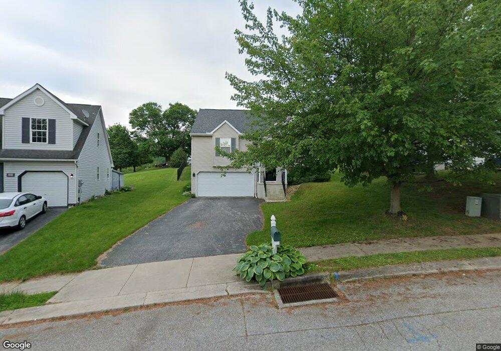
724 Blossom Hill Ln Dallastown, PA 17313
Estimated Value: $279,417 - $328,000
3
Beds
2
Baths
1,724
Sq Ft
$180/Sq Ft
Est. Value
About This Home
This home is located at 724 Blossom Hill Ln, Dallastown, PA 17313 and is currently estimated at $309,854, approximately $179 per square foot. 724 Blossom Hill Ln is a home located in York County with nearby schools including Ore Valley Elementary School, Dallastown Area Middle School, and Dallastown Area High School.
Ownership History
Date
Name
Owned For
Owner Type
Purchase Details
Closed on
Jun 30, 1999
Sold by
First Avalong Ltd Partnership
Bought by
Kirkwood Steven C and Kirkwood Roxanne M
Current Estimated Value
Home Financials for this Owner
Home Financials are based on the most recent Mortgage that was taken out on this home.
Original Mortgage
$114,800
Outstanding Balance
$31,217
Interest Rate
7.19%
Mortgage Type
FHA
Estimated Equity
$278,637
Purchase Details
Closed on
Jun 6, 1994
Bought by
First Avalong Limited Prtnrshp
Create a Home Valuation Report for This Property
The Home Valuation Report is an in-depth analysis detailing your home's value as well as a comparison with similar homes in the area
Home Values in the Area
Average Home Value in this Area
Purchase History
| Date | Buyer | Sale Price | Title Company |
|---|---|---|---|
| Kirkwood Steven C | $114,898 | -- | |
| First Avalong Limited Prtnrshp | $82,300 | -- |
Source: Public Records
Mortgage History
| Date | Status | Borrower | Loan Amount |
|---|---|---|---|
| Open | Kirkwood Steven C | $114,800 |
Source: Public Records
Tax History Compared to Growth
Tax History
| Year | Tax Paid | Tax Assessment Tax Assessment Total Assessment is a certain percentage of the fair market value that is determined by local assessors to be the total taxable value of land and additions on the property. | Land | Improvement |
|---|---|---|---|---|
| 2025 | $4,556 | $132,720 | $36,510 | $96,210 |
| 2024 | $4,489 | $132,720 | $36,510 | $96,210 |
| 2023 | $4,489 | $132,720 | $36,510 | $96,210 |
| 2022 | $4,343 | $132,720 | $36,510 | $96,210 |
| 2021 | $4,137 | $132,720 | $36,510 | $96,210 |
| 2020 | $4,137 | $132,720 | $36,510 | $96,210 |
| 2019 | $4,124 | $132,720 | $36,510 | $96,210 |
| 2018 | $4,096 | $132,720 | $36,510 | $96,210 |
| 2017 | $3,933 | $132,720 | $36,510 | $96,210 |
| 2016 | $0 | $132,720 | $36,510 | $96,210 |
| 2015 | -- | $132,720 | $36,510 | $96,210 |
| 2014 | -- | $132,720 | $36,510 | $96,210 |
Source: Public Records
Map
Nearby Homes
- 732 Blossom Hill Ln
- 428 W Main St
- 774 Blossom Hill Ln
- 355 W Main St
- 0 S Franklin St
- 2981 Sunset Dr
- 106 Teila Dr
- 74 S Main St
- 136 Teila Dr
- 64 S Pleasant Ave
- 122 S Pleasant Ave
- 424 Dartha Dr
- 435 Frederick Dr
- 125 Verna Dr
- 0 Gary Dr
- 2933 Exeter Dr S
- 246 Hudson Blvd
- 680 Hampstead Ct
- 234 Hudson Blvd
- 2925 Starfire Dr
- 728 Blossom Hill Ln
- 720 Blossom Hill Ln
- 716 Blossom Hill Ln
- 736 Blossom Hill Ln
- 399 W Chestnut St
- 709 Blossom Hill Ln
- 715 Blossom Hill Ln
- 708 Blossom Hill Ln
- 740 Blossom Hill Ln
- 721 Blossom Hill Ln
- 703 Blossom Hill Ln
- 407 W Broad St
- 393 W Chestnut St Unit 1
- 727 Blossom Hill Ln
- 704 Blossom Hill Ln
- 744 Blossom Hill Ln
- 389 W Chestnut St Unit 2
- 270 N Cedar St
- 409 W Broad St
- 385 W Chestnut St Unit 3