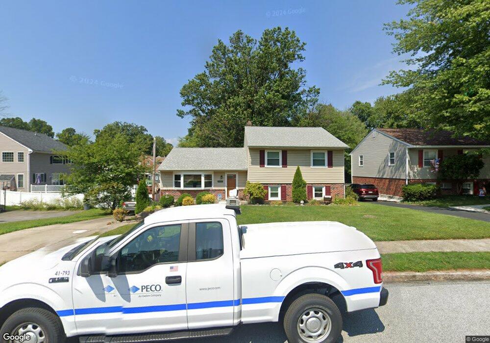
724 Evans Rd Springfield, PA 19064
Estimated Value: $516,318 - $671,000
3
Beds
3
Baths
2,056
Sq Ft
$275/Sq Ft
Est. Value
About This Home
This home is located at 724 Evans Rd, Springfield, PA 19064 and is currently estimated at $565,830, approximately $275 per square foot. 724 Evans Rd is a home located in Delaware County with nearby schools including Springfield High School, St Francis Of Assisi School, and Holy Cross School.
Ownership History
Date
Name
Owned For
Owner Type
Purchase Details
Closed on
Jun 30, 2008
Sold by
Grant Patricia A
Bought by
Ryan Brendan and Ryan Traci
Current Estimated Value
Home Financials for this Owner
Home Financials are based on the most recent Mortgage that was taken out on this home.
Original Mortgage
$292,500
Outstanding Balance
$186,003
Interest Rate
6.13%
Mortgage Type
Purchase Money Mortgage
Estimated Equity
$379,827
Create a Home Valuation Report for This Property
The Home Valuation Report is an in-depth analysis detailing your home's value as well as a comparison with similar homes in the area
Home Values in the Area
Average Home Value in this Area
Purchase History
| Date | Buyer | Sale Price | Title Company |
|---|---|---|---|
| Ryan Brendan | $325,000 | None Available |
Source: Public Records
Mortgage History
| Date | Status | Borrower | Loan Amount |
|---|---|---|---|
| Open | Ryan Brendan | $292,500 |
Source: Public Records
Tax History
| Year | Tax Paid | Tax Assessment Tax Assessment Total Assessment is a certain percentage of the fair market value that is determined by local assessors to be the total taxable value of land and additions on the property. | Land | Improvement |
|---|---|---|---|---|
| 2025 | $7,693 | $273,720 | $100,710 | $173,010 |
| 2024 | $7,693 | $273,720 | $100,710 | $173,010 |
| 2023 | $7,408 | $273,720 | $100,710 | $173,010 |
| 2022 | $7,248 | $273,720 | $100,710 | $173,010 |
| 2021 | $11,224 | $273,720 | $100,710 | $173,010 |
| 2020 | $6,566 | $144,910 | $48,420 | $96,490 |
| 2019 | $6,412 | $144,910 | $48,420 | $96,490 |
| 2018 | $6,320 | $144,910 | $0 | $0 |
| 2017 | $6,174 | $144,910 | $0 | $0 |
| 2016 | $795 | $144,910 | $0 | $0 |
| 2015 | $811 | $144,910 | $0 | $0 |
| 2014 | $795 | $144,910 | $0 | $0 |
Source: Public Records
Map
Nearby Homes
- 332 Franklin Ave
- 227 E Leamy Ave
- 114 Providence Rd
- 933 Greenbriar Ln
- 226 Lynbrooke Rd
- 364 S Rolling Rd
- 31 Wayfield Rd
- 493 Wheatsheaf Rd
- 978 Westfield Rd
- 173 Rambling Way
- 507 School St
- 838 West Ave
- 111 Broad St
- 111 Forest Rd
- 120 W Springfield Rd
- 514 Springview Ln
- 29 School Ln
- 202-203 Sycamore Ave
- 7 & 0 Woodland Ave
- 2 Yale Ave
- 720 Evans Rd
- 341 E Leamy Ave
- 339 E Leamy Ave
- 716 Evans Rd
- 337 E Leamy Ave
- 712 Evans Rd
- 269 Beechwood Rd
- 263 Beechwood Rd
- 401 E Leamy Ave
- 725 Evans Rd
- 721 Evans Rd
- 331 E Leamy Ave
- 717 Evans Rd
- 259 Beechwood Rd
- 405 E Leamy Ave
- 255 Beechwood Rd
- 609 Evans Rd
- 713 Evans Rd
- 327 E Leamy Ave
- 336 Franklin Ave
Your Personal Tour Guide
Ask me questions while you tour the home.