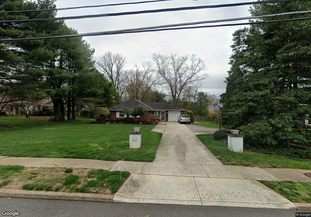
724 Kings Hwy Moorestown, NJ 08057
Estimated Value: $437,486 - $658,000
--
Bed
--
Bath
1,658
Sq Ft
$344/Sq Ft
Est. Value
About This Home
This home is located at 724 Kings Hwy, Moorestown, NJ 08057 and is currently estimated at $570,872, approximately $344 per square foot. 724 Kings Hwy is a home located in Burlington County with nearby schools including Mary E. Roberts Elementary School, Moorestown Upper Elementary School, and William Allen Middle School.
Ownership History
Date
Name
Owned For
Owner Type
Purchase Details
Closed on
Jun 23, 1992
Bought by
Donohue Richard
Current Estimated Value
Create a Home Valuation Report for This Property
The Home Valuation Report is an in-depth analysis detailing your home's value as well as a comparison with similar homes in the area
Home Values in the Area
Average Home Value in this Area
Purchase History
| Date | Buyer | Sale Price | Title Company |
|---|---|---|---|
| Donohue Richard | -- | -- |
Source: Public Records
Tax History Compared to Growth
Tax History
| Year | Tax Paid | Tax Assessment Tax Assessment Total Assessment is a certain percentage of the fair market value that is determined by local assessors to be the total taxable value of land and additions on the property. | Land | Improvement |
|---|---|---|---|---|
| 2025 | $7,419 | $261,500 | $162,000 | $99,500 |
| 2024 | $7,194 | $261,500 | $162,000 | $99,500 |
| 2023 | $7,194 | $261,500 | $162,000 | $99,500 |
| 2022 | $7,121 | $261,500 | $162,000 | $99,500 |
| 2021 | $6,452 | $261,500 | $162,000 | $99,500 |
| 2020 | $6,982 | $261,500 | $162,000 | $99,500 |
| 2019 | $6,859 | $261,500 | $162,000 | $99,500 |
| 2018 | $6,673 | $261,500 | $162,000 | $99,500 |
| 2017 | $6,731 | $261,500 | $162,000 | $99,500 |
| 2016 | $6,707 | $261,500 | $162,000 | $99,500 |
| 2015 | $6,626 | $261,500 | $162,000 | $99,500 |
| 2014 | $6,292 | $261,500 | $162,000 | $99,500 |
Source: Public Records
Map
Nearby Homes
- 12 Greenvale Rd
- 602 Windsor Place
- 601 Stratford Dr
- 1 Circle Dr
- 512 Regenhard Ave
- 21 Foxwood Dr Unit 21
- 42 Foxwood Dr Unit 42
- 403 S Lenola Rd
- 206 E Camden Ave
- 112 Beacon St
- 101 S Lenola Rd
- 430 Highland Dr
- 47 Eraser Rd
- 136 Chalkboard Ct
- 313 Fairview Ave
- 116 S Lincoln Ave
- 5 Domenica Dr
- 12 Vincent Way
- 9 Domenica Dr
- 18 Vincent Way