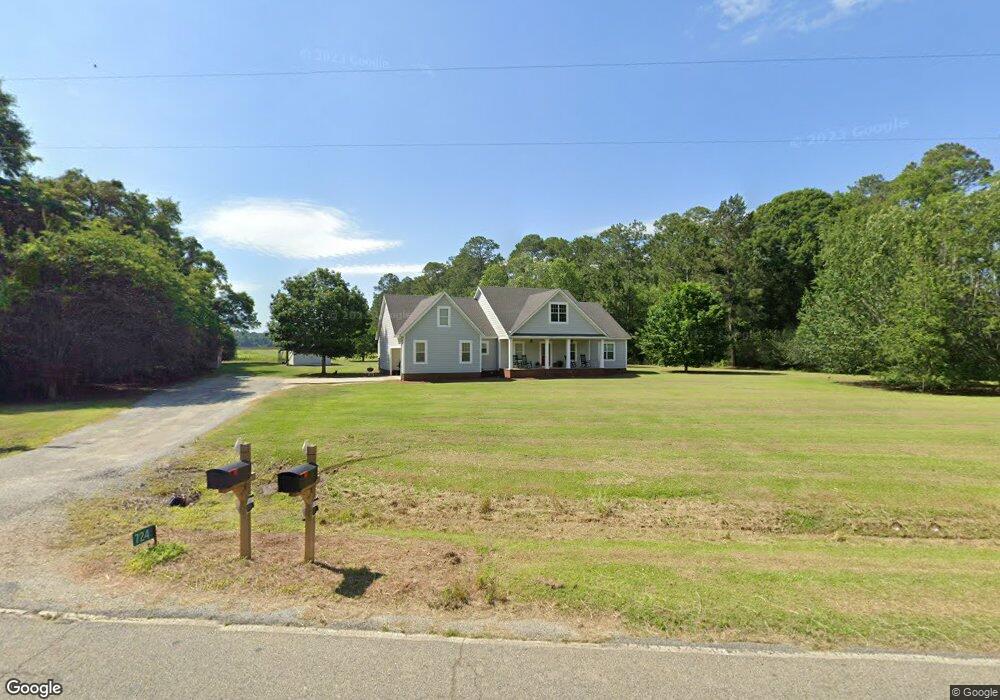
724 Lanier Rd Moultrie, GA 31788
Estimated Value: $311,000 - $412,000
3
Beds
3
Baths
2,342
Sq Ft
$154/Sq Ft
Est. Value
About This Home
This home is located at 724 Lanier Rd, Moultrie, GA 31788 and is currently estimated at $360,681, approximately $154 per square foot. 724 Lanier Rd is a home with nearby schools including Sunset Elementary School, Willie J. Williams Middle School, and C.A. Gray Junior High School.
Ownership History
Date
Name
Owned For
Owner Type
Purchase Details
Closed on
Apr 15, 2010
Sold by
Cooper Robert
Bought by
Cooper Robert F and Cooper Kristy C
Current Estimated Value
Home Financials for this Owner
Home Financials are based on the most recent Mortgage that was taken out on this home.
Original Mortgage
$145,600
Outstanding Balance
$96,686
Interest Rate
4.94%
Mortgage Type
New Conventional
Estimated Equity
$263,995
Purchase Details
Closed on
Apr 16, 2001
Bought by
Cooper Robert
Create a Home Valuation Report for This Property
The Home Valuation Report is an in-depth analysis detailing your home's value as well as a comparison with similar homes in the area
Home Values in the Area
Average Home Value in this Area
Purchase History
| Date | Buyer | Sale Price | Title Company |
|---|---|---|---|
| Cooper Robert F | -- | -- | |
| Cooper Robert | -- | -- |
Source: Public Records
Mortgage History
| Date | Status | Borrower | Loan Amount |
|---|---|---|---|
| Open | Cooper Robert F | $145,600 |
Source: Public Records
Tax History Compared to Growth
Tax History
| Year | Tax Paid | Tax Assessment Tax Assessment Total Assessment is a certain percentage of the fair market value that is determined by local assessors to be the total taxable value of land and additions on the property. | Land | Improvement |
|---|---|---|---|---|
| 2024 | $3,006 | $150,600 | $2,896 | $147,704 |
| 2023 | $3,134 | $110,640 | $2,896 | $107,744 |
| 2022 | $2,298 | $98,510 | $2,574 | $95,936 |
| 2021 | $2,128 | $89,618 | $2,574 | $87,044 |
| 2020 | $2,166 | $89,618 | $2,574 | $87,044 |
| 2019 | $1,966 | $73,518 | $2,574 | $70,944 |
| 2018 | $1,881 | $73,518 | $2,574 | $70,944 |
| 2017 | $1,986 | $74,965 | $4,021 | $70,944 |
| 2016 | $2,012 | $74,965 | $4,021 | $70,944 |
| 2015 | $2,031 | $74,965 | $4,021 | $70,944 |
| 2014 | $1,993 | $74,965 | $4,021 | $70,944 |
| 2013 | -- | $74,965 | $4,020 | $70,944 |
Source: Public Records
Map
Nearby Homes
- 1557 US Highway 319 S
- xx Ga Hwy 319 N
- 00 Ragin Rd Unit 7
- 00 Ragin Rd Unit 12
- 117 Will Rd
- XX Us Highway 319 S Unit 8-11
- 265 Lb Nevels Rd
- 199 Lb Nevels Rd
- 534 Us Highway 319 S
- 135 Southlake Dr
- 114 Baell Trace Ct SE
- 208 Baell Trace Ct SE
- 205 Baell Trace Ct SE
- 213 Baell Trace Ct SE
- 3 Baell Trace Ct SE
- 387 Tanglewood Dr
- 48 Packer Pride Dr SE
- 65 Packer Pride Dr SE
- 16 Francine Way SE
- 85 Cobblestone Blvd SE