Estimated Value: $340,636 - $391,000
3
Beds
2
Baths
1,398
Sq Ft
$265/Sq Ft
Est. Value
About This Home
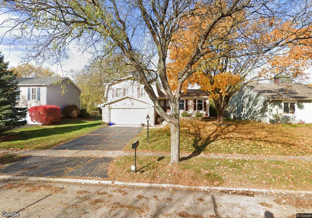
This home is located at 724 Manitou St, Cary, IL 60013 and is currently estimated at $370,659, approximately $265 per square foot. 724 Manitou St is a home located in McHenry County with nearby schools including Briargate Elementary School, Cary Jr High School, and Cary-Grove High School.
Ownership History
Date
Name
Owned For
Owner Type
Purchase Details
Closed on
Feb 27, 2012
Sold by
Pack Michael
Bought by
Mcintyre Gm Joellen
Current Estimated Value
Purchase Details
Closed on
Feb 22, 2002
Sold by
Amfahr David B and Amfahr Donna L
Bought by
Pack Michael J and Pack Joellen L
Home Financials for this Owner
Home Financials are based on the most recent Mortgage that was taken out on this home.
Original Mortgage
$146,000
Interest Rate
6.92%
Purchase Details
Closed on
Feb 9, 1999
Sold by
Amfahr David B and Amfahr Donna L
Bought by
Amfahr David B and Amfahr Donna L
Create a Home Valuation Report for This Property
The Home Valuation Report is an in-depth analysis detailing your home's value as well as a comparison with similar homes in the area
Home Values in the Area
Average Home Value in this Area
Purchase History
| Date | Buyer | Sale Price | Title Company |
|---|---|---|---|
| Mcintyre Gm Joellen | -- | None Available | |
| Pack Michael J | $182,500 | -- | |
| Amfahr David B | -- | -- |
Source: Public Records
Mortgage History
| Date | Status | Borrower | Loan Amount |
|---|---|---|---|
| Previous Owner | Pack Michael J | $146,000 | |
| Closed | Pack Michael J | $18,250 |
Source: Public Records
Tax History
| Year | Tax Paid | Tax Assessment Tax Assessment Total Assessment is a certain percentage of the fair market value that is determined by local assessors to be the total taxable value of land and additions on the property. | Land | Improvement |
|---|---|---|---|---|
| 2024 | $8,559 | $109,639 | $21,630 | $88,009 |
| 2023 | $8,336 | $98,058 | $19,345 | $78,713 |
| 2022 | $7,557 | $86,704 | $20,749 | $65,955 |
| 2021 | $7,195 | $80,775 | $19,330 | $61,445 |
| 2020 | $6,978 | $77,916 | $18,646 | $59,270 |
| 2019 | $6,836 | $74,575 | $17,846 | $56,729 |
| 2018 | $6,296 | $67,532 | $16,486 | $51,046 |
| 2017 | $6,166 | $63,620 | $15,531 | $48,089 |
| 2016 | $6,111 | $59,670 | $14,567 | $45,103 |
| 2013 | -- | $62,322 | $13,589 | $48,733 |
Source: Public Records
Map
Nearby Homes
- 800 Big Bear Trail
- 413 Haber Rd Unit 5
- 417 Haber Rd Unit 6
- 421 Haber Rd Unit 7
- 425 Haber Rd Unit 6
- 256 Haber Ct
- 204 Country Commons Rd
- 29 Ivanhoe Ln
- 0 Kaper Dr
- 1259 Chickory Ridge Trail
- 418 Glen Garry Rd
- 440 W James Way
- 1141 Westlake Dr
- 1145 Amber Dr
- 1150 Amber Dr
- Lots 2,3,4 Northwest Hwy
- 103 S Seebert St Unit 1
- 330 Park Ave
- 392 W Margaret Terrace
- 3712 3 Oaks Rd
- 730 Manitou St
- 718 Manitou St
- 727 Merrimac St
- 736 Manitou St
- 721 Merrimac St
- 712 Manitou St
- 733 Merrimac St
- 725 Manitou St
- 739 Merrimac St
- 742 Manitou St
- 731 Manitou St
- 74 Asbury Ln
- 713 Manitou St
- 709 Merrimac St
- 737 Manitou St
- 62 Asbury Ln
- 748 Manitou St
- 8 Cumberland Ct
- 56 Asbury Ln
- 751 Merrimac St
Your Personal Tour Guide
Ask me questions while you tour the home.