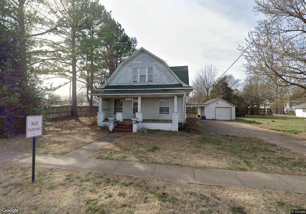
724 S Wright St Siloam Springs, AR 72761
Estimated Value: $249,231 - $329,000
--
Bed
2
Baths
2,113
Sq Ft
$133/Sq Ft
Est. Value
About This Home
This home is located at 724 S Wright St, Siloam Springs, AR 72761 and is currently estimated at $281,558, approximately $133 per square foot. 724 S Wright St is a home located in Benton County with nearby schools including Northside Elementary School, Southside Elementary School, and Delbert Pete & Pat Allen Elementary School.
Ownership History
Date
Name
Owned For
Owner Type
Purchase Details
Closed on
Sep 21, 2018
Sold by
Farnsworth Barbara
Bought by
Crabbs Angela
Current Estimated Value
Purchase Details
Closed on
Jul 2, 2018
Sold by
Farnsworth Barbara J and Estate Of Opal G Brammer
Bought by
Farnsworth Barbara J
Purchase Details
Closed on
Nov 18, 2003
Bought by
Brammer Rev Tr
Purchase Details
Closed on
Oct 31, 2003
Bought by
Brammer Rev Tr
Purchase Details
Closed on
Jun 29, 1999
Bought by
Dod 06-29-1999
Purchase Details
Closed on
Jul 2, 1997
Bought by
Brammer O
Create a Home Valuation Report for This Property
The Home Valuation Report is an in-depth analysis detailing your home's value as well as a comparison with similar homes in the area
Home Values in the Area
Average Home Value in this Area
Purchase History
| Date | Buyer | Sale Price | Title Company |
|---|---|---|---|
| Crabbs Angela | -- | None Available | |
| Farnsworth Barbara J | -- | None Available | |
| Brammer Rev Tr | -- | -- | |
| Brammer Rev Tr | -- | -- | |
| Dod 06-29-1999 | -- | -- | |
| Brammer O | -- | -- |
Source: Public Records
Tax History Compared to Growth
Tax History
| Year | Tax Paid | Tax Assessment Tax Assessment Total Assessment is a certain percentage of the fair market value that is determined by local assessors to be the total taxable value of land and additions on the property. | Land | Improvement |
|---|---|---|---|---|
| 2025 | $1,845 | $43,057 | $7,400 | $35,657 |
| 2024 | $1,735 | $43,057 | $7,400 | $35,657 |
| 2023 | $1,578 | $30,920 | $5,600 | $25,320 |
| 2022 | $1,455 | $30,920 | $5,600 | $25,320 |
| 2021 | $1,330 | $30,920 | $5,600 | $25,320 |
| 2020 | $1,213 | $21,060 | $5,600 | $15,460 |
| 2019 | $1,212 | $21,060 | $5,600 | $15,460 |
| 2018 | $1,120 | $21,060 | $5,600 | $15,460 |
| 2017 | $1,027 | $21,060 | $5,600 | $15,460 |
| 2016 | $584 | $21,060 | $5,600 | $15,460 |
| 2015 | $929 | $17,180 | $1,750 | $15,430 |
| 2014 | $579 | $17,180 | $1,750 | $15,430 |
Source: Public Records
Map
Nearby Homes
- 817 S Katlyn Dr
- 722 S College St
- 622 S Wright St
- 823 S Wright St
- 845 S Wright St
- 824 S Mount Olive St
- 600 S Elm St
- 926 S Elm St
- 716 S Washington St
- 412 W Kenwood St
- 515 S Washington St
- 509 S Washington St
- 920 W Granite St
- 607 E Delaware St
- 114 S College St
- 0 S Carl St
- 1.94 AC Lot 2 S Britt St
- 3 AC Lot 1 S Britt St
- 4.94 AC Lots 1 & 2 S Britt St
- 0 S Mount Olive St
- 3309 E Jace St
- 3201 E Jace St
- 2403 Dusty Ct
- 2402 Dusty Ct
- 2403 Dusty Ct
- 2404 Dusty Ct
- 2405 Dusty Ct
- 825 S Katlyn Dr
- 805 S Katlyn Dr
- 901 S Katlyn Dr
- 2401 Dusty Ct
- 905 S Katlyn Dr
- 1607 S Corsac St
- 1509 S Corsac St
- 1601 S Corsac St
- 1607 S Corsac St
- 714 S Wright St
- 710 S Wright St
- 713 S College St
- 111 W Tulsa St